
GPM Sees More Powerful Tropical cyclone 06P (ULA)
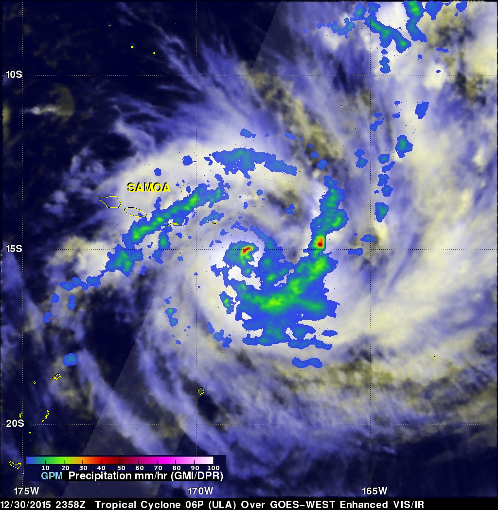
The GPM core observatory satellite had an excellent daytime view of tropical cyclone 06P (ULA) on December 30, 2015 at 2358 UTC. The tropical cyclone had moved to the east-southeast of Samoa in the South Pacific Ocean with maximum sustained winds increasing to about 50 kts (58 mph). The rainfall pattern derived from GPM's Microwave Imager (GMI) and Dual-Frequency Precipitation Radar (DPR) instruments showed that 06P was much better organized. Powerful thunderstorms at the center of the tropical cyclone were found by DPR to be dropping rain at a rate of over 66 mm (2.6 inches) per hour. GPM's GMI data also indicated that rain was falling at rate of over 50 mm (2 inches) per hour in a strong feeder band on the tropical cyclone's eastern side.
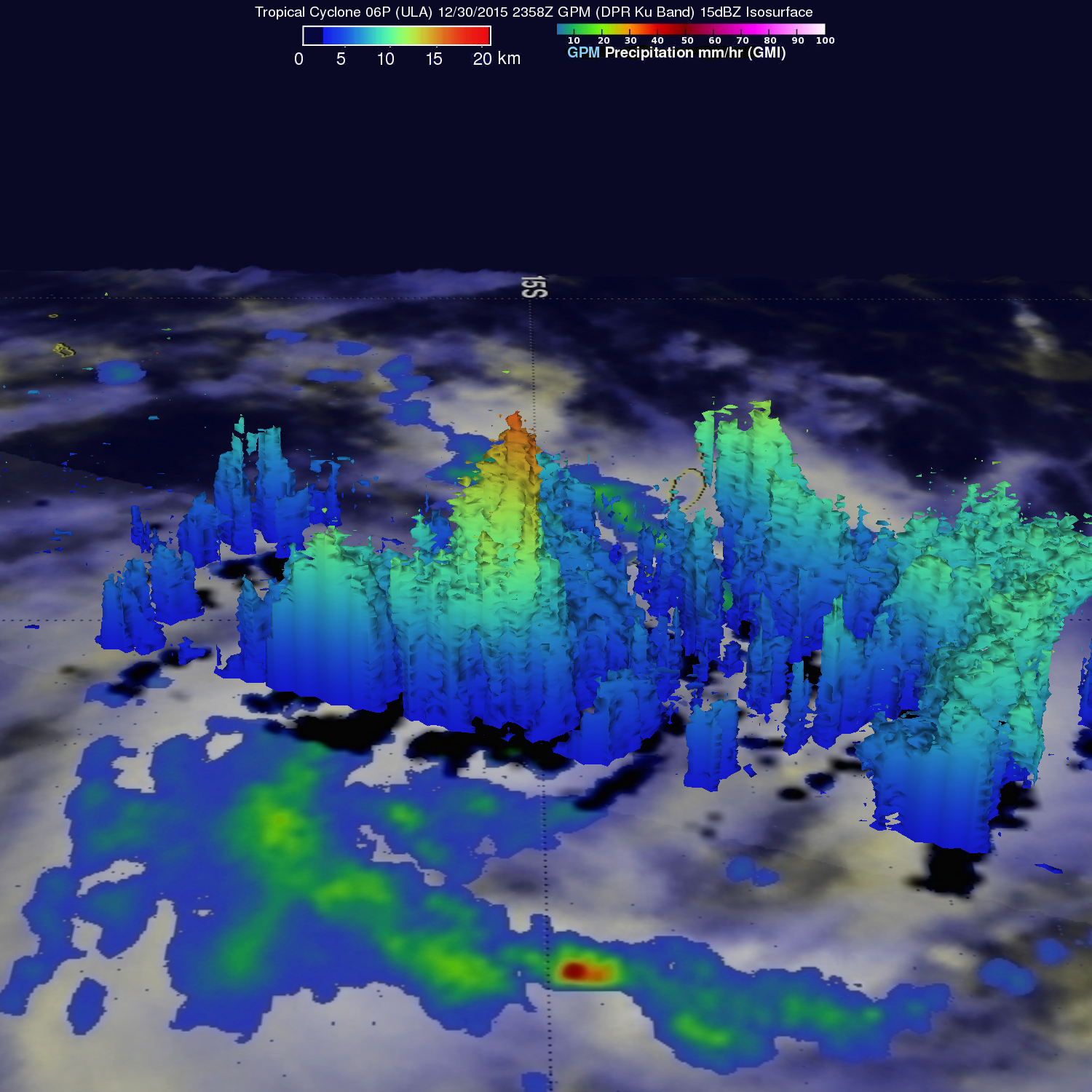
GPM's Radar (DPR Ku band) were used to show in 3-D the towering thunderstorms near 06P's center reaching heights of over 17 km (10.5 miles). These strong thunderstorms called "hot towers" often lead to rapid intensification in a tropical cyclone.
The Joint Typhoon Warning Center (JTWC) predicts that tropical cyclone 06P (ULA) will intensify and will move to the southwest of the Fiji Islands in a couple days. Wind speeds in the tropical cyclone are expected to reach 80 kts (92 mph).