
GPM Satellite Sees Storms Over Israel
An upper level low generated stormy weather for a few days as it moved through the southeastern Mediterranean. Heavy rainfall in these storms resulted in deadly flash floods that killed ten teenagers in southern Israel.
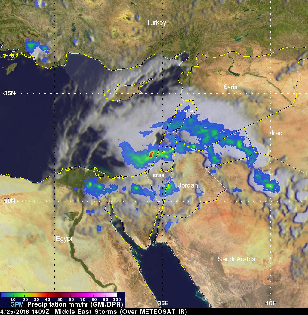
The GPM core observatory satellite passed above intense storms that were moving through the eastern Mediterranean on April 25, 2018 at 1409 UTC (4:09 PM IST). Data collected by the satellite's Microwave Imager (GMI) and Dual Frequency Precipitation Radar (DPR) instruments revealed the location of heavy rainfall that was approaching Israel. GPM's radar (DPR Ku Band) measured rain falling at a rate of greater than 73 mm (2.9 inches) per hour in one line of strong storms that was moving over Israel. The area covered by GPM's radar is shown in lighter shades that extends from the northwestern to the southeastern side of the display.
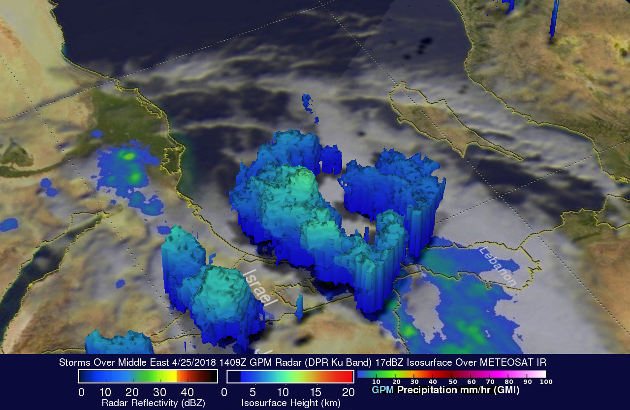
This 3-D image shows a computer simulated view of precipitation within storms moving through the Middle East. This was made possible using data from GPM's radar (DPR Ku Band). Several of these storms approaching Israel were shown by GPM's radar to reach heights of about 10 km (6.2 miles).