
GPM Satellite Sees Cindy Drenching Gulf Coast
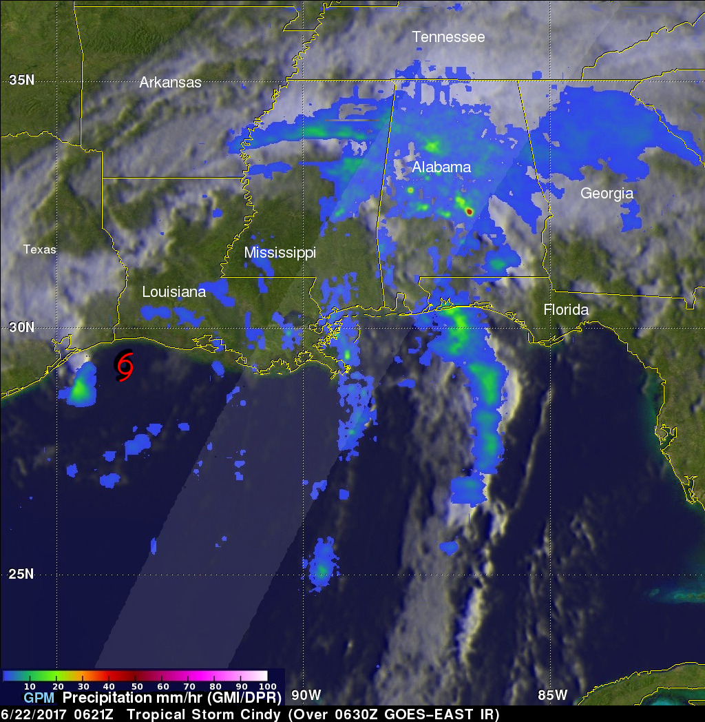
The GPM core observatory satellite passed above as tropical storm Cindy was approaching the western Louisiana coast on June 22, 2017 at 1:21 AM CDT (0621 UTC). Cindy had maximum sustained winds of about 40 kts (46 mph) at that time. A red tropical storm symbol shows Cindy's approximate location. Rainfall derived from Microwave Imager (GMI) and Dual-Frequency Precipitation Radar (DPR) measurements showed that there was very little rainfall near Cindy's center of circulation but bands of moderate to heavy showers are shown moving into the states along the Gulf Coast. GPM's Radar (DPR Ku Band) found that storms over central Alabama were dropping rain at a rate of over 3.6 inches (91 mm) per hour.
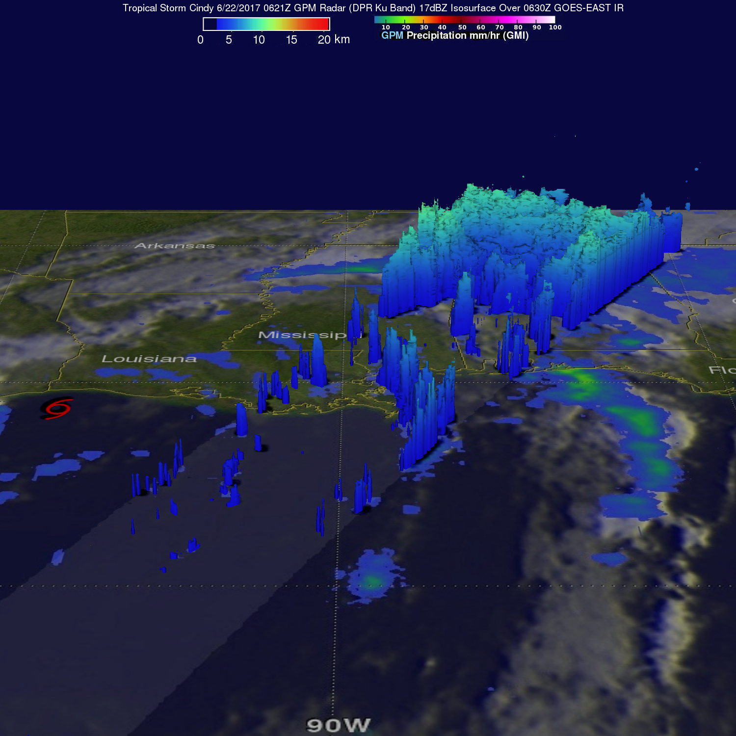
GPM radar (DPR Ku Band) data were used to show the 3-D structure of rainfall within Cindy's storm tops. GPM's radar revealed that a few storms within rain bands near New Orleans were reaching heights of over 7.2 miles (11.6 km). GPM's radar found that the heaviest downpours over Alabama were returning radar reflectivity values of over 51dBZ to the GPM satellite.