
GPM Satellite Probes Dangerous Category Five Hurricane Irma

The GPM core observatory satellite had an exceptional view of hurricane Irma's eye when it flew above on September 5, 2017 at 12:52 PM AST (1652 UTC). This image shows a rainfall analysis that was derived from GPM's Microwave Imager (GMI) and Dual-Frequency Precipitation Radar (DPR) data. Irma was approaching the Leeward Islands with maximum sustained winds of about 178 mph (155 kts). This made Irma a dangerous category five hurricane on the Saffir-Simpson hurricane wind scale. Intense rainfall is shown within Irma's nearly circular eye. GPM's DPR (shown in lighter shades) uncloaked precipitation that was falling at a rate of more than 10.8 inches (274 mm) per hour in the solid ring of powerful storms within Irma's eye wall.
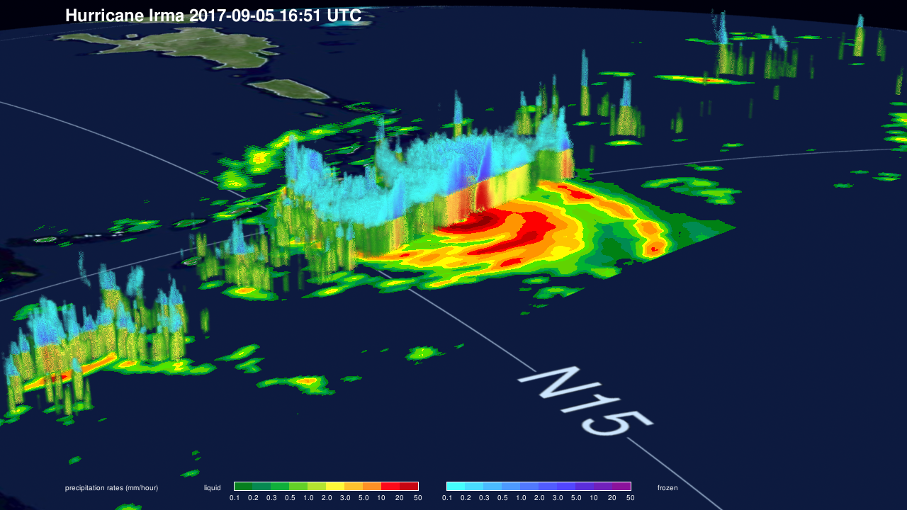
This 3-D cross-section through Irma's eye was constructed using GPM's radar (DPR Ku band) data. GPM's radar revealed that the extremely powerful storms rotating around the eye were reaching altitudes greater than 7.75 miles (12.5 km). The tallest thunderstorms were found by GPM's radar in a feeder band that was located to the southwest of Irma's eye. These extreme storms were reaching heights of over 10.0 miles (16.2 km). Intense downpours in the eye wall were found to be returning radar reflectivity values of over 80dBZ to the GPM satellite.
On September 5, 2017 At 1:15 PM AST (1715 UTC) the National Hurricane Center (NHC) indicated that hurricane Irma was moving toward the west at about 13.8 mph (12 kts) with maximum sustained wind speeds of 184 mph (160 kts). This means that Irma was threatening the Leeward Islands, Virgin Islands and Puerto Rico as an extremely dangerous category five hurricane.
Images produced by Hal Pierce (SSAI/NASA GSFC) and Jacob Reed (Telophase/NASA GSFC). Captions by Hal Pierce.