
GPM Probes Tropical Storm Maliksi
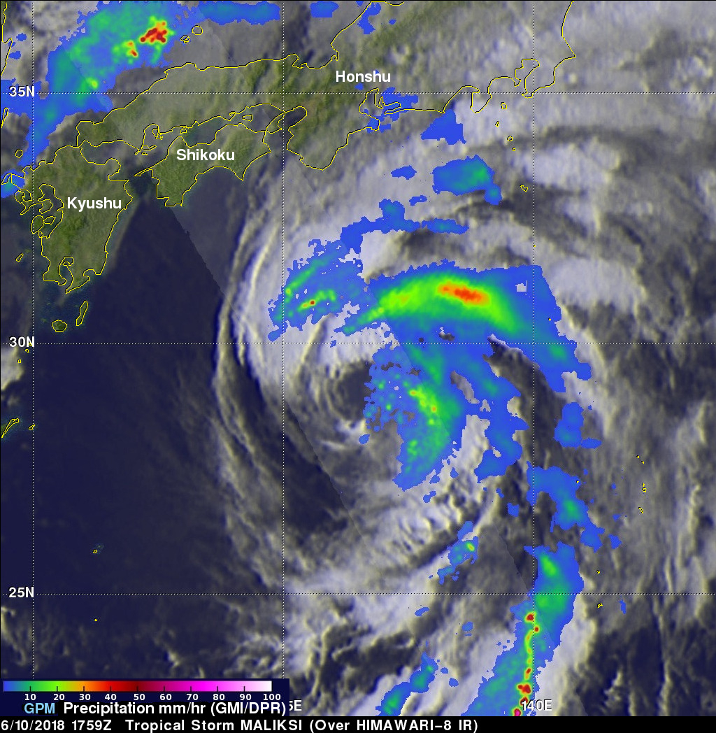
The GPM core observatory satellite had an excellent view of tropical storm MALIKSI when it passed over southern Japan on June 10, 2018 at 1759 UTC. GPM's Microwave Imager (GMI) and Dual Frequency Precipitation Radar (DPR) instruments collected data that revealed the horizontal and vertical extent of precipitation within the tropical storm. GPM's GMI showed that heavy downpours were occurring in a rain band wrapping around MALIKSI's northeastern side. GPM's radar (DPR Ku Band) found that bands of storms moving around the northwestern side of the tropical storm were dropping rain at a rate of almost 224 mm (8.8 inches) per hour. GPM's radar (DPR Ku Band) data swath passed directly over the center of the tropical storm's large eye and showed that very little precipitation was located to the west of MALIKSI's center of circulation.
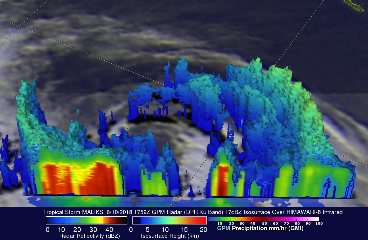
The GPM satellite's radar data (DPR Ku Band) provided data that were used in this 3-D cross-section view of tropical storm MALIKSI's precipitation. GPM's radar showed that the tallest storms were reaching heights of about 11.5 km (7.1 miles) in rain bands within the tropical storm.
This animation shows a simulated 3-D flyby of tropical storm MALIKSI courtesy of GPM's radar reflectivity data (17 dBZ Isosurface). It shows strong radar reflectivity values in the 3-D slice through storms that were located southeast of MALIKSI's large eye. The lowest storm tops are colored blue and the tallest storms reaching altitudes above 11 km (6.8 miles) are colored light green.