GPM Observes Tropical Storm Merbok
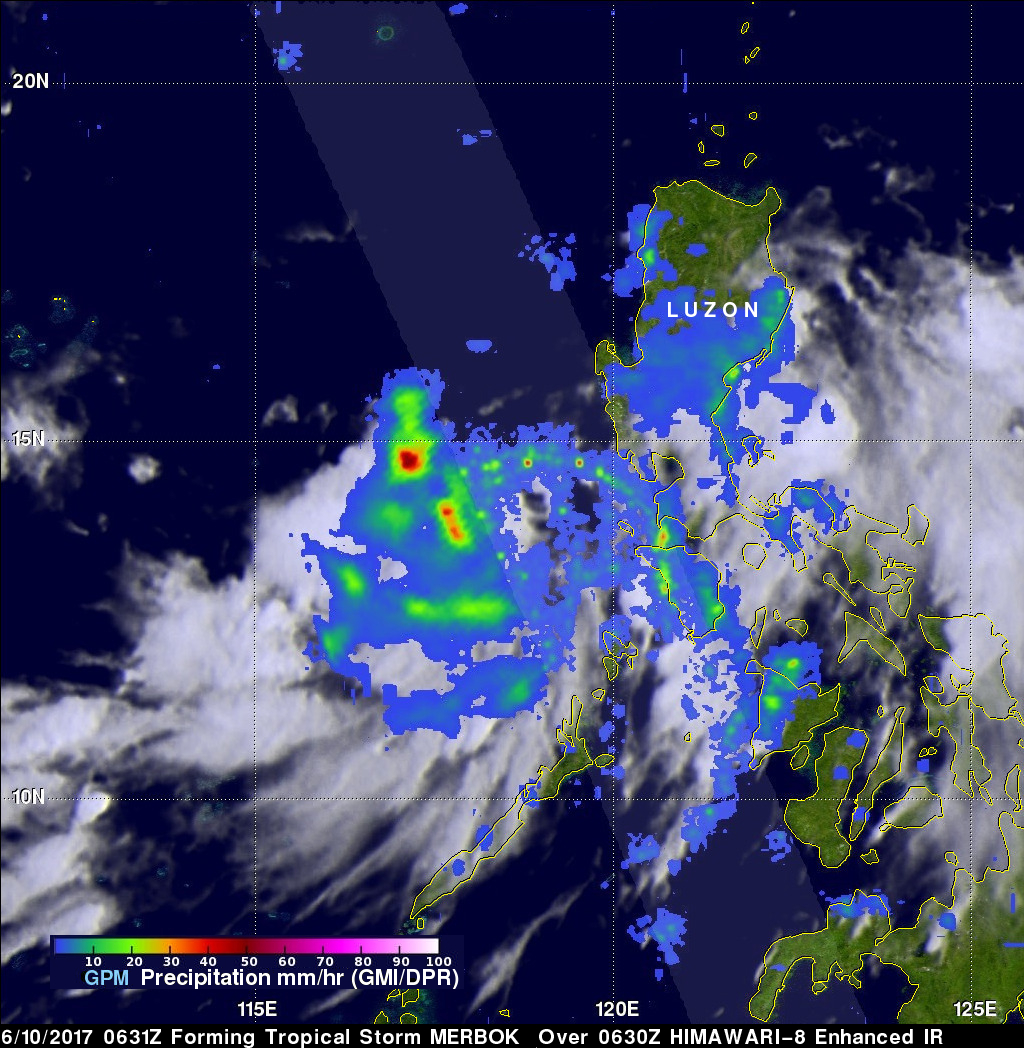
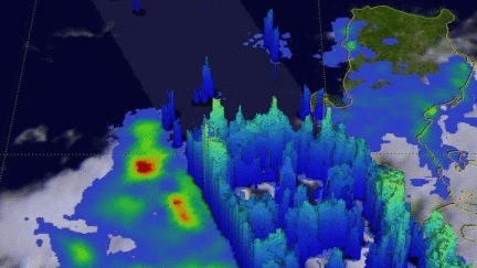
Tropical storm MERBOK formed in the South China Sea west of the Philippines on June 11, 2017. The GPM core observatory satellite flew above MERBOK on June 10, 2017 at 0631 UTC when the tropical storm was forming. GPM's Microwave Imager (GMI) and Dual-Frequency Precipitation Radar (DPR) showed that the future tropical storm was starting to get organized. Feeder bands were shown converging into the center of the circulation located in the South China Sea west of Luzon.
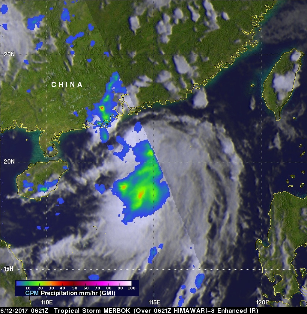
GPM passed over the western side of tropical storm MERBOK again on June 12, 2017 at 0621 UTC when it's maximum sustained winds were about 40 kts (46 mph). These winds speeds are close to tropical storm MERBOK's predicted maximum peak winds of about 45kts (~52 mph). Data collected by GPM's Microwave Imager (GMI) instrument indicated that rain was falling at a rate of over 57mm (2.2 inches) per hour in one of MERBOK's rain bands that was moving over southern China.
This image shows the 3-D structure of rain bands within forming tropical storm MERBOK on June 10, 2017. GPM's radar (DPR Ku Band) indicated that, at that time, storm tops within the rain bands west of the Philippines were only reaching heights of about 10 km (6.2 miles).