GPM Observes Tropical Cyclone 12P Forming
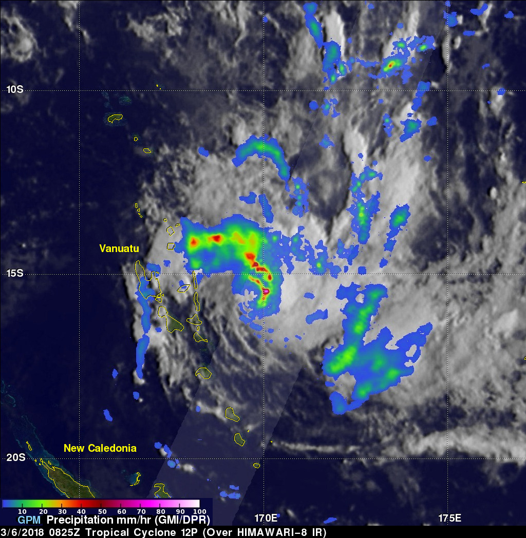
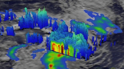
On March 6, 2018 at 0825 UTC the GPM core observatory satellite flew above a forming tropical cyclone in the southern Pacific Ocean just east of Vanuatu. GPM's Dual Frequency Precipitation Radar (DPR) scanned storms in the center of forming tropical cyclone 12P's circulation. This view by GPM's DPR revealed that convective storms were dropping extremely heavy rainfall on the eastern edge of the forming tropical cyclone's low level center. DPR indicated that rain was falling at a rate of over 241 mm (9.5 inches) per hour in this area.
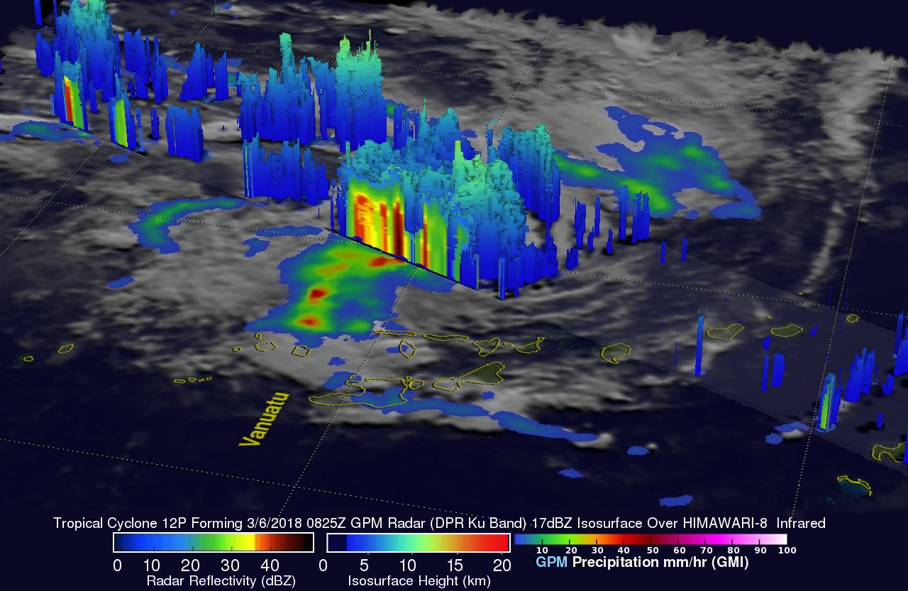
The use of GPM satellite's radar data enabled this 3-D view of the forming tropical cyclone's precipitation. These probes of tropical cyclone 12P showed the heights of precipitation within the convective storms wrapping around the forming tropical cyclone's low level center of circulation. GPM's radar clearly showed that some tall storms on the eastern edge of 12P's center of circulation were reaching heights above 12 km (7.4 miles).
The Joint Typhoon Warning Center (JTWC) issued it's first warning for tropical cyclone 12P less than 7 hours later on March 6, 2018 at 1500 UTC. Tropical cyclone 12P is expected to intensify to hurricane intensity within the next few days. The initial movement is expected to be toward the west-southwest over southern Vanuatu. 12P is then expected to round the sub-tropical ridge and move south-southeastward toward northern New Zealand.