
GPM Observes Newly Formed Tropical Depression Eight-E

The eastern Pacific Ocean continues to show that it's environment is favorable for the birth of tropical cyclones. Tropical Depression EIGHT-E (TD08E) quickly followed tropical storm FRANK as the latest example of tropical cyclogenesis in the eastern Pacific Ocean.
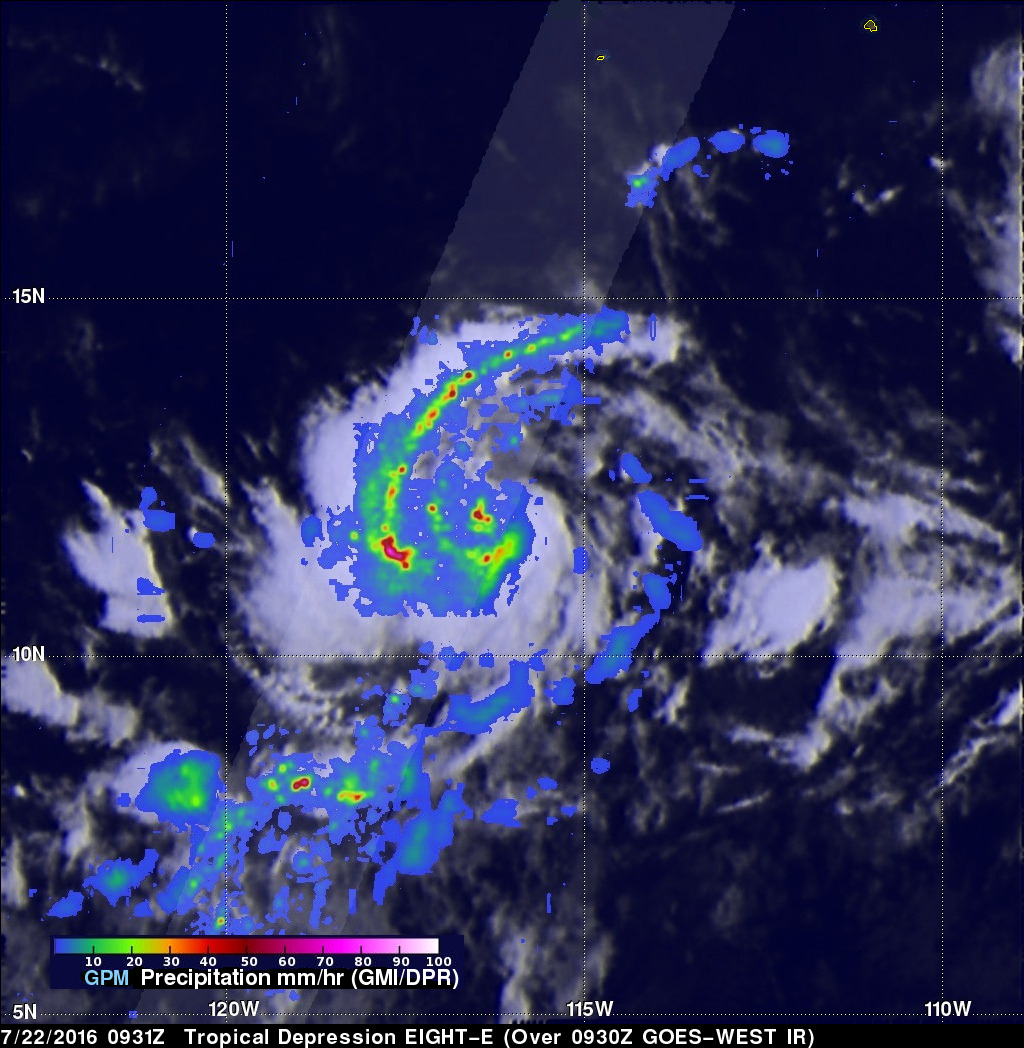
The GPM core observatory satellite examined TD08E when it flew directly above on July 22, 2016 at 0931 UTC. At that time maximum sustained winds were only estimated to be about 30 kts (34.5 mph). Rainfall was examined in TD08E using data collected by GPM's Microwave Imager (GMI) and Dual-Frequency Precipitation Radar (DPR) instruments. Extremely heavy rain falling at a rate of over 224 mm (8.8 inches) per hour was found by DPR in convective storms southwest of TD08's center of circulation.
GPM's Dual-Frequency Precipitation Radar (DPR) instrument (Ku Band), developed by JAXA and NICT (also of Japan), was used to measure the three-dimensional structure of precipitation within TD08E. Several storm top heights southwest of TD08's center were found by DPR to reach altitudes of over 14 km (8.7 miles).
TD08E is predicted by the National Hurricane Center (NHC) to intensify to hurricane strength in a couple days while moving toward the northwest.