
GPM Monitors Western Pacific Typhoon IN-FA
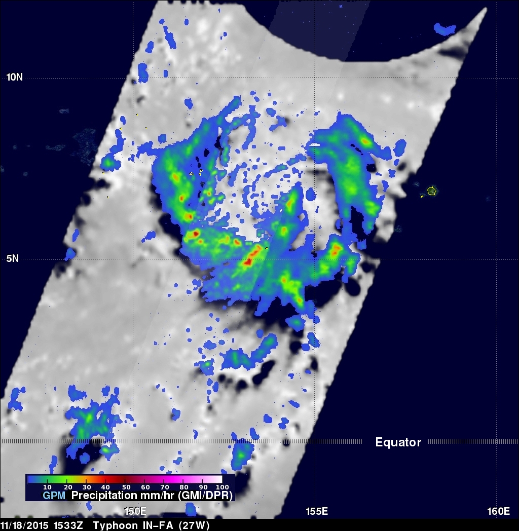
On November 18, 2015 at 1533 the GPM core observatory satellite flew directly over a recently formed typhoon called IN-FA that was located near the Equator well to the southeast of Guam. Favorable environmental conditions such as low vertical wind shear and warm sea surface temperatures helped typhoon IN-FA intensify quickly from a tropical depression on November 17 to a typhoon on November 18, 2015. Rainfall from GPM's Microwave Imager (GMI) and Dual-Frequency Precipitation Radar (DPR) instruments were used to analyze the rainfall around typhoon IN-FA. GPM's DPR found that rain was falling at a rate over 74 mm (2.9 inches) per hour in powerful convective thunderstorms to the south of the typhoon's center.
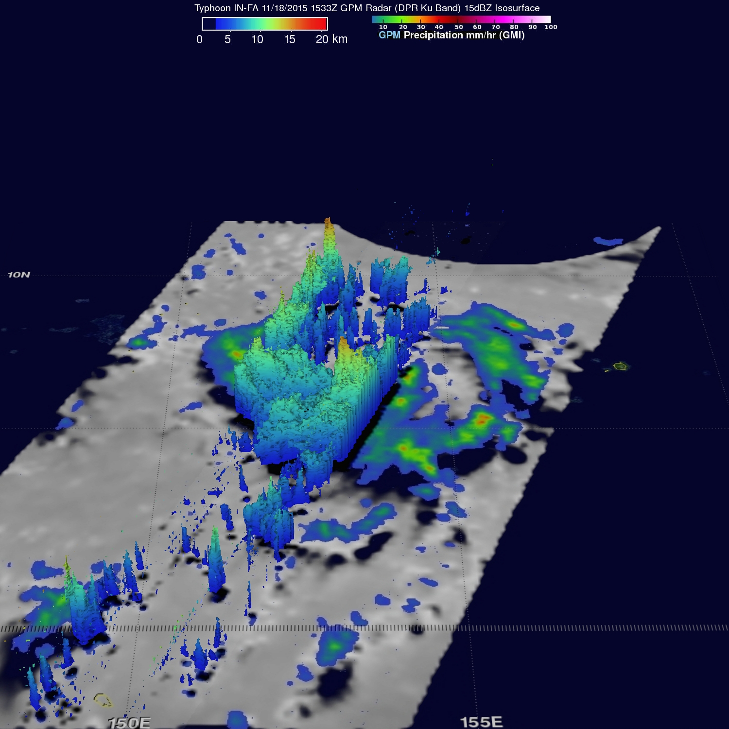
This image shows a 3-D cross-section of radar reflectivity values that GPM's Radar (Ku Band) cut through the typhoon. Storm top heights are shown reaching heights of up to 16.7 km (10.4 miles) in convective storms within a feeder band to the west of IN-FA's eye.
The Joint Typhoon Warning Center (JTWC) predicts that typhoon IN-FA will become more powerful over the next few days and pass to the south of Guam with sustained winds of over 100kts (115 mph).