GPM Flies Over Intensifying Tropical Cyclone Nora
Intensifying tropical cyclone NORA has been moving southeastward into the Gulf of Carpentaria since it formed in the Arafura Sea north-northeast of Darwin,Australia. The Joint Typhoon Warning Center (JTWC) issued it's first warning for Tropical cyclone NORA on March 22, 2018 at 0900Z. After that NORA's winds increased to over 65 kts (75 mph). That means that today NORA became the equivalent of a category one hurricane on the Saffir-Simpson hurricane wind scale.
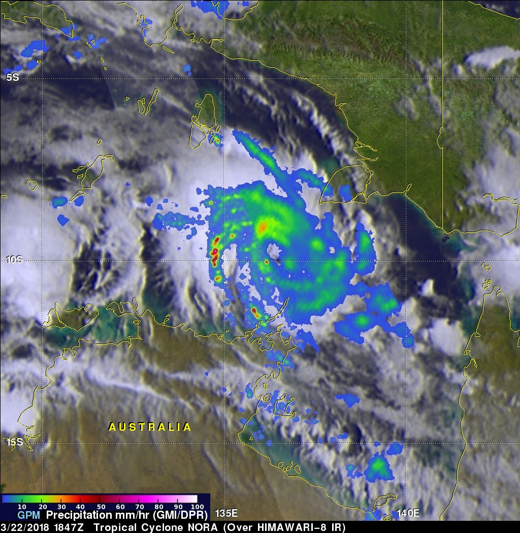
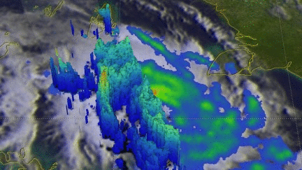
The GPM core observatory satellite scanned tropical cyclone NORAas it passed above on March 22, 2018 at 1847 UTC. GPM's Microwave Imager (GMI) data revealed the locations of stormy weather associated with the tropical cyclone. GPM's GMI revealed that rain bands north of the Wessel Islands were showing the location of NORA's center of circulation. GPM's Dual Frequency Precipitation Radar (DPR) uncloaked rain falling at greater than 191 mm (7.5 inches) in an intense feeder band wrapping around the western side of the intensifying tropical cyclone.
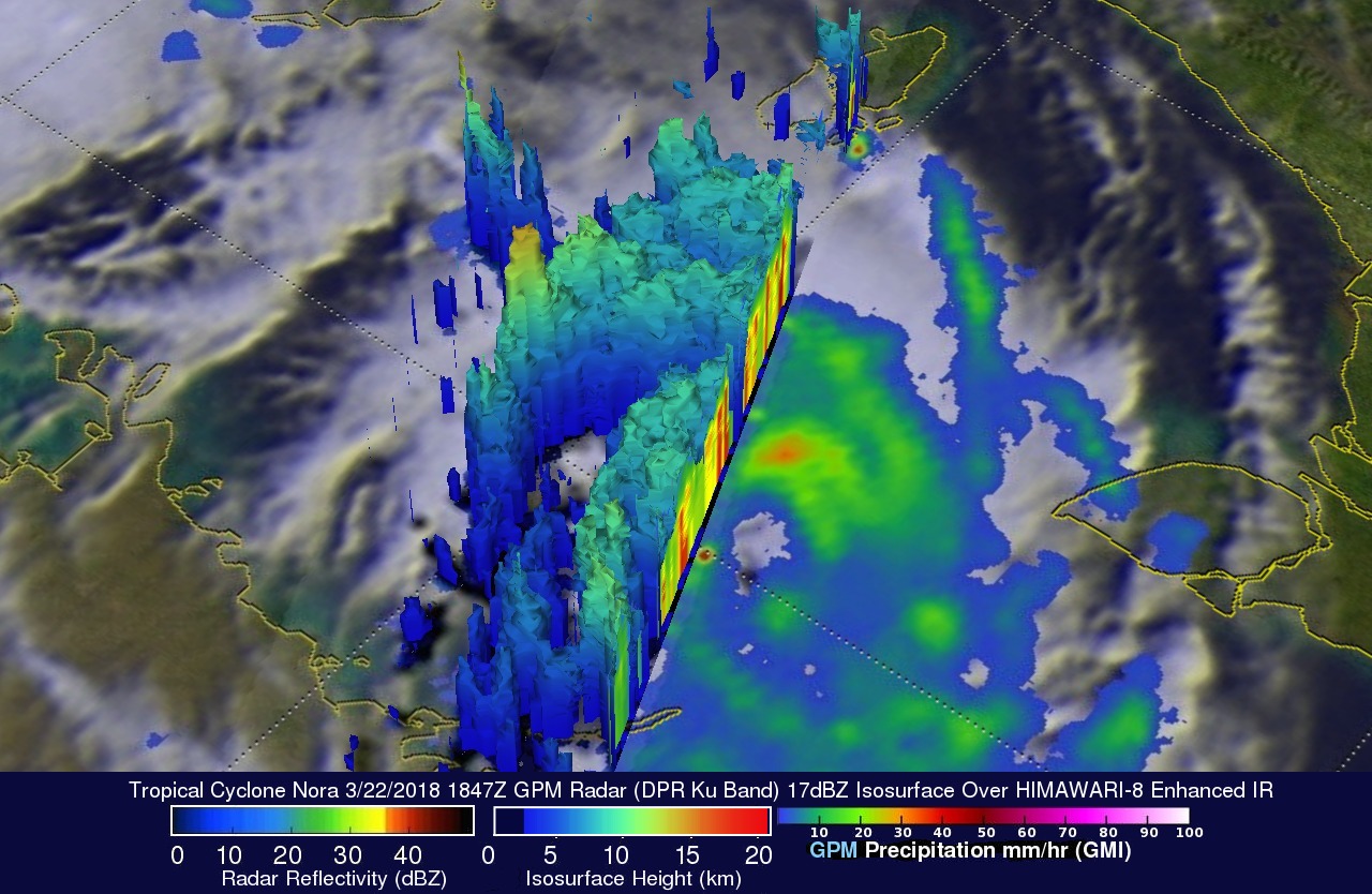
GPM's radar (DPR Ku Band) showed the 3-D structure of precipitation within powerful convective storms in the rain band on NORA's western side. GPM radar (DPR Ku Band) showed that storm tops in a few of these convective storms were reaching altitudes higher than 16 km (9.9 miles).
The Joint Typhoon Warning Center (JTWC) predicts that intensifying tropical cyclone NORA will move toward the southeastern Gulf Of Carpentaria for the next five days. NORA is expected to attain peak intensity of 130 kts (149.5 mph) over the warm waters of the northern Gulf Of Carpentaria tomorrow (March 24). NORA is expected to dissipate after going ashore in northwestern Queensland in about five days.