
GPM Flies Over Hurricane Bud off the Coast of Mexico
View full-screen in STORM Event Viewer
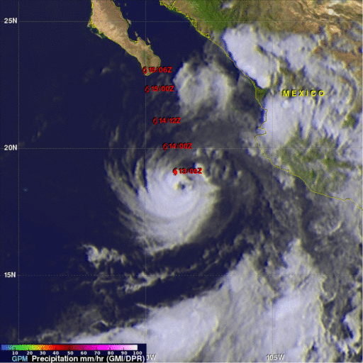
The GPM core observatory satellite passed above hurricane BUD in the eastern Pacific Ocean on June 12, 2018 at 5:27 PM MDT (2327 UTC). BUD's movement over colder waters had caused it's eye to become less defined. Data collected by GPM's Microwave Imager (GMI) showed that moderate to heavy precipitation was only present in the southeastern quadrant of the weakening hurricane. GPM's GMI also indicated that the heaviest rainfall in the area, of over 78 mm (3.1 inches) per hour, was occurring near Mexico's coastline well to the northeast of BUD's center of circulation. GPM's Microwave Imager (GMI) and Dual Frequency Precipitation Radar (DPR) data were used in this image to show location and intensity of rainfall with hurricane BUD. GPM's radar swath (shown in lighter shades) only covered the nearly rain free area west of BUD's center of circulation.
This animation shows the locations and intensity of GPM derived precipitation overlaid on a GOES-WEST enhanced infrared image.
A recent National Hurricane Center (NHC) forecast was used to show BUD's future locations (red) with appropriate tropical cyclone symbols. The NHC predicts that BUD will continue to weaken and be a tropical storm when it hits the Baja Peninsula in a couple days. Moisture from tropical storm BUD is predicted to spread over the Desert Southwest over the weekend with possible heavy rainfall and flash floods in that area.