
GPM Finds Intense Rainfall In Matthew Rainband
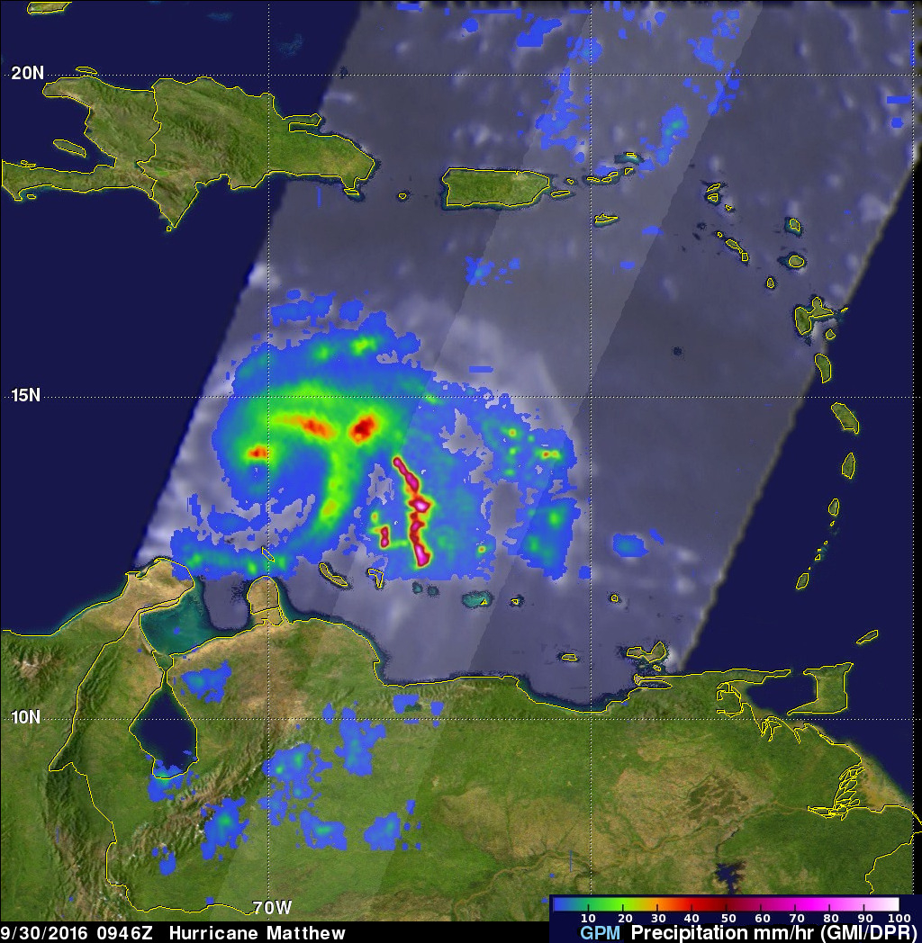
Matthew rapidly intensified Thursday evening and winds increased to 100 kts (115 mph) by Friday September 30, 2016. The GPM core observatory satellite flew over Hurricane Matthew on September 20, 2016 at 0946Z (5:46 AM EDT). A rainfall analysis from GPM's Microwave Imager (GMI) and Dual-Frequency Precipitation Radar (DPR) showed that the Matthew had heavy rainfall in the northern side of the newly formed eye wall. GPM’s radar area of coverage (shown in a higher shade) included a very intense feeder band on the southeastern side of the hurricane. DPR measured rain falling at a rate of greater than 229 (9 inches) per hour in that area.
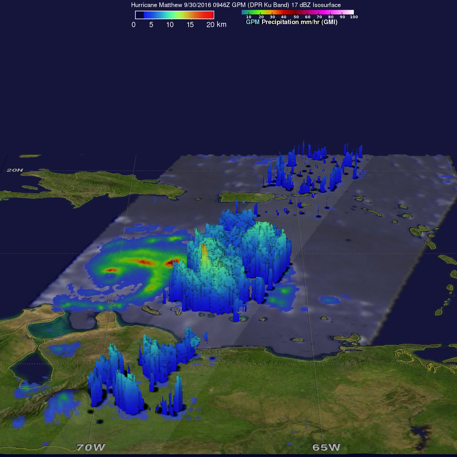
A 3-D radar analysis (DPR Ku Band) showed that storm top heights in the feeder band were reaching heights above 16 km (9.9 miles).
GPM is a joint mission between NASA and the Japanese space agency JAXA.