GPM Examines Tropical Storm Lester
Lester became the 12rd named storm of the 2016 eastern Pacific Ocean hurricane today. Lester was far away from the Mexican coast early today and headed toward the west-northwest. Low vertical wind shear and warm sea surface temperatures are expected to assist Lester's intensification to hurricane status tomorrow.
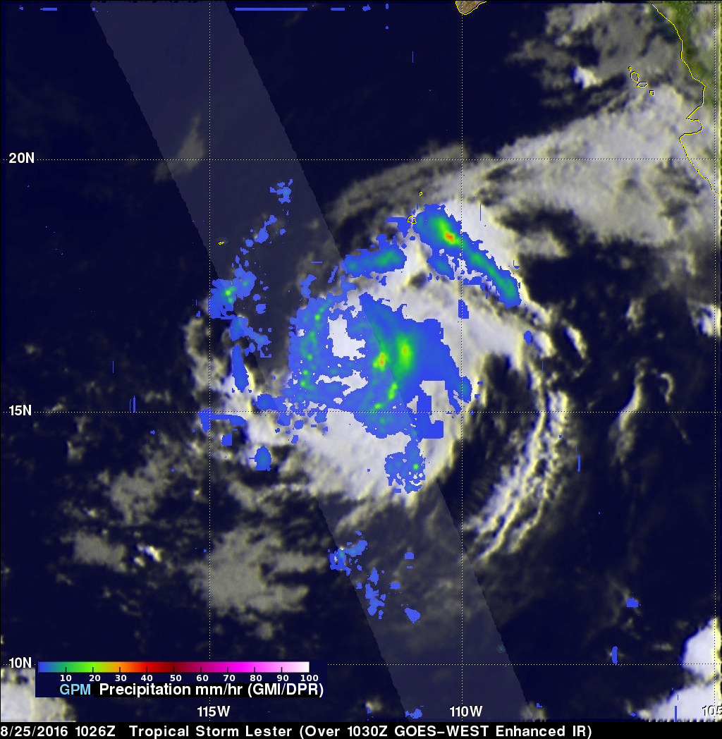
Tropical storm Lester had wind speeds of about 35 kts (40 mph) when the GPM core observatory satellite passed over on August 25, 2016 at 1026 UTC. Data from GPM satellite's Microwave Imager (GMI) and Dual-Frequency Precipitation Radar (DPR) instruments showed that Lester was getting organized. Moderate intensity bands of rain were revealed curving around the eastern side of the tropical storm. DPR found that rain was falling at a rate of over 54 mm (2.1 inches) per hour in these rain bands.
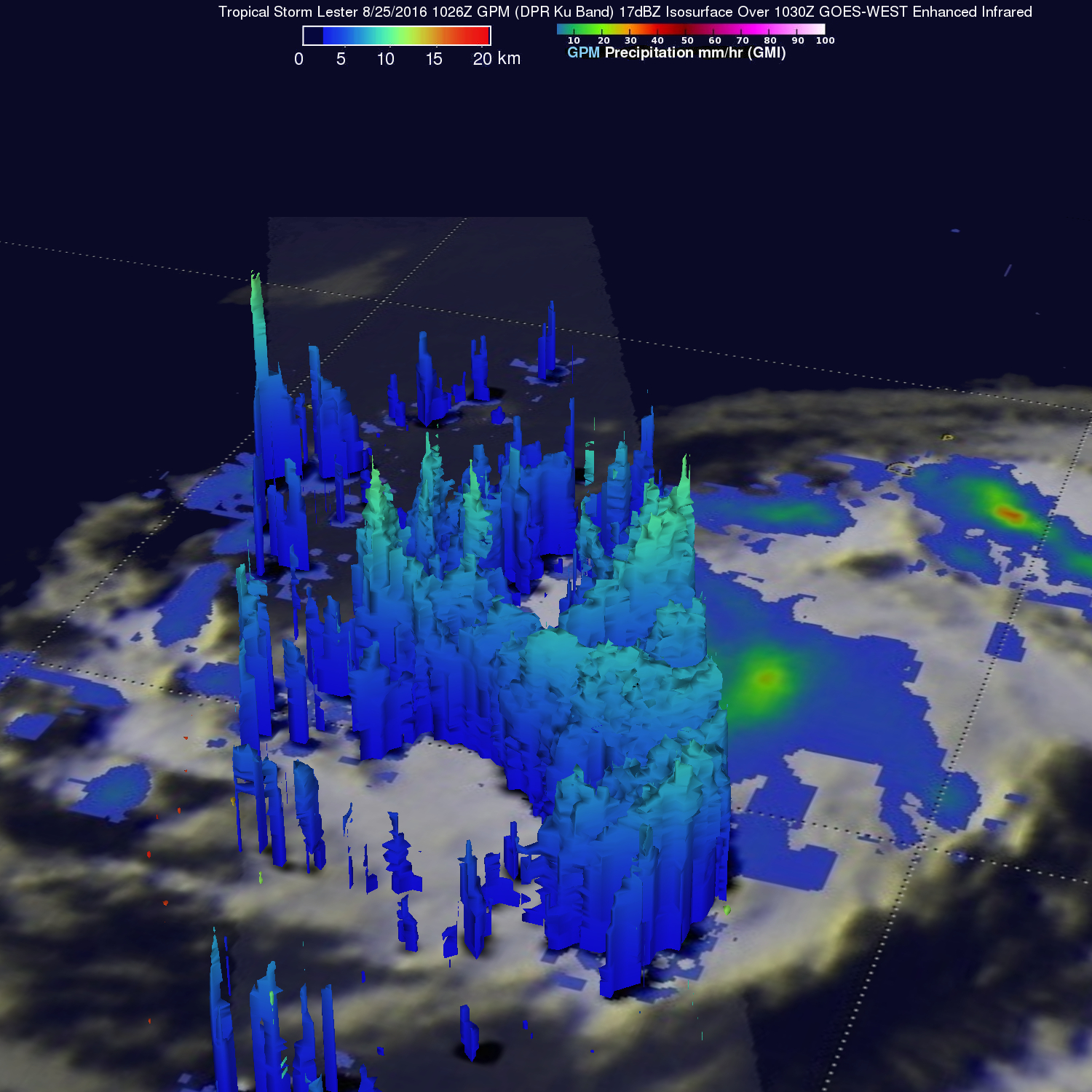
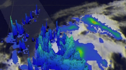
A 3-D examination of precipitation was performed on tropical storm Lester using DPR (Ku Band) radar data captured with this pass. This examination found that cloud top heights were reaching about 12km (7.4 miles) in the tallest storms.