GPM Catches Line of Strong Storms Responsible For Tornadoes in Eastern U.S.
Yesterday, Sunday April 15th, a line of strong storms at one point stretched from the Florida Straits below the Florida Keys all the way up the East Coast and into Ohio. Many of the storms were strong with wide spread reports of wind damage from north Florida up through the Carolinas and into central Virginia. Among these were several reports of tornadoes from Florida to Virginia. The most significant were an EF-2 tornado that stuck Greensboro, NC, killing one person, and a tornado near Lynchburg in Amherst County Virginia that injured 8 people.
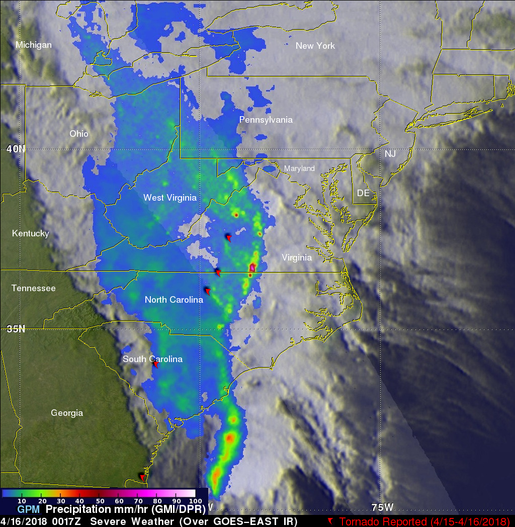
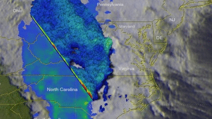
GPM captured this image of the advancing line of storms at 00:17 UTC 16 April 2018 (8:17 pm EDT) about one hour after the tornado was reported near Lynchburg, VA. The image shows instantaneous surface precipitation rates estimated from the GPM DPR in the inner swath and similar rates from the GMI in the outer swath. GPM reveals that the storms are organized into a classic squall line with a strong relatively narrow leading line of thunderstorms producing heavy rain rates (orange and red areas), followed by a much broader area of light to moderate rain (blue and lighter green areas). This leading line has a wave-like pattern. Often times, stronger storms can be found where the line bows forward. The second image was taken at the same time and shows a 3D perspective of the storms from the DPR, revealing areas of higher echo tops over central and southern VA where thunderstorms are active.
The storms and severe weather were spawned by a deep trough of low pressure west of the Appalachians over the Middle Mississippi Valley that stretched all the way down into the central Gulf of Mexico. Ahead of the trough, strong southerly winds drew warm, very moist air up from the Gulf while just enough directional wind shear aloft allowed storms to rotate and spin up tornadoes. This same storm system was also responsible for bringing record breaking snowfall to parts of the upper Midwest. Minneapolis/St. Paul reported nearly 15" of snow, which set the record for their largest April snowfall. The storm brought six plus inches of snow to parts of Nebraska, South Dakota, Iowa, Minnesota, Wisconsin and Michigan.
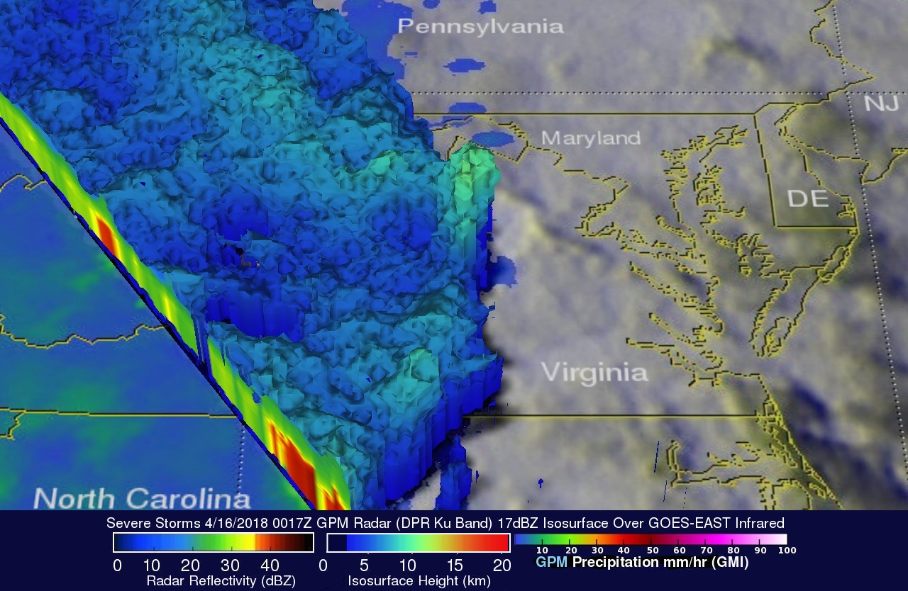
This 3-D view of the stormy weather was provided courtesy of GPM's radar (DPR Ku Band). DPR found that tall storms over central Virginia were reaching heights above 10.8 km (6.7 miles). GPM's radar found that rain in that stormy area was falling at a rate of greater that 85.4 mm (3.4 inches) per hour.