
GPM Again Examines Powerful Tropical Cyclone Uriah
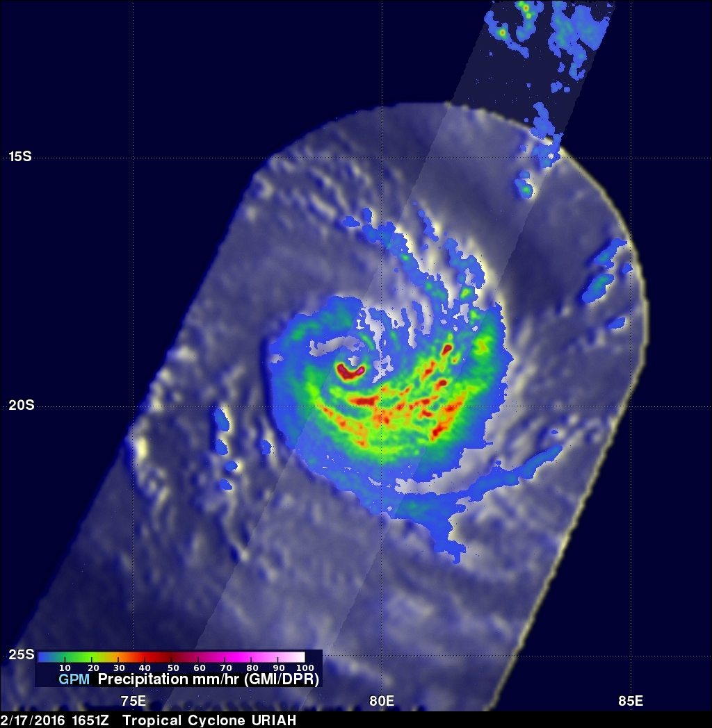
Both yesterday and today the GPM core observatory satellite had excellent views of tropical cyclone Uriah in the South Indian Ocean. Uriah was intensifying with winds of about 115 kts (132 mph) on February 17, 2016 at 1651 UTC when the GPM satellite passed above. A rainfall analysis derived from GPM's Microwave Imager (GMI) and Dual-frequency Precipitation Radar (DPR) data collected with that pass revealed that Uriah had a well defined circular eye. Rain was measured by DPR falling at a rate of over 179 mm (7 inches) per hour on the southern side of Uriah's eye wall. GPM passed over again on February 18, 2016 at 0613 UTC when Uriah's maximum wind speeds were estimated at 125 kts (144 mph). GPM revealed that, although wind speeds estimates were higher today, the tropical cyclone was starting to deteriorate. The northern side of the eye wall contained very little rainfall in the latest over flight but rain was falling at a rate of over 137 mm (5.4 inches) south of Uriah's center.

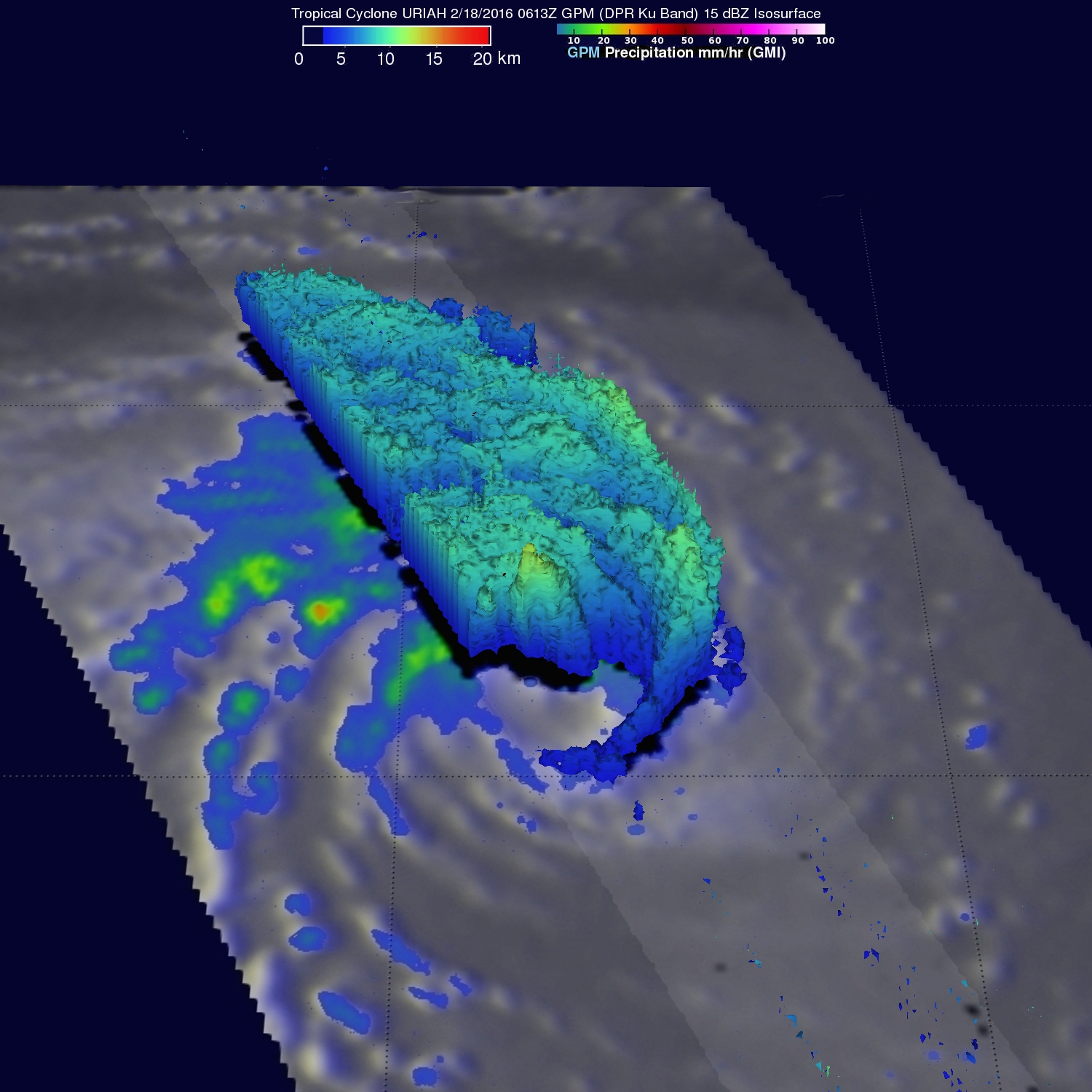
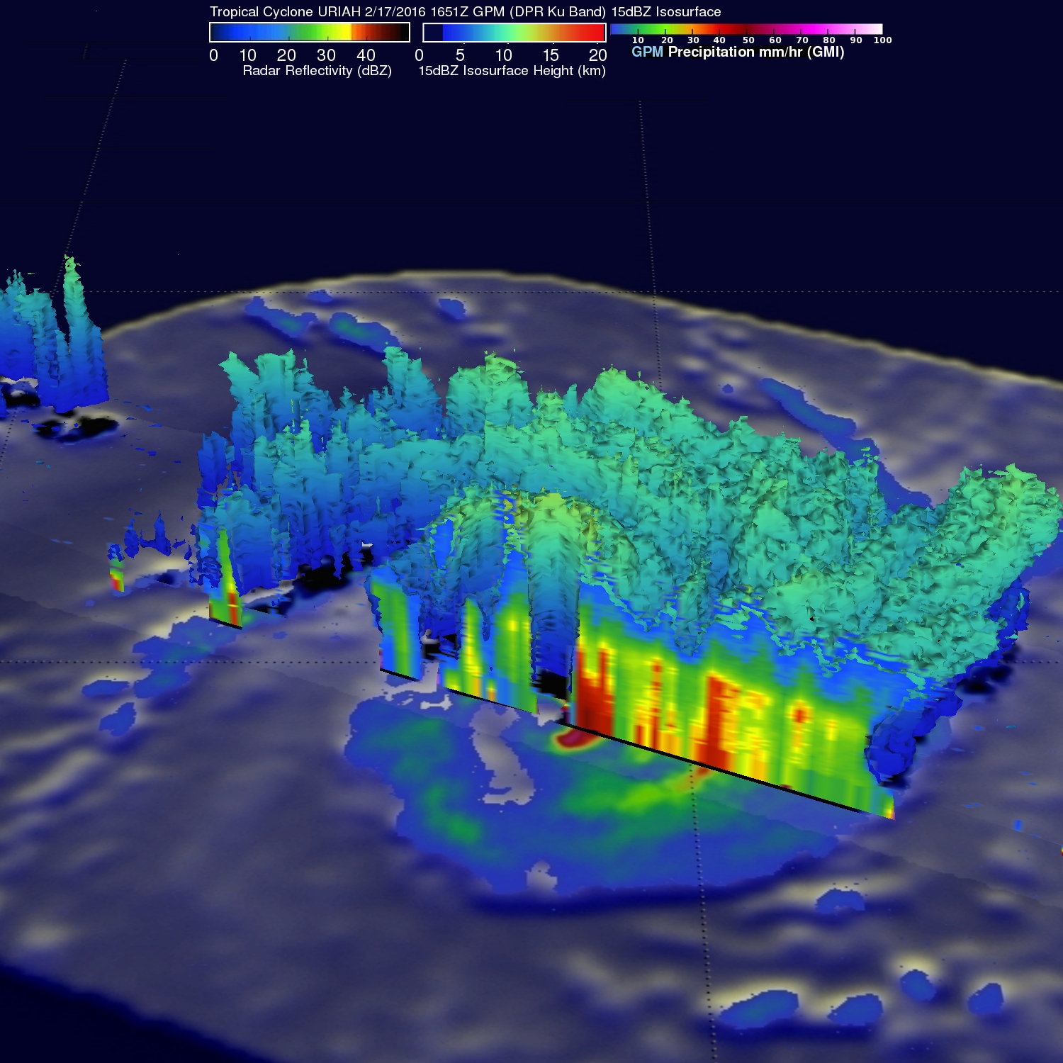
GPM's Radar (DPR ku Band) were used to examine the 3-D structure of precipitation within tropical cyclone Uriah with both February 17 and February 18,2016 over passes. A 3-D cross section through data captured by GPM yesterday showed radar reflectivity values of over 45 dbz (decibels relative to Z)in the southern side of Uriah's well structured eye wall. GPM's radar instrument found little rainfall structure in the northern side of the eye wall with today's view (looking toward the south).
The Joint Typhoon Warning Center (JTWC) predicts that Uriah will continue to slowly weaken while moving southward and have only tropical storm force winds in a few days.