Flooding Rainfall Over the U.S. East Coast Examined by GPM
Flood watches and warnings have been issued today for states from North Carolina through New York. Major flooding of rivers and streams is forecast in Pennsylvania as heavy rainfall continues. A Large blocking high located east of Nova Scotia and Low Pressure over the upper mid west has been funneling moisture over the Mid-Atlantic states. This weather pattern includes a strong upper level trough with it’s axis becoming oriented from the Great Lakes through the eastern Gulf Of Mexico. This resulted in a dip in the jet stream that has been transporting tremendous amounts of moisture from the Caribbean and the Bahamas.

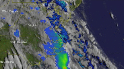
On July 2018 at 2:50 PM EDT (1850 UTC) the GPM core observatory satellite had an excellent view of storms associated with moisture streaming from the tropics into the Mid-Atlantic states. This view of rainfall was made possible using data collected by the GPM satellite's Microwave Imager (GMI) and Dual-Frequency Precipitation Radar (DPR) instruments. GPM's radar (DPR Ku Band) showed rain falling at a rate of over 1.8 inches (46 mm ) per hour in some areas.
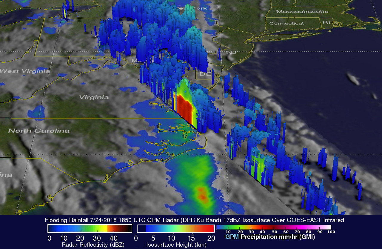
This 3-D image showing the structure of precipitation being streamed onto the Carolinas was derived from data collected by the GPM satellite. GPM's radar (DPR Ku Band) data shows that storm tops were reaching heights above 6.2 miles (10 km) in a heavy downpour along the coast near the border between North Carolina and Virginia. Most rain storms were shown by GPM to have much lower heights.