Eastern Pacific Tropical Storm Fabio Examined With GPM Satellite
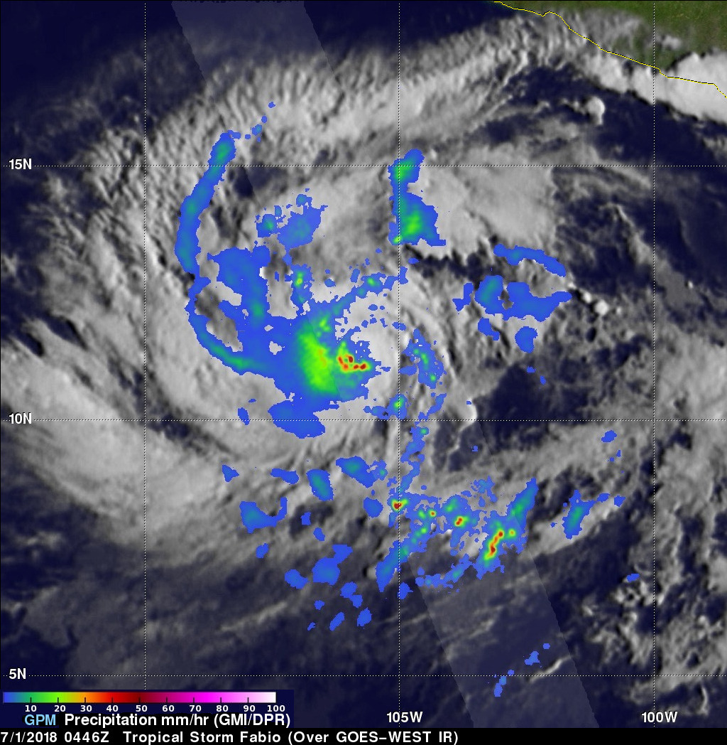
NASA's GPM core observatory satellite flew above tropical storm FABIO in the eastern Pacific Ocean south of Mexico on June 30, 2018 at 10:46 PM MDT (July 1, 2018 at 0446 UTC). FABIO has continued to intensify since then and the National Hurricane Center (NHC) predicts that the tropical storm will become a hurricane later today. FABIO is then expected to become a major hurricane on July 3, 2018 and reach it's peak intensity with wind speeds of about 105 kts (121 mph).
Rainfall measurements by GPM's Microwave Imager (GMI) and Dual-Frequency Precipitation Radar (DPR) instruments showed that FABIO contained intense convective storms. DPR measured rain was dropping at a rate of over 175 mm (6.9 inches) per hour in the heaviest concentration of rainfall that was located just to west of the tropical storm's center of circulation.
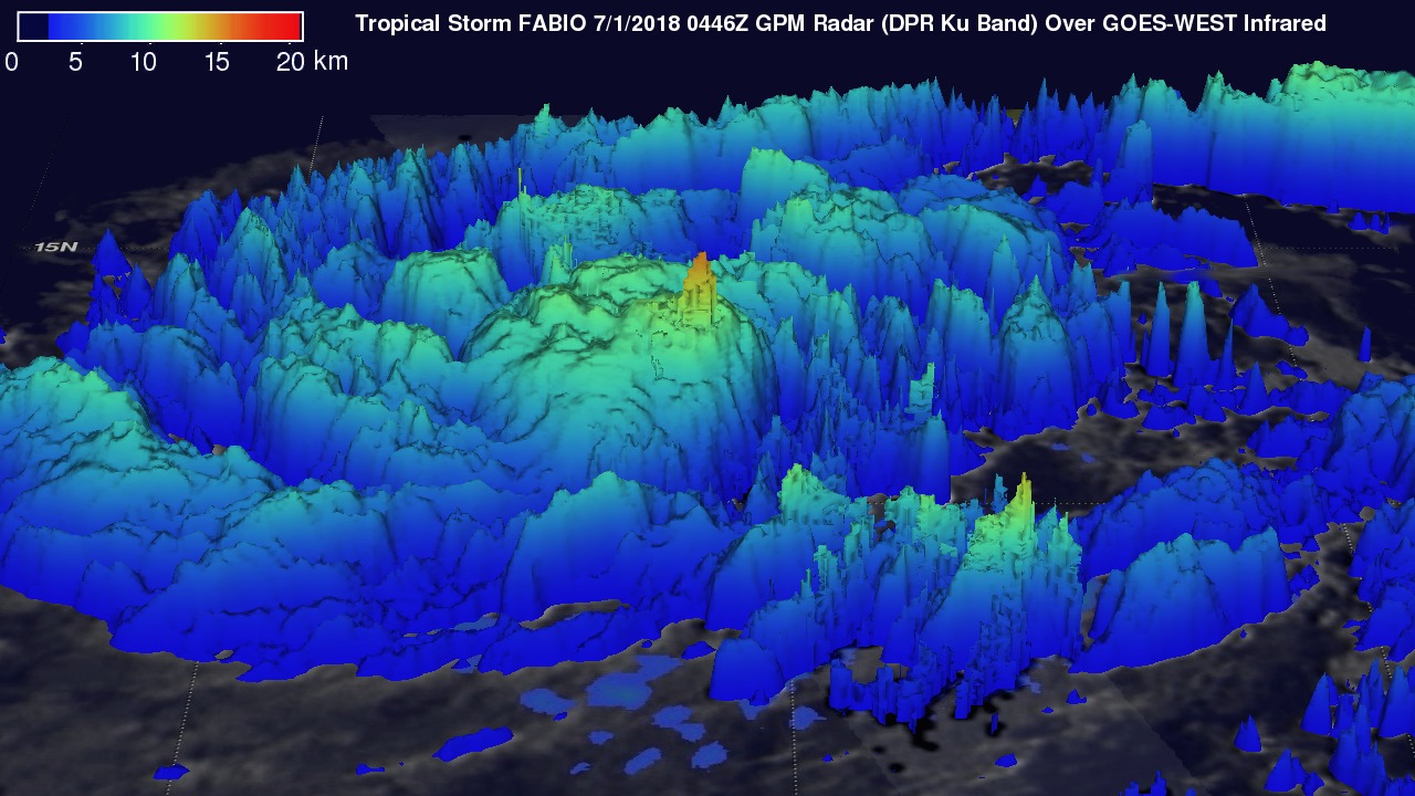
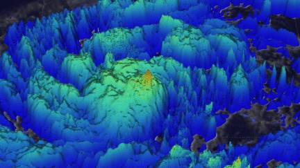
The GPM satellite's radar (DPR Ku Band) scanned strong convective storms that were producing heavy precipitation close to the southwestern side of FABIO's center of circulation. This simulated 3-D view from the south used GPM's radar data (DPR Ku Band). It shows that a few storm tops near the center of the tropical storm were reaching heights of almost 16 km (9.9 miles). Cloud top heights over a larger area are shown here by adjusting cloud top heights estimates from the GOES-WEST satellite's infrared temperatures to match storm top heights measured by the GPM satellite's radar (DPR Ku band). Tall convective storms near the center produce energy (latent heat of condensation) that can aid in the intensification of a tropical cyclone.