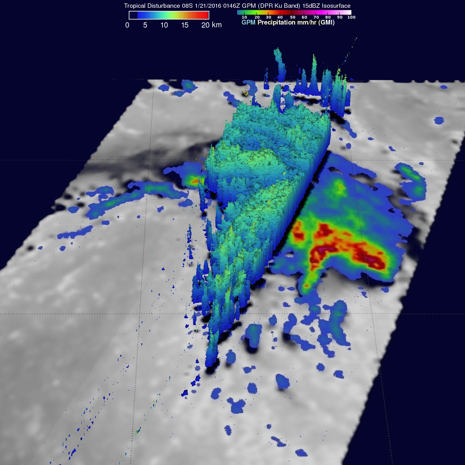
Developing Tropical Cyclone Viewed By GPM
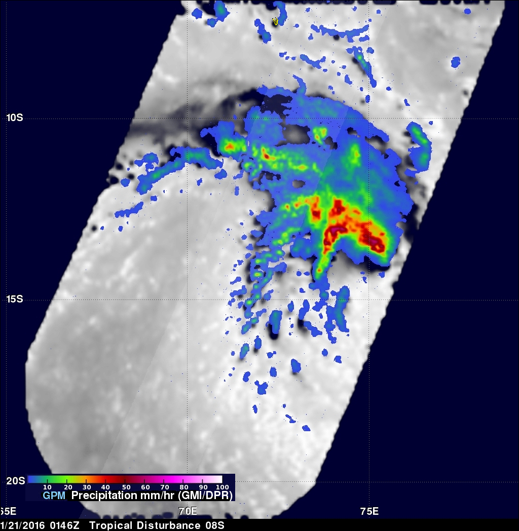
The GPM core observatory satellite saw a tropical cyclone developing in the South Indian Ocean east of Madagascar on January 21, 2016 at 0146 UTC. GPM's Microwave Imager (GMI) and Dual-frequency Precipitation Radar (DPR) measured precipitation in the potential tropical cyclone. The most intense showers were shown by the GMI instrument to be dropping rain at a rate of over 71 mm (2.8 inches) per hour in strong storms to the northeast of the tropical low's center of circulation. GPM's radar (DPR) viewed a swath of data to the west of the developing tropical cyclone center where rain was measured falling at a rate of over 80 mm (3.1 inches) per hour. A 3-D view derived from GPM's DPR (Ku Band) shows that storm tops were reaching heights of almost 13 km (8 miles) in the intense feeder band west of the low's center of circulation.