Damrey's Heavy Rainfall Examined Using IMERG Data
Typhoon Damrey originated as a tropical depression over the Philippines on October 31, 2017. Damrey intensified while moving westward over the South China Sea and became a typhoon on November 3, 2017. Typhoon Damrey hit Vietnam's south central coast the next day with sustained winds of about 75 kts (~86 mph). Torrential rainfall led to deadly flooding. As much as 580 mm (22.8 inches) of rain was reported near the coast well north of where typhoon Damrey came ashore. The Vietnamese government reported that Damrey was responsible for 89 deaths.
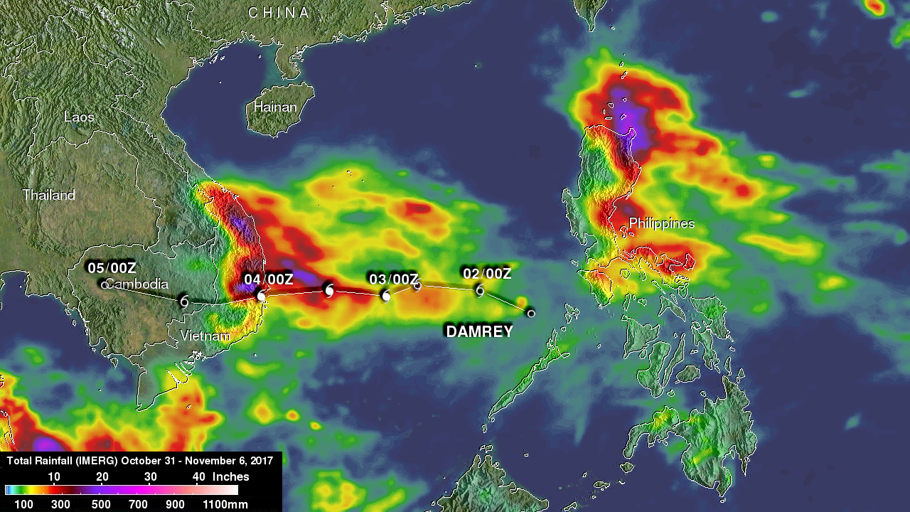
This rainfall accumulation analysis was derived from NASA's Integrated Multi-satellitE Retrievals data (IMERG). IMERG data are used to calculate estimates of precipitation from a combination of space-borne passive microwave sensors, including the GMI microwave sensor onboard the GPM satellite, and geostationary IR (infrared) data. This image shows IMERG rainfall estimates over Southeast Asia during the period from October 31 to November 6, 2017. This IMERG rainfall analysis indicates Damrey's onshore flow caused the heaviest rainfall north of where the typhoon came ashore. IMERG estimated that more than 500 mm (19.7 inches) of rain was common in this part of south central Vietnam. Rainfall totals decreased as Damrey moved westward and dissipated over Cambodia .