PMM

Content which is not specifically affiliated with GPM or TRMM, but which is about the Precipitation Measurement Missions in general.

NASA Widens 2014 Hurricane Research Mission
NASA's airborne Hurricane and Severe Storm Sentinel or HS3 mission, will revisit the Atlantic Ocean for the third year in a row. Image Credit: NASA's Goddard Space Flight Center/Ryan Fitzgibbons Download this video in HD formats from NASA Goddard's Scientific Visualization Studio During this year's Atlantic hurricane season, NASA is redoubling its efforts to probe the inner workings of hurricanes and tropical storms with two unmanned Global Hawk aircraft flying over storms and two new space-based missions. NASA's airborne Hurricane and Severe Storm Sentinel or HS3 mission, will revisit the...
GPM flying over Earth with a data swath visualized.
March 17, 1947 - November 20, 2013 Watch the video "Remembering Arthur Hou: A Legacy of Leadership" Event Photos The Dr. Arthur Hou Memorial Symposium at the 2014 PMM Science Team Meeting. Dr. Michael Freilich, NASA Earth Science Division Director, speaking at the Dr. Arthur Hou Memorial Symposium. Dr. Piers Sellers, Deputy Director of the Sciences and Exploration Directorate, speaking at the Dr. Arthur Hou Memorial Symposium. Dr. Piers Sellers and Dr. Riko Oki presenting plaques to the family of Dr. Arthur Hou. Event Information August 4, 2014 from 1-5 p.m. Embassy Suites - Grand Historic...

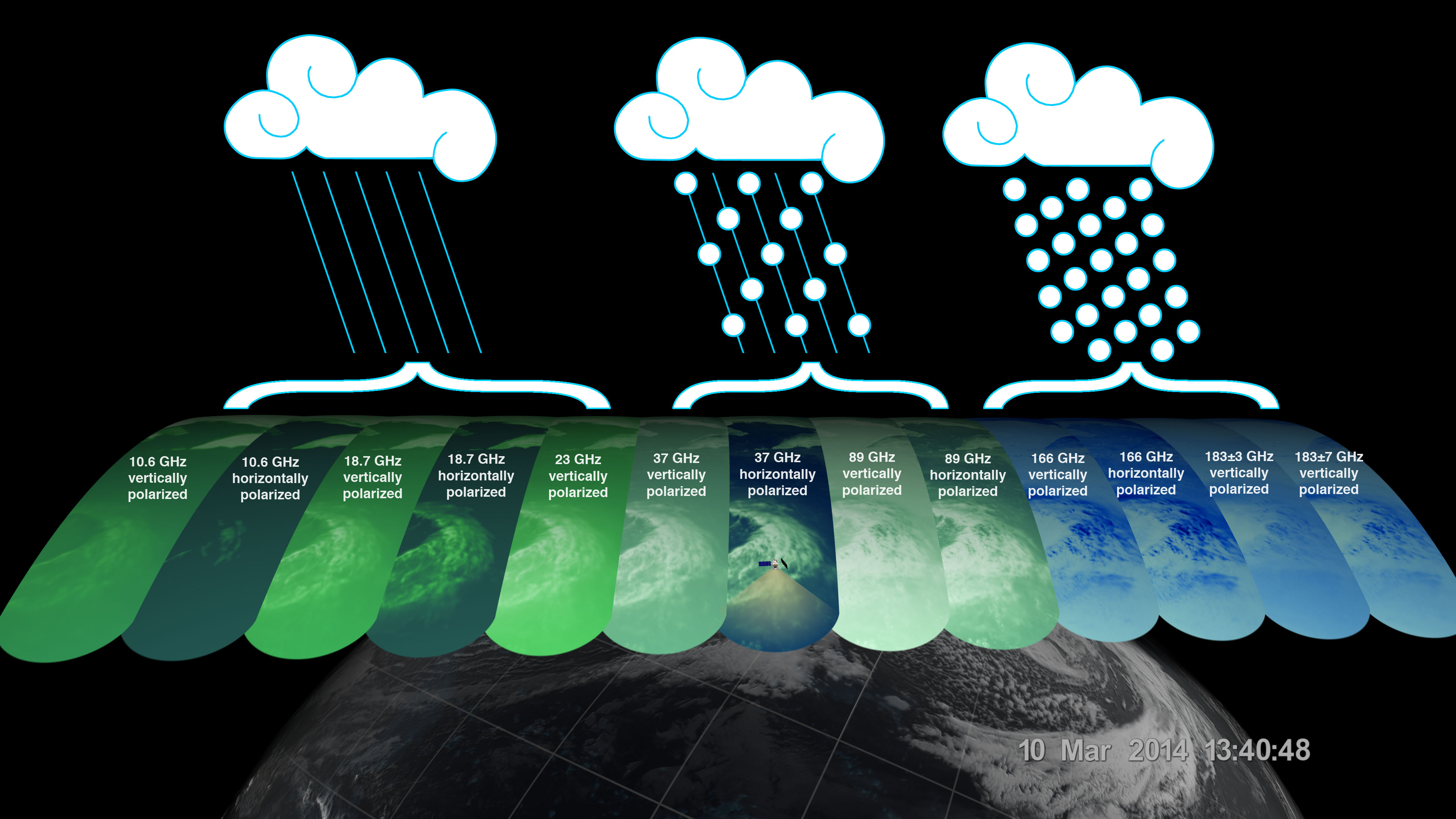
13 Channels of the GMI

13 Channels of GMI
Image Caption
The GMI instrument has 13 channels, each sensitive to different types of precipitation.
The GPM Microwave Imager (GMI) has a swath 550 miles (885 kilometers) wide, giving it a broad view of the extra-tropical cyclone observed off the coast of Japan on March 10, 2014. The GMI instrument has 13 channels, each displayed in this visualization of the data. Each channel is sensitive to a different frequency of microwave energy naturally emitted from or affected by precipitation. As depicted by the graphics, the five channels on the left are sensitive to heavy and moderate rainfall.

First Images from GPM

First Images from GPM
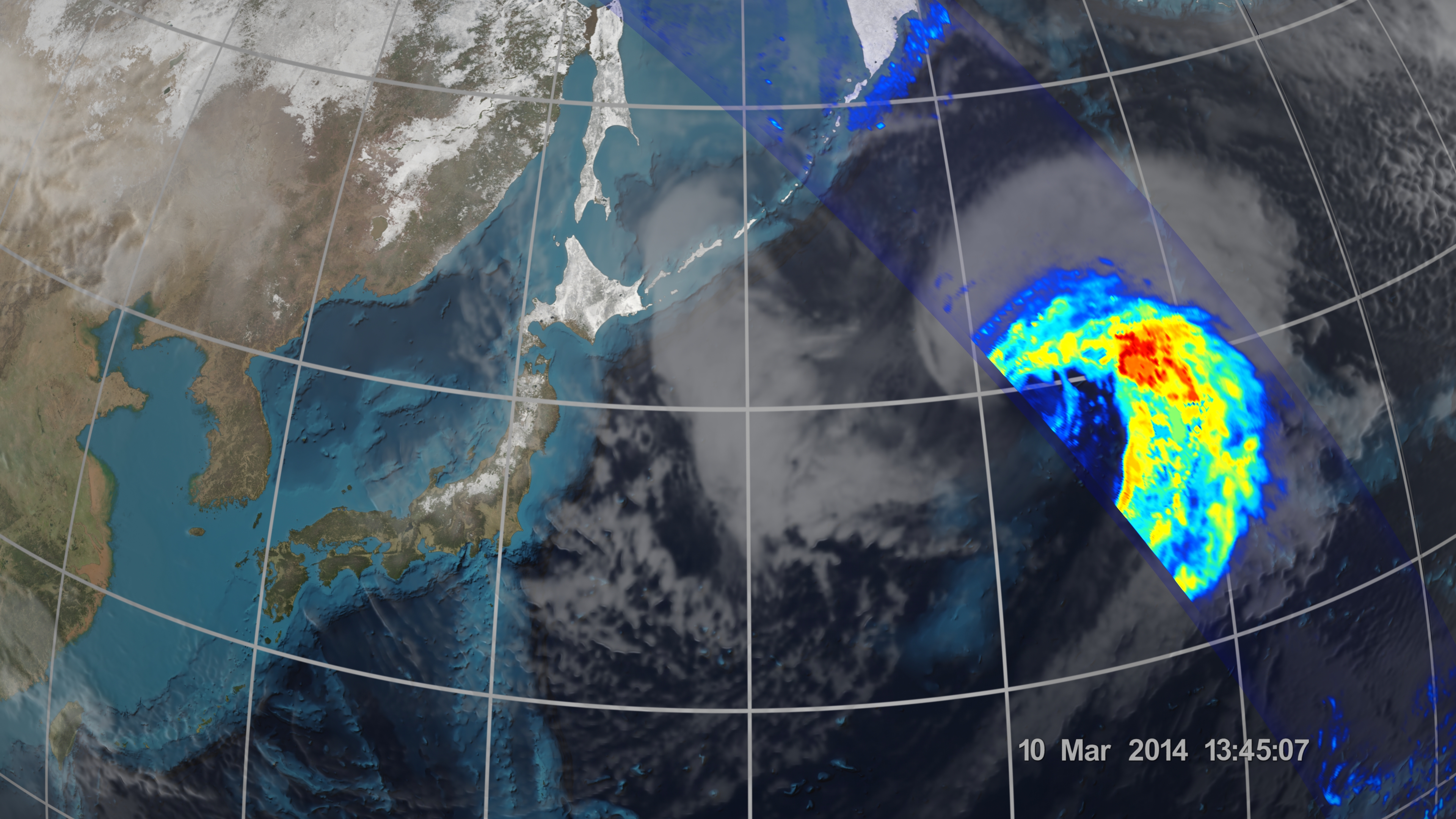
Image Caption
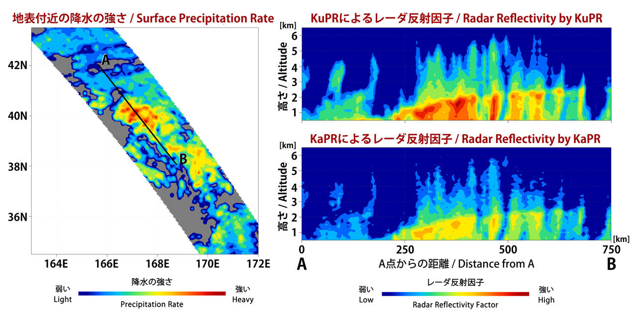
The Dual-frequency Precipitation Radar observes rainfall and snowfall that occurs within clouds in three dimensions, across the surface of the Earth and upward into the atmosphere.
An extra-tropical cyclone was observed over the northwest Pacific Ocean off the coast of Japan on March 10, 2014. 
 
The graph on the left shows the extra-tropical storm seen by the DPR as the satellite passed overhead. The x-axis is the east-west longitude and the y-axis is north-south latitude. The colors show the rain rate at sea-level, with more intense rainfall represented by red and lighter precipitation shown in blue.

First Images from GPM

First Images from GPM
Image Caption
On March 10, the Core Observatory passed over an extra-tropical cyclone about 1055 mi (1700 km) due east of Japan's Honshu Island.

The storm formed from the collision of a cold air mass wrapping around a warm air mass, emerging over the ocean near Okinawa on March 8. It moved northeast over the ocean south of Japan, drawing cold air west-to-east over the land, a typical winter weather pattern that also brought heavy snow over Hokkaido, the northernmost of the four main islands. After the GPM images were taken, the storm continued to move eastward, slowly intensifying before weakening in the central North Pacific. 

Learn More

First Images from GPM Dual-Frequency Precipitation Radar
First Images from GPM Dual-Frequency Precipitation Radar
Image Caption
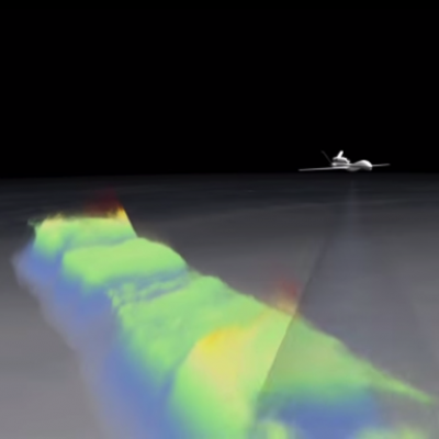
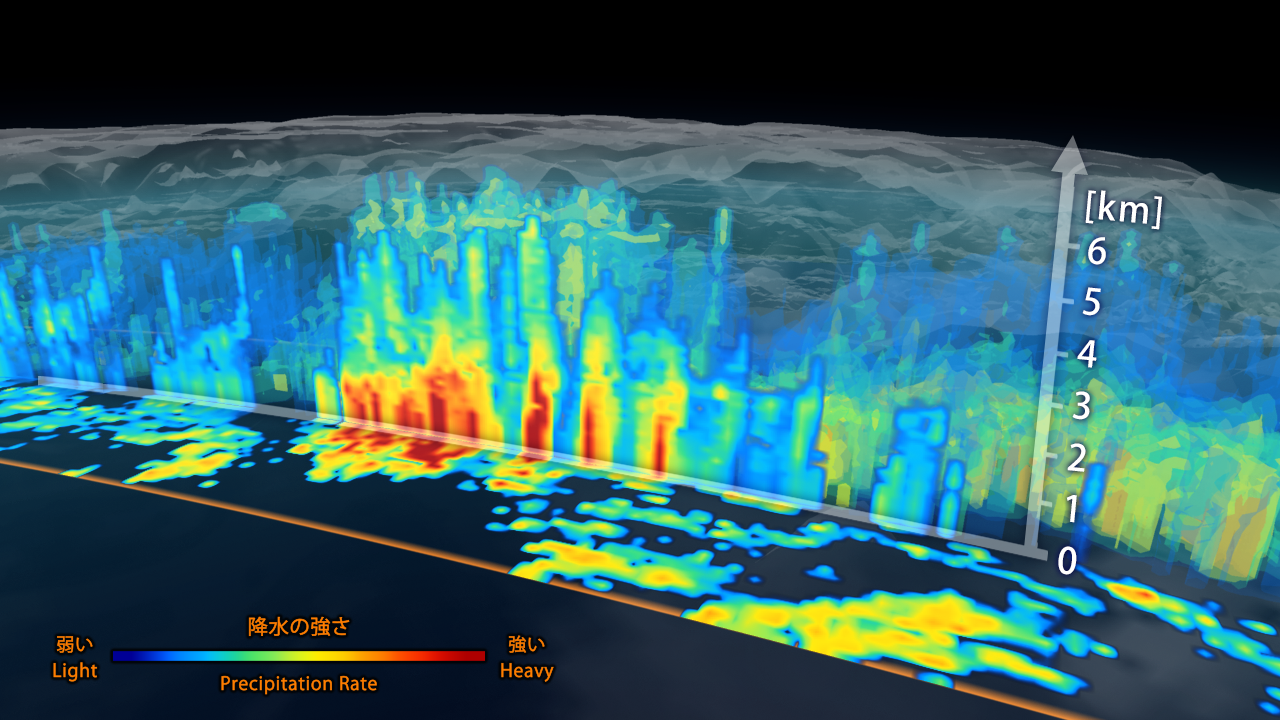
3D view inside an extra-tropical cyclone observed off the coast of Japan, March 10, 2014, by GPM's Dual-frequency Precipitation Radar.

First data visualization of the three-dimensional structure of precipitation collected by the Dual-frequency Precipitation Radar aboard the Global Precipitation Measurement (GPM) mission's Core Observatory. The image shows rain rates across a vertical cross-section approximately 4.4 miles (7 kilometers) high through an extra-tropical cyclone observed off the coast of Japan on March 10, 2014. The DPR 152-mile (245 kilometers) wide swath is nested within the center of the GPM Microwave Imager's wider observation path.

First Images from GPM Microwave Imager
First Images from GPM Microwave Imager
Image Caption
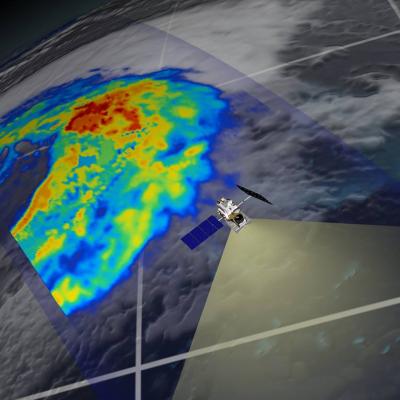
First Images from GPM Microwave Imager

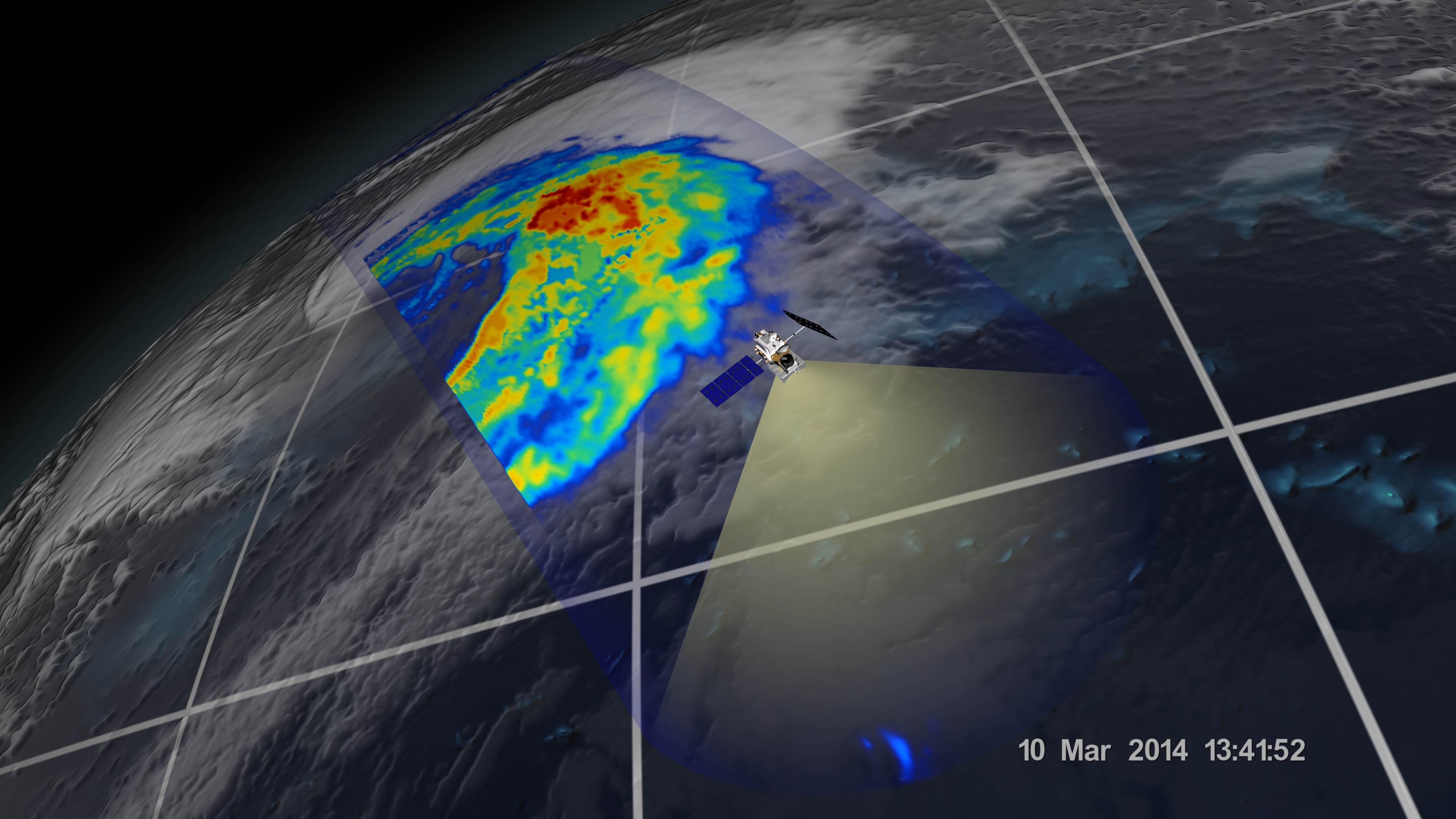
The image shows rain rates across a 550-mile (885 kilometer) wide swath of an extra-tropical cyclone observed off the coast of Japan on March 10, 2014. Red areas indicate heavy rainfall, while yellow and blue indicate less intense rainfall. In the northwest part of the storm in the upper left of the image, the blue areas indicate falling snow.

Learn More