TRMM

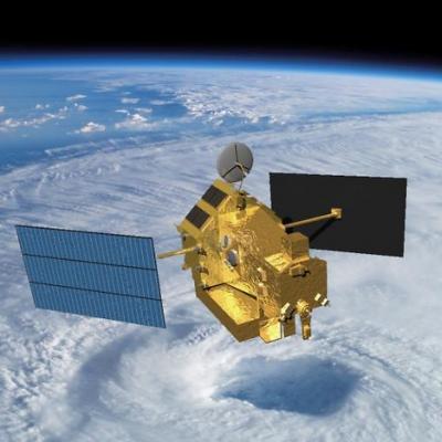
TRMM Spacecraft Re-Entry

June 16, 2015, Update: The Tropical Rainfall Measuring Mission (TRMM) spacecraft re-entered the Earth’s atmosphere on June 15, 2015, at 11:55 p.m. EDT, over the South Indian Ocean, according to the U.S. Strategic Command’s Joint Functional Component Command for Space through the Joint Space Operations Center (JSpOC). The U.S. Space Surveillance Network, operated by the Defense Department's JSpOC, had been closely monitoring TRMM’s descent since the mission was ended in April. Most of the spacecraft was expected to burn up in the atmosphere during its uncontrolled re-entry. Learn more. ----

TRMM PR Data Distribution Resumes

TRMM/PR data distribution resumes during the experimental operation period. The satellite has descended to an altitude of around 350 km on February 12, 2015, which is the original nominal altitude before 2001. Verification of the data quality concluded and JAXA and PPS started distribution of PR data around the 350 km altitude (orbit number from 98231) to the public. PR available data period around 350 km altitude will be about 40 days since February 12, 2015. Please see TRMM/PR data distribution for further information and for the data locations.

Two Satellites Measured Rainfall in Tropical Depression Mekkhala

The first tropical depression of the 2015 western Pacific season formed southwest of Guam on January 13 and is predicted to intensify into a tropical storm while headed toward the Philippines. NASA's TRMM and GPM satellites provided a look at Tropical Depression Mekkhala's rainfall data that showed the area of moderate rainfall had expanded as the storm strengthened on January 13. Mekkhala was previously known as Tropical Depression 01W until January 14 when it was renamed. Both the Global Precipitation Measurement (GPM) core satellite and the Tropical Rainfall Measuring Mission (TRMM)

TRMM Precipitation Radar Data Suspended

The TRMM satellite is descending, and the users of TRMM Precipitation Radar (PR) data should be aware that the last production orbit of public PR data was orbit #96230 from October 7th, 2014. From that point forward, the TRMM PR data is suspended because no useful cloud data are being observed. It is possible that PR data will again be made available when TRMM descends to the vicinity of its at-launch altitude of 350 km. TRMM Microwave Imager (TMI) data will continue to be produced and publicly available during the descent of the spacecraft until it reaches its decommissioning altitude of

TRMM And GPM Core Satellite See Sinlaku Headed Toward Vietnam

Tropical storm Sinlaku formed on November 26, 2014 over the southeastern Philippines. As a tropical depression Sinlaku caused flooding in areas of the Visayas and Mindanao. The TRMM and the GPM core satellite viewed Sinlaku after it had strengthened into a tropical storm over the South China Sea. The first image shows rainfall derived from TRMM Microwave Imager (TMI) data collected when the satellite flew over on November 28, 2014 at 0716 UTC. The second view shows rainfall from GPM Microwave Imager (GMI) measurements received a little over six hours later at 1326 UTC. Rainfall was measured by
Date Last Updated
October 2nd, 2020
Document Description

The transition from the Tropical Rainfall Measuring Mission (TRMM) data products to the Global Precipitation Measurement (GPM) mission products has begun. This document specifically addresses the multi-satellite products, the TRMM Multi-satellite Precipitation Analysis (TMPA), the real-time TMPA (TMPA-RT), and the Integrated Multi-satellitE Retrievals for GPM (IMERG).

Goodbye to TRMM, First Rain Radar in Space
After 17 years of groundbreaking 3-D images of rain and storms, the joint NASA and Japan Aerospace Exploration Agency Tropical Rainfall Measuring Mission (TRMM) will come to an end next year. NASA predicts that science operations will cease in or about April 2015, based on the most recent analysis by mission operations at NASA’s Goddard Space Flight Center, Greenbelt, Maryland. Artist concept of TRMM in space over the eye of a tropical cyclone. Image Credit: NASA On July 8, 2014, pressure readings from the fuel tank indicated that TRMM was near the end of its fuel supply. As a result, NASA...

Cristobal Passes Northwest Of Bermuda

The TRMM satellite had a very good view of Cristobal on August 28, 2014 at 1258 UTC (8:58 EDT) as the hurricane passed well to the northwest of Bermuda. Rainfall derived from TRMM's Microwave Imager (TMI) and Precipitation Radar (PR) data is shown overlaid on a 1300 UTC GOES-EAST Visible/Infrared image. TRMM PR found some intense thunderstorms producing rain at a rate of almost 78 mm (about 3.1 inches) per hour in a band of precipitation feeding into Cristobal's southeastern side. The next image is a simulated 3-D view (from the west) of Cristobal's rainfall structure using radar reflectivity
TRMM Out Of Fuel, Continues to Provide Data
Pressure readings from the Tropical Rainfall Measuring Mission's (TRMM) fuel tank on July 8 indicated that the satellite was nearly at the end of its fuel supply. As a result, NASA has ceased maneuvers to keep the satellite at its operating altitude of 402 kilometers (~250 miles). With its speed decreasing, TRMM has begun to drift downward. A small amount of fuel remains to conduct debris avoidance maneuvers to ensure the satellite remains safe. Artist's visualization of the TRMM satellite in space over a tropical cyclone. Image Credit: NASA TRMM's slow descent will continue over the next 2 to...

TRMM Satellite Out of Station-keeping Fuel

Since December 1997, TRMM and the instruments it carries have provided valuable information to researchers, the applications community, and the public. On July 8, 2014, pressure readings from the fuel tank indicated that TRMM is at the end of its fuel. As a result, NASA has ceased station keeping maneuvers and TRMM has begun its drift downward from its operating altitude of 402 km. A small amount of fuel has been retained to conduct debris avoidance maneuvers to ensure the satellite remains safe during the drift down. TRMM observations will continue as the spacecraft descends to 335 km, at