Tornados

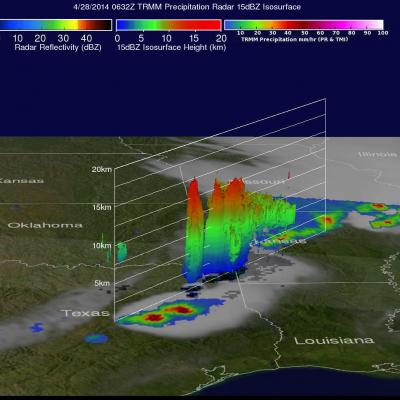
Heavy Rain & Tornadoes

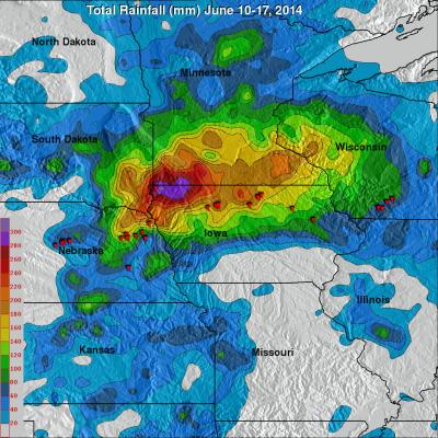
Tornadoes killed two people yesterday in Pilger, Nebraska. Tornadoes were reported with violent weather that also hit the states of North Dakota, Iowa and Wisconsin. Heavy rainfall with this extreme weather was monitored with the TRMM-based, near-real time Multi-satellite Precipitation Analysis (TMPA) at the NASA Goddard Space Flight Center. An analysis of TMPA rainfall totals is shown here for the seven days from June 10-17, 2014. This analysis indicated that the highest rainfall totals for the period (light purple) were greater than 300 mm (about 11.8 inches) in northwestern Iowa. Locations

Deadly Tornadoes Hit Southern and Central US

The TRMM satellite flew over the southern United States on April 28, 2014 at 0454 UTC (April 27, at 11:54 CDT) and April 28, 2014 at 0632 UTC (1:32 AM CDT). At both times severe weather pushing through the central and southern United States was observed by the satellite. Tornadoes associated with these areas of powerful thunderstorms killed at least 16 people with 14 deaths reported in Arkansas. Rainfall from TRMM's Microwave Imager (TMI) and Precipitation Radar (PR) instruments is shown above overlaid on GOES-EAST infrared satellite images received at close to the same time. The locations of

TRMM Sees Deadly Louisiana Tornado

The TRMM satellite was flying high over head when it passed above tornadoes occurring in the state of Louisiana on 5 March 2011 at 1411 UTC (8:11 AM CST). The National Oceanic and Atmospheric Administration (NOAA) reported that seven tornadoes were spotted in Louisiana on that date. These tornadoes caused at least 15 injuries and one death with a tornado that hit in the northwest section of Rayne, Louisiana. The image on the left above shows a precipitation analysis using data collected with that TRMM orbit. TRMM's Microwave Imager (TMI) and Precipitation Radar (PR) (in the lighter swath)