Destructive Tropical Cyclone Gita's Rainfall Measured With IMERG
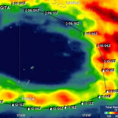
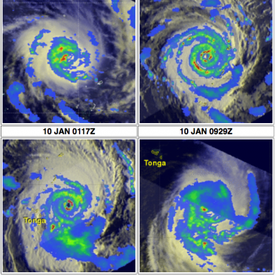
Tropical cyclone GITA recently battered and drenched first Samoa and then Tonga as it passed close to both island groups. GITA was a tropical storm with winds of about 40 kts (46 mph) when it passed to the south of Samoa but still caused widespread destruction and flooding. The president of the United States approved a disaster declaration for Samoa. The tropical cyclone's winds had increased to about 125 kts (144 mph) when it battered Tonga as the equivalent of a category four hurricane on the Saffir-Simpson hurricane wind scale. Destructive winds were the main cause of destruction but heavy