Thunderstorms

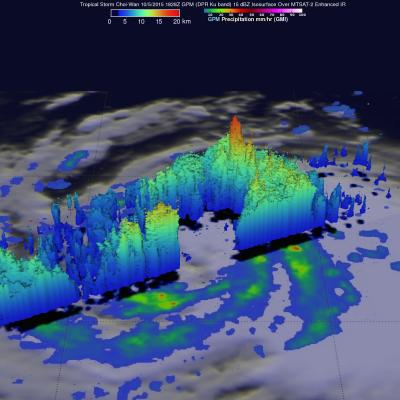
GPM Reveals Very Strong Thunderstorms in Typhoon Choi-Wan

The GPM core observatory satellite flew above tropical storm Choi-Wan on October 5, 2015 at 1828 UTC and then saw Choi-Wan again as a hurricane on October 6, 2015 at 0448 UTC. The tropical cyclone was spreading clouds and rain over a large area of the northwest Pacific Ocean southeast of Japan. GPM discovered that Choi-Wan's organization had slightly improved. GPM's Microwave Imager (GMI) and Dual-Frequency Precipitation Radar (DPR) instruments were able to peer through the overcast and reveal the locations of rainfall bands within the tropical cyclone. GMI found several areas where Choi-Wan

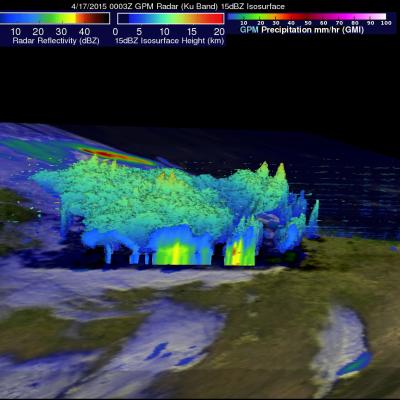
A GPM View of Tornado Spawning Thunderstorms

Twelve tornado sightings reported to NOAA yesterday were associated with severe thunderstorms extending from the Texas Gulf coast, through Oklahoma and Kansas. The GPM core observatory satellite had a good look at this area of severe weather on April 17, 2015 at 0003 UTC (April 16, 2015 at 7:03 PM CDT). A precipitation analysis using GPM's Microwave Imager (GMI) shows that some of these severe storms were dropping rain at a rate of over 86 mm (about 3.4 inches) per hour. Reflectivity data from the Ku band on GPM's dual frequency radar was used to construct this 3-D view of tornado spawning

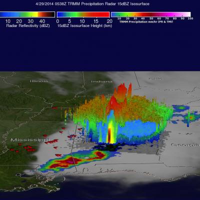
Deadly Tornadoes Hit Southern States For Second Day

For the second day in a row deadly tornadoes hit the the southern United States. Mississippi was the hardest hit with nine people killed by tornadoes that hit Tupelo. The TRMM satellite had two good views as extreme weather continued moving through the area on Monday April 28, 2014 at 11:00 PM CDT (April 29, 2014 at 0400 UTC) and early Tuesday April 29, 2014 at 00:38 AM CDT (0538 UTC). Rainfall derived from TRMM's Microwave Imager (TMI) and Precipitation Radar (PR) data is shown overlaid on GOES-EAST infrared satellite images captured on April 29, 2014 at 0402 UTC and 0532 UTC. Red symbols

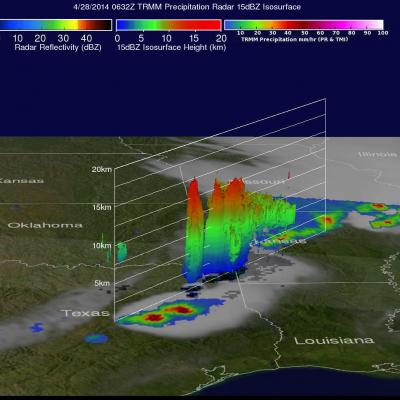
Deadly Tornadoes Hit Southern and Central US

The TRMM satellite flew over the southern United States on April 28, 2014 at 0454 UTC (April 27, at 11:54 CDT) and April 28, 2014 at 0632 UTC (1:32 AM CDT). At both times severe weather pushing through the central and southern United States was observed by the satellite. Tornadoes associated with these areas of powerful thunderstorms killed at least 16 people with 14 deaths reported in Arkansas. Rainfall from TRMM's Microwave Imager (TMI) and Precipitation Radar (PR) instruments is shown above overlaid on GOES-EAST infrared satellite images received at close to the same time. The locations of

TRMM Sees Tornadic Thunderstorms

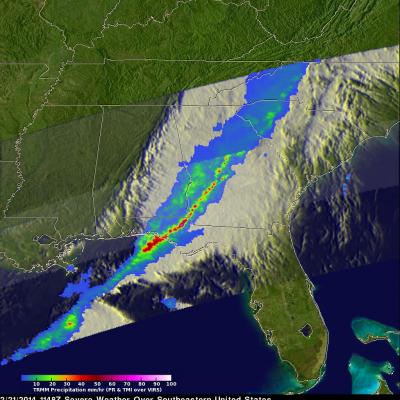
The TRMM satellite passed above a line of severe thunderstorms over the eastern United States on February 21, 2014 at about 1148UTC (6:48 AM EST). Several reports of tornadoes in Illinois were associated with this system yesterday. A possible tornado was reported in Georgia this morning. The 3-D image below shows a TRMM Precipitation Radar (PR) slice through the line of severe thunderstorms. One tall thunderstorm in the Florida panhandle was shown reaching heights of about 13.8km (~8.5 miles) and returning Radar reflectivity values of over 58dBZ to the satellite. Rain was found by TRMM PR to

TRMM Sees Powerful Storm Over San Antonio

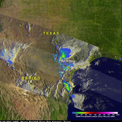
Three people died this past weekend from flooding in San Antonio, Texas. The TRMM satellite flew above Texas early Saturday morning at 1118 UTC (6:18 AM CDT) when powerful thunderstorms were drenching San Antonio. Data captured with this orbit by TRMM's Microwave Imager (TMI) and Precipitation Radar (PR) were used in this rainfall analysis. TRMM's Precipitation Radar (PR) instrument found rain falling at a rate of over 66 mm/hr (~2.5 inches) in one violent thunderstorm shown near the center of this image. This 3-D image shows a TRMM Precipitation Radar (PR) slice through storms over Texas. One

TRMM Sees Tornado Spawning Thunderstorms

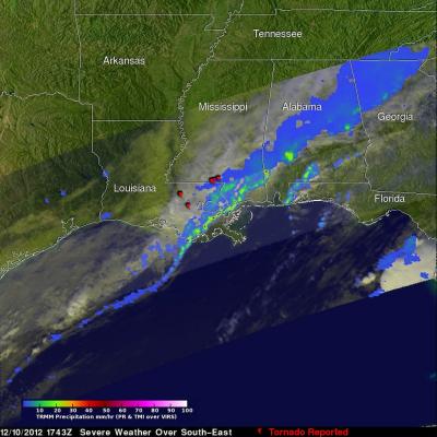
In the United States tornadoes develop most often in the spring when warm moist unstable air accompanies strong fronts and fluctuating upper-air systems. There is a also a slight increase in tornado activity in late October and November. Tornadoes form least often in December and January so the tornadoes that occurred yesterday over the south-eastern United States were unusual. The TRMM satellite was flying over on December 10, 2012 at 1743 UTC (12:43 PM EST) and captured data showing tornado spawning thunderstorms within a frontal system moving through Louisiana, Mississippi, Alabama, Georgia
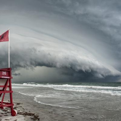
Shelf cloud approaching the beach.
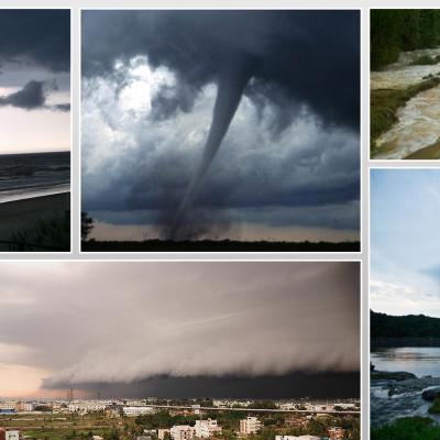
Thank you to everyone who submitted photos to the first installment of our GPM Extreme Weather Photo Competition. We loved all of your entries and thoroughly appreciate your participation! The GPM Photo Competition Committee is happy to announce our top 5 picks. We’ll be sending the submitters NASA bags and GPM stickers. Please stay tuned for additional contests and activities. Ormond Shelf, by Jason Weingart Date and Location: May 15, 2012 Ormond Beach, Florida How this Photo Was Taken: “I'm a photography student at the University of Central Florida. I began chasing storms a little over three...
GPM Extreme Weather Photo Contest
Powerful weather systems like thunderstorms and tornadoes are awesome displays of the force of nature. Now NASA wants to display YOUR photos of extreme weather! Post your coolest photographs and we'll pick the best ones to feature on the NASA Precipitation Measurement Missions websites (http://pmm.nasa.gov/ & http://www.nasa.gov/GPM). While we want extreme weather, we don't want YOU to be too extreme. So before you take that photo, please make sure you're keeping safe. Submission Guidelines: Submit your photo's to the GPM Extreme Weather Flickr group: http://www.flickr.com/groups/gpm-extreme...