Texas

Slow-moving Frontal System Brings Heavy Rains, Flooding to Parts of Texas

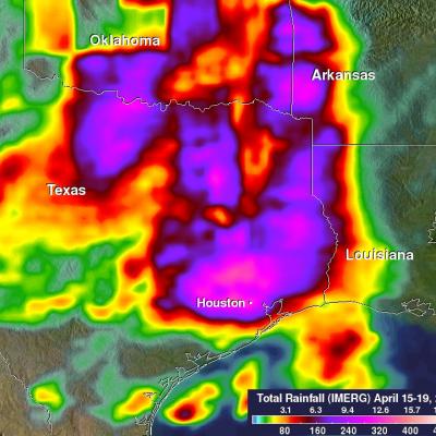
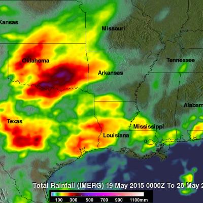
A slow-moving frontal system associated with a stagnant upper-air pattern set the stage for heavy rains and flooding early this week from East Texas all the way up through the Central and Northern Plains. The hardest hit region was in and around the Houston area. On Monday, the National Weather Service reported that Houston International Airport broke its all time daily rainfall record with 9.92 inches of rain. Elsewhere in Harris County, over 17 inches of rain was recorded as of Monday evening. The main culprit was a stationary upper-level low pressure center spinning over the Central Rockies
Torrential Rain Over South Measured From Space JacobAdmin Mon, 03/14/2016
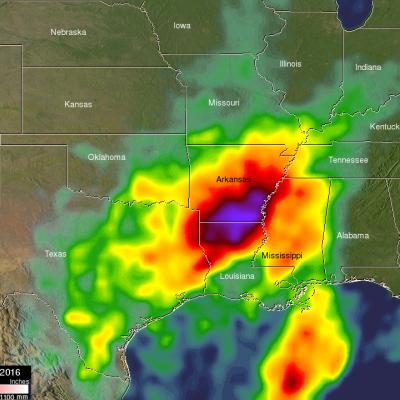
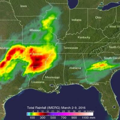
Extremely heavy rain fell over the southern United States during the past week. A slow moving area of low pressure pumped moisture from the Gulf Of Mexico causing torrential rain that resulted in wide spread flooding in states from Texas to Tennessee. Over 24 inches of rain was reported in Monroe, Louisiana. Over 4,958 homes in Louisiana were reportedly damaged by the flooding. Strong winds accompanying intense thunderstorms also toppled trees in Mississippi and Louisiana. A simulated 3-D animation of NASA merged satellite rainfall analysis (TMPA) using data collected from March 7-14, 2016

GPM Views Severe Weather And Heavy Rain in the U.S.

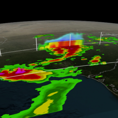
The GPM satellite flew above storms in the southwestern United States this morning (March 9, 2016) at 1011 UTC (5:11 CST). Severe weather has been moving slowly through this area for the past couple days. Two tornadoes developed in north central Texas yesterday morning (March 8, 2016). This morning rain was measured by GPM's Dual-Frequency Precipitation Radar (DPR) instrument falling at the extreme rate of over 148 mm (5.8 inches) in one powerful storm over eastern Texas. GPM's radar (DPR Ku Band) found that a few thunderstorm tops in this area were reaching altitudes above 13.7 km (8.5 miles)
GPM Sees Tropical Storm Bill Over Texas
Download in hi-res from the NASA Goddard Scientific Visualization Studio Tropical Storm Bill made landfall over Texas at approximately 11:45am CST on June 16, 2015. Shortly after midnight, GPM passed over the storm as it slowly worked it's way northward across the already drenched state of Texas. This visualization shows Bill at precisely 12:11:27am CST (6:11:27 GMT) on June 17, 2015. The GPM Core Observatory carries two instruments that show the location and intensity of rain and snow, which defines a crucial part of the storm structure – and how it will behave. The GPM Microwave Imager sees...

Severe Flooding Hits Central Texas, Oklahoma

A stagnant upper-air pattern that spread numerous storms and heavy rains from central Texas up into Oklahoma has resulted in record flooding for parts of the Lone Star State. One of the hardest hit areas was in Hays County Texas south of Austin where the Blanco River rose rapidly and set a new record crest at over 40 feet, 13 feet above flood stage, following a night of very heavy rain in the area, with over 12 inches reported locally in a short period of time, in an area already wet from previous storms. The combination of high pressure over the southeastern United States and a persistent

GPM Sees Weekend Texas Tornadoes

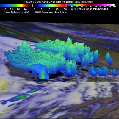
Stormy spring weather over the Southwest popping up during the past weekend with at least twenty tornadoes sightings over Texas on Sunday April 26, 2015. The GPM core Observatory satellite had a good view of severe storms developing yesterday through central Texas when it flew over at 2134 UTC (4:42 PM CDT). Large hail and heavy rainfall was associated with some of these storms. This image shows a 3-D view of severe weather over Texas using data from the first space-borne Ku/Ka-band Dual-frequency Precipitation Radar (DPR) on board the GPM Core Observatory satellite. Ku Band radar from this

TRMM Sees Powerful Storm Over San Antonio

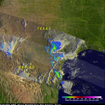
Three people died this past weekend from flooding in San Antonio, Texas. The TRMM satellite flew above Texas early Saturday morning at 1118 UTC (6:18 AM CDT) when powerful thunderstorms were drenching San Antonio. Data captured with this orbit by TRMM's Microwave Imager (TMI) and Precipitation Radar (PR) were used in this rainfall analysis. TRMM's Precipitation Radar (PR) instrument found rain falling at a rate of over 66 mm/hr (~2.5 inches) in one violent thunderstorm shown near the center of this image. This 3-D image shows a TRMM Precipitation Radar (PR) slice through storms over Texas. One

Heavy Weekend Rainfall Causes Flooding In Texas

Warm moist air from the Gulf of Mexico collided with a cold front resulting in extremely heavy rainfall in eastern Texas over the weekend. Rapid flooding resulted from reported rainfall of up to seven inches near Houston, Texas. The rainfall analysis was derived from the TRMM-based, near-real time Multi-satellite Precipitation Analysis (TMPA) at the NASA Goddard Space Flight Center. These rainfall data are derived from a TRMM-calibrated merger of various other satellite rainfall data. TMPA rainfall totals are shown here for the 3-day period from April 26-29, 2013. This analysis shows that

NASA's TRMM Satellite Sees Tornadic Texas Storms in 3-D

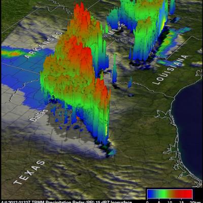
NASA's Tropical Rainfall Measuring Mission (TRMM) satellite provides a look at thunderstorms in three dimensions and shows scientists the heights of the thunderclouds and the rainfall rates coming from them, both of which indicate severity. Powerful thunderstorms that created severe weather were more than 8 miles high. The TRMM satellite passed above northeastern Texas on April 3, 8:33 p.m. CDT and gathered rainfall and cloud height data from a line of thunderstorms moving through the area. The rainfall image above shows a distinct line of tornadic thunderstorms extending from Arkansas through