Pacific

Powerful Typhoon Phanfone

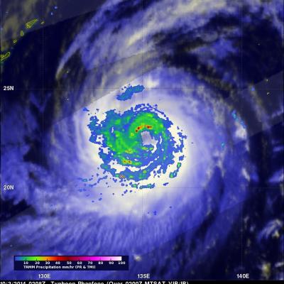
Typhoon Phanfone had sustained wind speeds of about 110 kts (127 mph) and a well defined eye when the TRMM satellite passed over on October 3, 2014 at 0208 UTC. Microwave Imager (TMI) and Precipitation Radar (PR) measurements showed that Phanfone's eye wall and strong feeder bands contained rain frequently falling at a rate of over 60 mm (2.4 inches) per hour. Typhoon Phanfone's wind speeds were predicted today by the Joint Typhoon Warning Center (JTWC) to peak at 120 kts (138 mph) on October 4, 2014 0600 UTC. As a weakening typhoon, Phanfone's course is predicted to change from north

Active Eastern & Central Pacific Hurricane Season

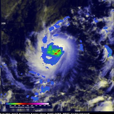
Tropical cyclones are frequently forming during this active hurricane season in the eastern and central Pacific ocean. As hurricane Julio was fading in the central Pacific Ocean north of Hawaii, hurricane Karina was forming on August 13, 2013 off the Mexican coast. The TRMM satellite passed directly above the center of intensifying tropical storm Karina on August 14, 2014 at 1927 UTC. A rainfall analysis that used data from TRMM's Microwave Imager (TMI) is shown overlaid on a GOES-WEST image received at 1930 UTC. TRMM TMI showed that storms near Karina's center were dropping rain at a rate of

Tropical Storm Iselle Departs Hawaii While Julio Stays Well North

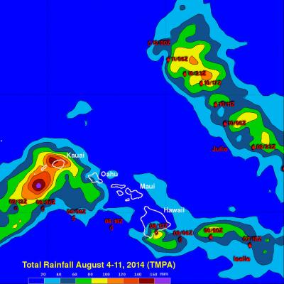
Iselle was once a rather powerful category 4 hurricane in the East Pacific with sustained winds estimated at 120 knots (~138 mph) by the National Hurricane Center. Fortunately, a combination of southwesterly wind shear, drier air and cooler waters weakened Iselle considerably as it approached the Hawaiian Islands. Although much weaker, Iselle still struck the southeast Kau coast of the Big Island of Hawaii as a rather strong tropical storm. In fact Iselle, was the strongest and only the 2nd tropical storm to hit the Big Island in over 50 years. The center made landfall around 2:30 am HST

TRMM Sees Iselle and Julio Menacing Hawaii

The TRMM satellite saw both weakening hurricane Iselle and category two hurricane Julio in the same orbit as they were moving toward the Hawaiian islands on August 7, 2014 at 0922Z. This image shows data collected by TRMM's Microwave Imager (TMI) instrument with the orbit containing both hurricanes located in the center of the image. Microwave brightness temperatures at 85.5 GHZ and at 37.0 GHZ were combined in the red, green and blue components to construct the image. Recent forecasts of tracks for hurricane Julio and tropical storm Iselle are shown overlaid in white and red respectively.

Amanda Weakening

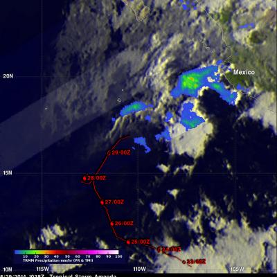
Once powerful hurricane Amanda was weakening to tropical depression intensity when the TRMM satellite passed above on May 29, 2014 at 1038 UTC. A rainfall analysis derived from TRMM data is shown overlaid on a GOES-15 enhanced infrared image. TRMM's Microwave Imager (TMI) found rain falling at a rate of slightly over 47 mm/hr (about 1.9 inches) in storms located between Amanda's center and Mexico's coast. Amanda's locations and intensities are shown in red.

Eastern Pacific Category Four Hurricane Amanda

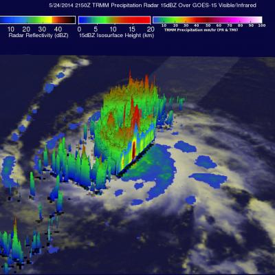
The first hurricane of the eastern Pacific hurricane 2014 season, called Amanda, reached wind speeds estimated at 135 kts (about 190 mph) on May 25, 2014. This made it a category four on the Saffir-Simpson hurricane wind scale. Fortunately the powerful hurricane was over open waters well to the southwest of Mexico's coast when the maximum intensity was reached. The images above show data collected when the TRMM satellite passed overhead on Saturday May 24, 2014 at 2150 UTC. Rainfall data from TRMM's Microwave Imager (TMI) and Precipitation Radar (PR) instruments are shown overlaid on a GOES-15

TRMM Sees Two Pacific Tropical Cyclones

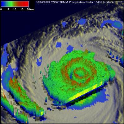
Tropical Storm Lekima Tropical Storm Francisco The TRMM satellite flew above the centers of two tropical cyclones in the western Pacific Ocean early this morning. The first orbit saw super typhoon LEKIMA at 0745 UTC and with the next orbit tropical storm FRANCISCO came into view at 0919 UTC. Lekima was located southeast of tropical storm Francisco over the open waters of the Pacific. Precipitation data from TRMM's Microwave Imager (TMI) and Precipitation Radar (PR) instuments are shown overlaid on infrared images from TRMM's Visible and InfraRed Scanner (VIRS). These rainfall analyses show the

Hurricane Henriette

The TRMM satellite flew over the eastern Pacific Ocean on August 6, 2013 0233 UTC (~5:33 PM local time) collecting data for the low sun angle views of hurricane Henriette shown here. The Visible/Infrared image on the left shows the shadows cast by towering thunderstorms on the northeastern side of Henriette's forming eye wall. The image on the right shows the same image with rainfall derived from TRMM's Microwave Imager (TMI) and Precipitation Radar (PR) instruments overlaid. TRMM's PR instrument measured rain falling at the rate of over 55.46mm/hr (~2.2 inches) per hour in this towering

Tropical Storm Four Forms in the Pacific

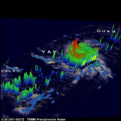
The TRMM satellite flew over rapidly forming TS04W in the western Pacific on 20 May 2011 at 0037 UTC (~10:37 AM LOCAL TIME). This daylight TRMM pass showed that the tropical cyclone was becoming much better organized. The intensifying tropical cyclone now contained several areas of heavy thunderstorms dropping rain at over 50 mm/hour (~2 inches/hour). The 3-D perspective image on the upper right shows the storm's vertical structure. TRMM's Precipitation Radar (PR) now showed that some thunderstorm towers near the center of circulation were punching up to heights of over 16 km (~9.9 miles)