Melissa

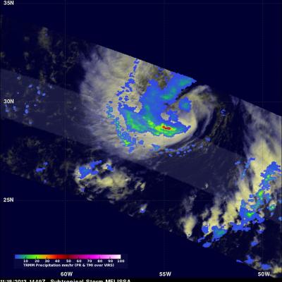
Morning View of Tropical Storm Melissa

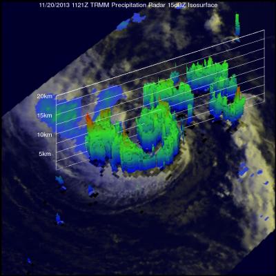
The TRMM satellite passed directly above tropical storm Melissa's center of circulation on November 20, 2013 at 1121 UTC (6:21 EST). TRMM's Precipitation Radar (PR) instrument found that rain was falling at a maximum rate of 55 mm/hr (~2.2 inches) in an area just to the southeast of Melissa's center of circulation. TRMM Precipitation Radar data were also used in the image on the right to show Melissa's 3-D structure. The tallest towers, reaching heights of over 13km (~8 km), were located in a band of rainfall to the northwest of Melissa's center. The strongest intensity radar echo of over

TRMM Views New Tropical Storm Melissa

The TRMM satellite flew above recently formed subtropical storm MELISSA in the central Atlantic Ocean on November 18, 2013 at 1449 UTC (9:49 AM EST). The image above shows rainfall data from TRMM's Microwave Imager (TMI) and Precipitation Radar (PR) overlaid on an enhanced visible/infrared image from TRMM's Visible and InfraRed Scanner (VIRS). This TRMM pass found that the heaviest rainfall within MELISSA was falling at a rate of over 74mm/hr (~2.9 inches) in an area of strong convective rainfall that was wrapping around the southern side of the storm. The National Hurricane Center (NHC)