Instruments

GPM flying over Earth with a data swath visualized.
The GCPEx observing strategy framework is designed to use a combination of multi-frequency radar, particle imaging and water equivalent-measuring surface instrumentation in conjunction with airborne dual-frequency radar, high frequency radiometer and in situ microphysics observations arranged in stacked altitude patterns to provide the most complete coupled sampling of surface and in-cloud microphysical properties possible. The resulting 3D volumes will be combined to provide a fundamental description of snowfall physics at the ground and through the atmospheric column, and to create an...
GPM flying over Earth with a data swath visualized.
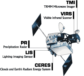
The CERES instrument The Clouds and the Earth’s Radiant Energy System (CERES) instrument is one of five instruments that is being flown aboard the Tropical Rainfall Measuring Mission (TRMM) observatory. The data from the CERES instrument was used to study the energy exchanged between the Sun; the Earth’s atmosphere, surface and clouds; and space. However, it only operated during January - August of 1998, and March 2000, so the available data record is quite brief. Balancing the Earth's Energy Budget The Earth’s daily weather and climate are controlled by the balance between the amount of solar...
GPM flying over Earth with a data swath visualized.
The Lightning Imaging Sensor is a small, highly sophisticated instrument that detects and locates lightning over the tropical region of the globe. Looking down from a vantage point aboard the Tropical Rainfall Measuring Mission (TRMM) observatory, 250 miles (402 kilometers) above the Earth, the sensor provides information that could lead to future advanced lightning sensors capable of significantly improving weather "nowcasting." Using a vantage point in space, the Lightning Imaging Sensor promises to expand scientists' capabilities for surveying lightning and thunderstorm activity on a global...
GPM flying over Earth with a data swath visualized.
The Precipitation Radar was the first spaceborne instrument designed to provide three-dimensional maps of storm structure. These measurements yield invaluable information on the intensity and distribution of the rain, on the rain type, on the storm depth and on the height at which the snow melts into rain. The estimates of the heat released into the atmosphere at different heights based on these measurements can be used to improve models of the global atmospheric circulation. The Precipitation Radar has a horizontal resolution at the ground of about 3.1 miles (five kilometers) and a swath...
GPM flying over Earth with a data swath visualized.
The Tropical Rainfall Measuring Mission’s (TRMM) Microwave Imager (TMI) is a passive microwave sensor designed to provide quantitative rainfall information over a wide swath under the TRMM satellite. By carefully measuring the minute amounts of microwave energy emitted by the Earth and its atmosphere, TMI is able to quantify the water vapor, the cloud water, and the rainfall intensity in the atmosphere. It is a relatively small instrument that consumes little power. This, combined with the wide swath and the good, quantitative information regarding rainfall make TMI the "workhorse" of the rain...
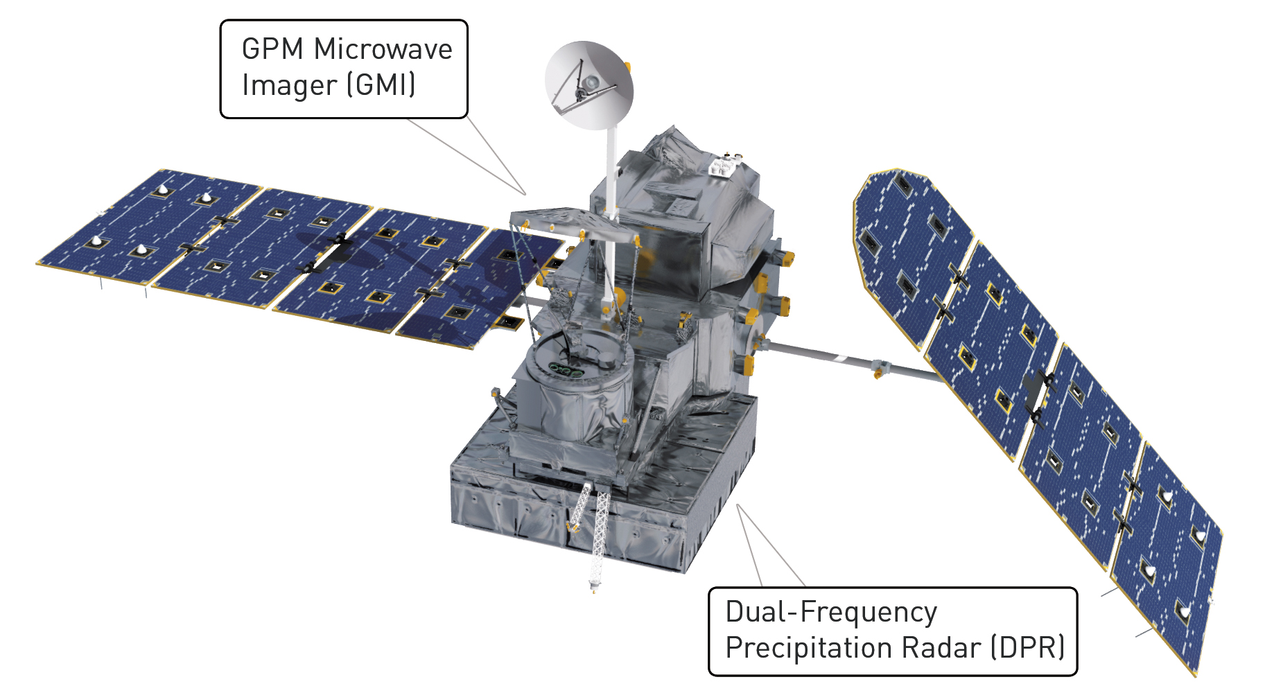
GPM flying over Earth with a data swath visualized.
The Visible and Infrared Scanner (VIRS) is one of the primary instruments aboard the Tropical Rainfall Measuring Mission (TRMM) observatory. VIRS is one of the three instruments in the rain-measuring package and serves as a very indirect indicator of rainfall. It also ties in TRMM measurements with other measurements that are made routinely using the meteorological Polar Orbiting Environmental Satellites POES) and those that are made using the Geostationary Operational Environmental Satellites (GOES) operated by the United States. VIRS, as its name implies, senses radiation coming up from the...
Engineers at Goddard Space Flight Center constructing the TRMM satellite assembl
The Tropical Rainfall Measuring Mission is the first Earth Science mission dedicated to studying tropical and subtropical rainfall: precipitation that falls within 35 degrees north and 35 degrees south of the equator. Tropical rainfall comprises more than two-thirds of the world's total. The satellite uses several instruments to detect rainfall including radar, microwave imaging, and lightning sensors. Flying at a low orbital altitude of 240 miles (400 kilometers) TRMM's data collection of tropical precipitation helps improve our understanding about climate and weather. The Japanese space...