Hawaii

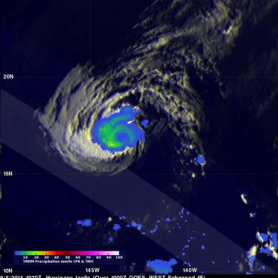
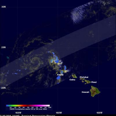
TRMM Sees Iselle and Julio Menacing Hawaii

The TRMM satellite saw both weakening hurricane Iselle and category two hurricane Julio in the same orbit as they were moving toward the Hawaiian islands on August 7, 2014 at 0922Z. This image shows data collected by TRMM's Microwave Imager (TMI) instrument with the orbit containing both hurricanes located in the center of the image. Microwave brightness temperatures at 85.5 GHZ and at 37.0 GHZ were combined in the red, green and blue components to construct the image. Recent forecasts of tracks for hurricane Julio and tropical storm Iselle are shown overlaid in white and red respectively.

Iselle Moves Toward Hawaii

Hurricane Iselle has weakened from a very dangerous category four hurricane on August 4, 2014 to a category one hurricane when the TRMM satellite passed over on August 6, 2014 at 1020 UTC. Rainfall data from TRMM's Microwave Imager (TMI) and Precipitation Radar (PR) are shown overlaid on an enhanced infrared image from the 1000 UTC GOES-WEST satellite. TRMM TMI showed that heavy rainfall was occurring around the filling eye. TRMM TMI indicated that the most intense rain was falling at a rate of over 43.5 mm (about 1.7 inches) in a band southwest of the eye. The second image is an animation

Tropical Storm Julio Following Iselle's Track

The hurricane season in the eastern Pacific Ocean has been very active this year. Eleven named tropical cyclones have already formed in the eastern Pacific Ocean. Tropical storm Julio that formed yesterday is following almost the same path as hurricane Iselle toward the central Pacific and the Hawaiian Islands. The TRMM satellite flew over tropical storm Julio on August 5, 2014 at 0944 UTC and collected data used in these images. The first image shows a rainfall analysis derived from TRMM's Microwave Imager (TMI) and Precipitation Radar (PR) overlaid on an enhanced GOES-WEST image received at

Hurricane Iselle Heads Toward Hawaii

The TRMM satellite flew directly over the eye of powerful hurricane Iselle on August 4, 2014 at 1037 UTC. Iselle had winds of about 120kts (about 138 mph) at that time making it a dangerous category four hurricane on the Saffir-Simpson hurricane wind scale. Rainfall from TRMM's Microwave Imager (TMI) and Precipitation Radar (PR) instruments is shown overlaid on a GOES-WEST enhanced infrared image captured at 1030 UTC. Rain was found by TRMM PR to be falling at a rate of almost 182 mm (about 7.2 inches) per hour in Iselle's eye wall. Hurricane Iselle is predicted by the National Hurricane

Potential Tropical Development Southeast Of Hawaii

Early this morning at 1100 UTC the TRMM satellite flew above an area where a possible tropical cyclone is developing southeast of the Hawaiian Islands (12 North 140 West). A rainfall analysis from TRMM's Microwave Imager (TMI) and Precipitation Radar (PR) instruments is shown on the left overlaid on a GOES-WEST image received at the exact same time. TRMM PR data found powerful storms near the center of the tropical disturbance where rain was falling at a rate of over 105 mm (about 4.1 inches). Radar reflectivity values of over 50dBZ were being returned to the satellite from intense rain

Hawaii Says Aloha To Flossie

The TRMM satellite had an excellent day time view of dissipating tropical depression Flossie as it was moving to the northwest of the Hawaiian Islands on July 30, 2013 at 2348 UTC (1:38 PM HAST). An analysis of rainfall from TRMM's Microwave Imager (TMI) and Precipitation Radar (PR) is shown overlaid on a combination visible and infrared image from TRMM's Visible and InfraRed Scanner (VIRS) instrument. This analysis shows that very little precipitation was then occurring near the center of the weakening tropical cyclone's circulation. The most intense rain was found by TRMM to be falling at a

Weakening Tropical Storm Flossie Hits Hawaiian Islands

Weakening tropical storm Flossie had lightning with heavy rain and winds as it drove through the Hawaiian islands. The TRMM satellite flew above tropical depression Flossie on July 30, 2013 at 0717 UTC (July 29, 2013 at 9:17 PM HAST). TRMM's Microwave Imager (TMI) and Precipitation Radar (PR) instruments showed that the heaviest rain at that time was located to the southwest of the Islands and was falling at a rate of over 88mm/hr (3.5 inches). Flossie's approximate locations with appropriate tropical cyclone symbols are shown overlaid in white. TRMM's Precipitation Radar is able to separate

Tropical Storm Flossie Threatens Hawaiian Islands

The TRMM satellite had a very good view of tropical storm Flossie in the eastern Pacific Ocean on July 28, 2013 at 0734 UTC. The image on the left shows an analysis of rainfall data from that pass using TRMM's Microwave Imager (TMI) and Precipitation Radar (PR) instruments. TRMM PR data found rain falling at a rate of over 46 mm/hr (~1.8 inches) in storms just south of Flossie's center of circulation. TRMM PR also found that some of these storms were returning 45dBZ reflectivity values to the satellite indicating that moderate to heavy rain was falling in that area. The map on the right shows