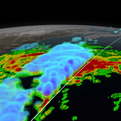
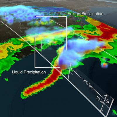
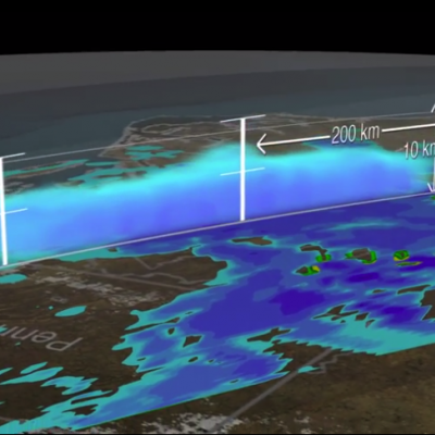
The Evolution of NASA Precipitation Data

The Global Precipitation Measurement (GPM) mission core satellite provided many views of Tropical Cyclone Kilo over its very long life. GPM is a satellite co-managed by NASA and the Japan Aerospace Exploration Agency that has the ability to analyze rainfall and cloud heights. GPM was able to provide data on Kilo over its 21 day life-span.
Rain, snow, hail, ice, and every mix in between make up the precipitation that touches everyone on our planet. But precipitation doesn't fall equally in all places around the world, as seen in NASA's new animation that captures every shower, snowstorm and tropical cyclone over a six-day period in August 2014. The time lapse was created from data captured by the Global Precipitation Measurement (GPM) satellite mission, now just over a year old, which scientists are using to better understand freshwater resources, natural disasters, crop health and more.
At 5:05 p.m. EST Monday, Jan. 26, 2015, the Global Precipitation Measurement mission's Core Observatory flew over the Nor'easter that dumped snow on New England. This satellite image shows the rate of rainfall, with low amounts in green and high in red, and snowfall, in blue to purple. The center of the storm, shown in 3-D, was offshore with far reaching bands of snowfall. More intense snow rates are shown in darker blue, which can be seen on the northern edge of the storm.
The Global Precipitation Measurement (GPM) mission's Precipitation Processing System at NASA’s Goddard Space Flight Center in Greenbelt, Maryland, has released the Level 2 GPM Microwave Imager (GMI) data to the public. The data set includes precipitation rates, which show how much rain and snowfall accumulate over a given time period.
The GPM spacecraft continues to perform normally. The GPM Microwave Imager and Dual-frequency Precipitation radar continue operations and calibration.