GMI

13 Channels of the GMI
13 Channels of GMI
Image Caption
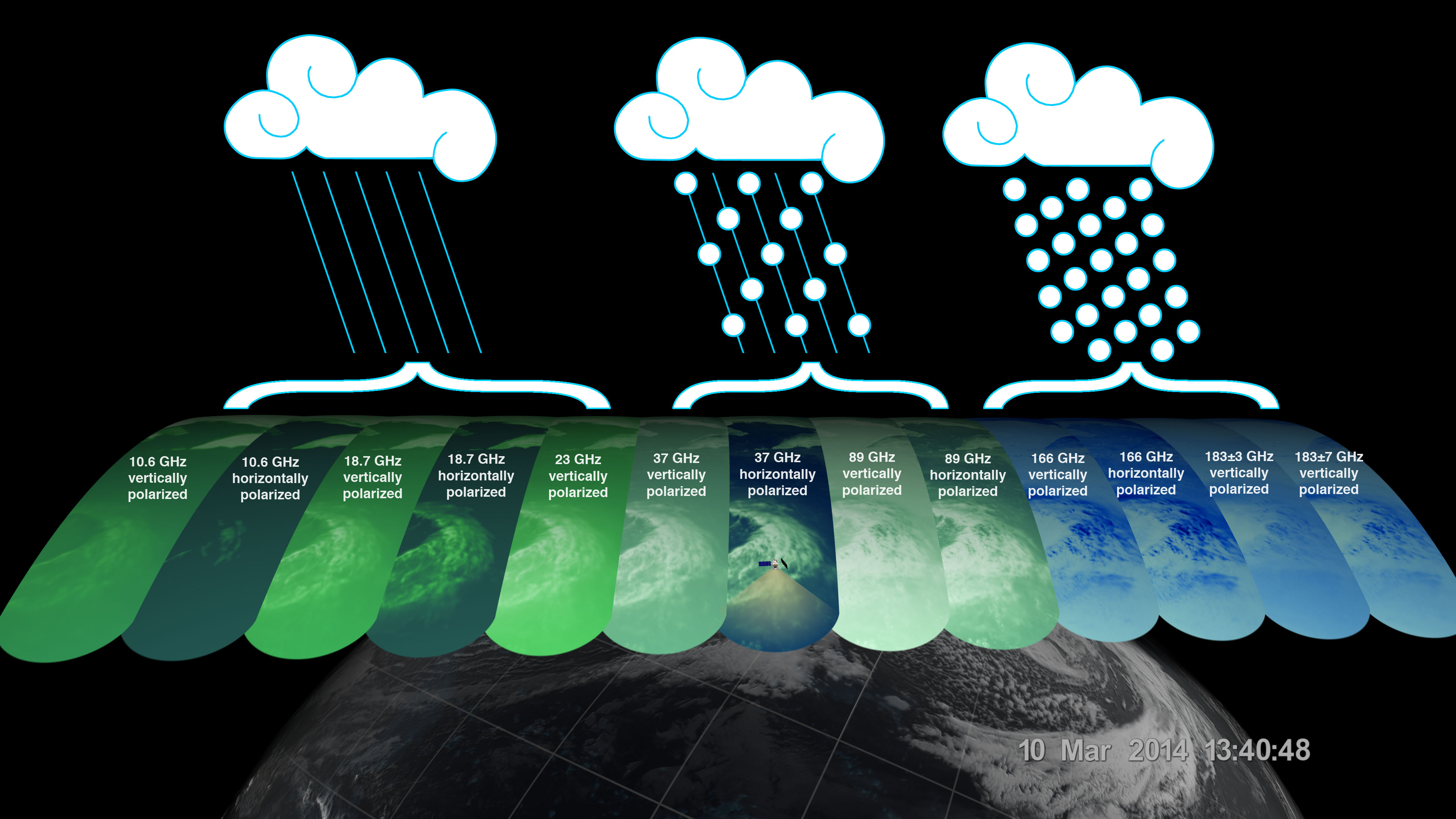
The GMI instrument has 13 channels, each sensitive to different types of precipitation.
The GPM Microwave Imager (GMI) has a swath 550 miles (885 kilometers) wide, giving it a broad view of the extra-tropical cyclone observed off the coast of Japan on March 10, 2014. The GMI instrument has 13 channels, each displayed in this visualization of the data. Each channel is sensitive to a different frequency of microwave energy naturally emitted from or affected by precipitation. As depicted by the graphics, the five channels on the left are sensitive to heavy and moderate rainfall.

First Images from GPM

First Images from GPM
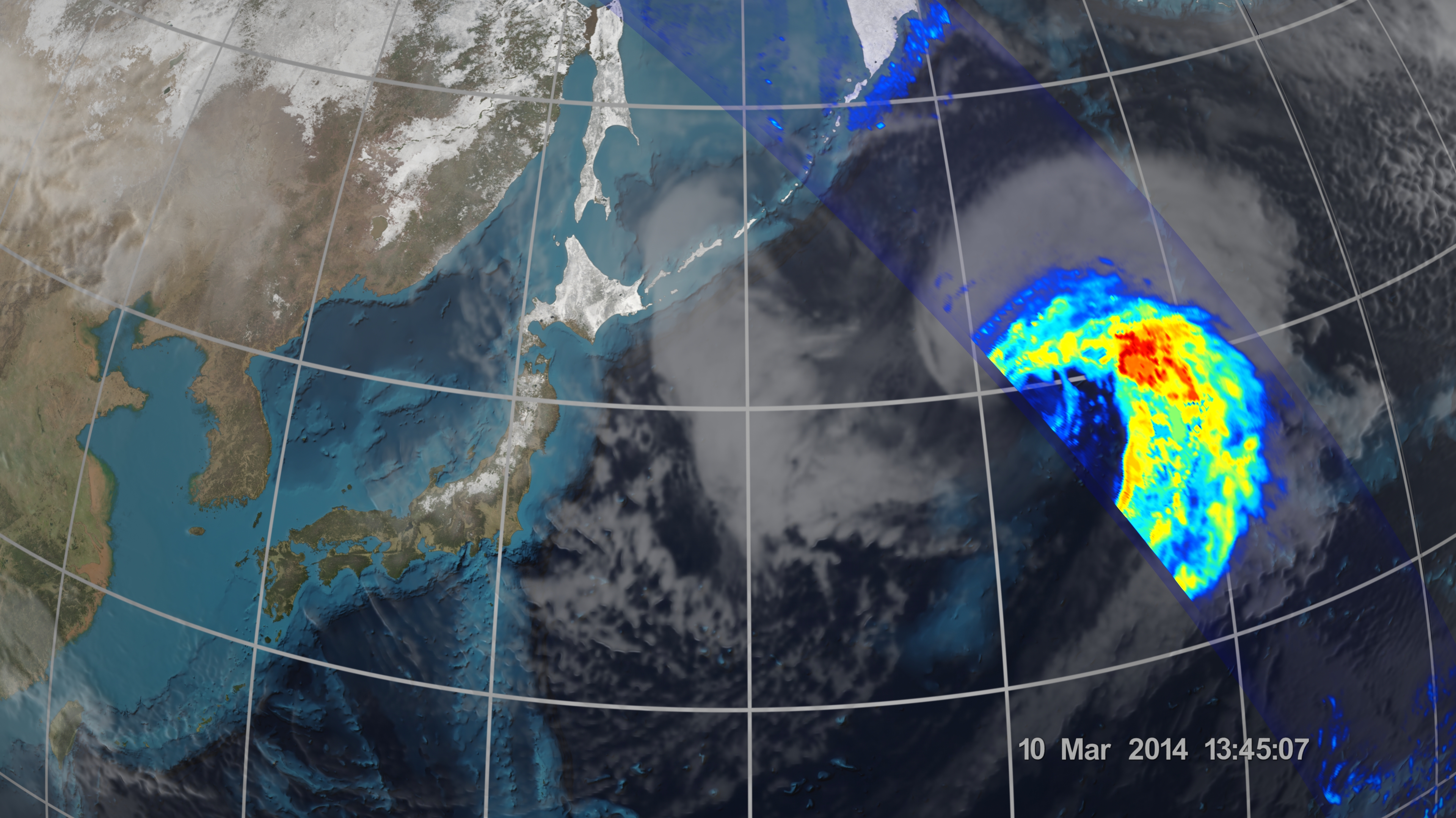
Image Caption
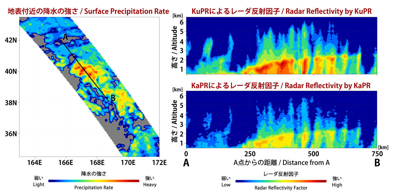
The Dual-frequency Precipitation Radar observes rainfall and snowfall that occurs within clouds in three dimensions, across the surface of the Earth and upward into the atmosphere.
An extra-tropical cyclone was observed over the northwest Pacific Ocean off the coast of Japan on March 10, 2014. 
 
The graph on the left shows the extra-tropical storm seen by the DPR as the satellite passed overhead. The x-axis is the east-west longitude and the y-axis is north-south latitude. The colors show the rain rate at sea-level, with more intense rainfall represented by red and lighter precipitation shown in blue.

First Images from GPM

First Images from GPM
Image Caption
On March 10, the Core Observatory passed over an extra-tropical cyclone about 1055 mi (1700 km) due east of Japan's Honshu Island.

The storm formed from the collision of a cold air mass wrapping around a warm air mass, emerging over the ocean near Okinawa on March 8. It moved northeast over the ocean south of Japan, drawing cold air west-to-east over the land, a typical winter weather pattern that also brought heavy snow over Hokkaido, the northernmost of the four main islands. After the GPM images were taken, the storm continued to move eastward, slowly intensifying before weakening in the central North Pacific. 

Learn More

First Images from GPM Microwave Imager
First Images from GPM Microwave Imager
Image Caption
First Images from GPM Microwave Imager

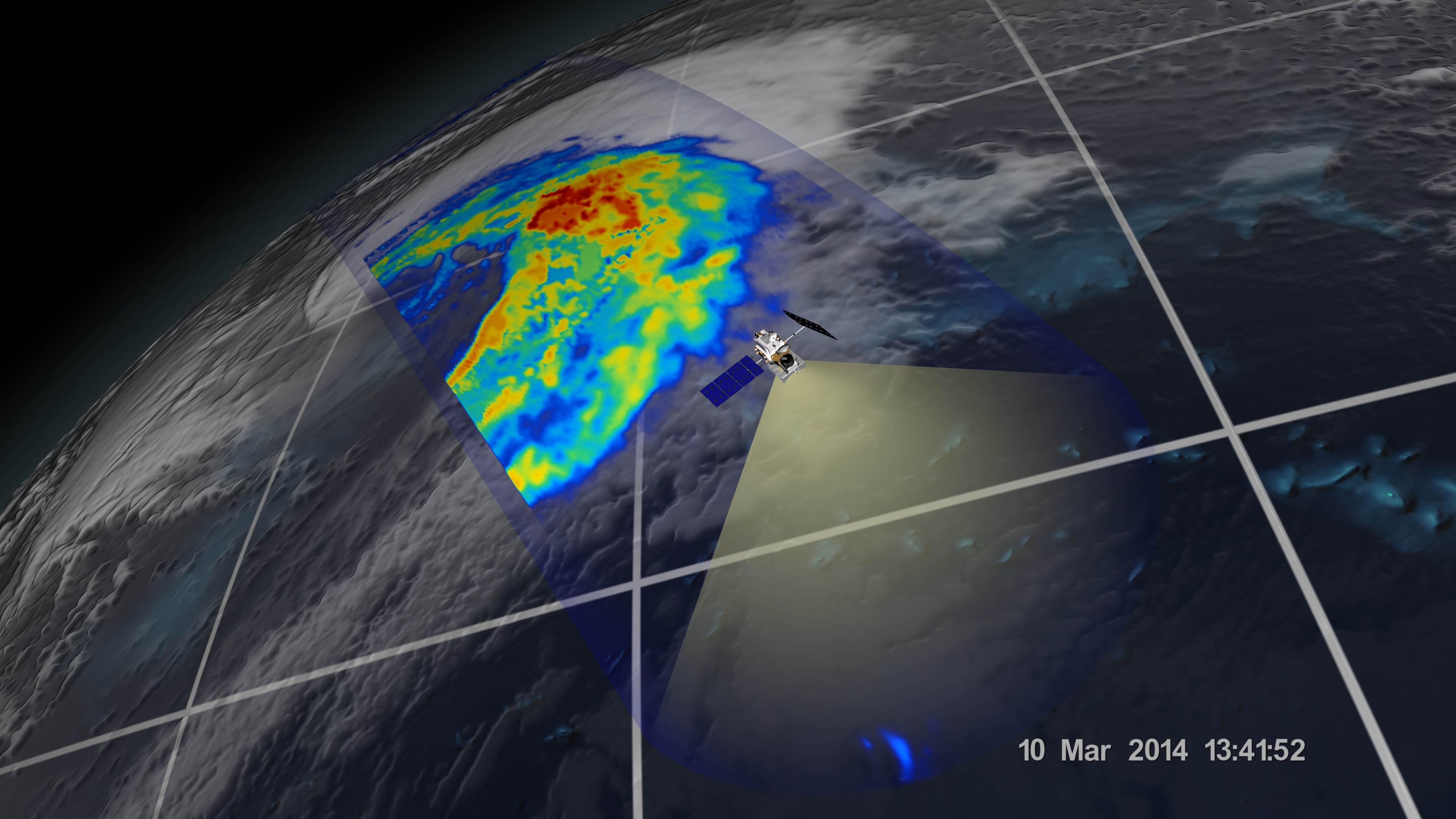
The image shows rain rates across a 550-mile (885 kilometer) wide swath of an extra-tropical cyclone observed off the coast of Japan on March 10, 2014. Red areas indicate heavy rainfall, while yellow and blue indicate less intense rainfall. In the northwest part of the storm in the upper left of the image, the blue areas indicate falling snow.

Learn More

Calibrating Thrusters, Verifying Science Data

The Global Precipitation Measurement mission's Core Observatory is performing normally. On March 12, the GPM Core Observatory fired its thrusters for a 30-second check-out of their performance. The burn, called a delta-v, changes the velocity of the spacecraft to adjust the altitude of its orbit. This week's short maneuver did not greatly alter the satellite's orbit but was used instead for further calibration of the thrusters. Functional checkout activities and internal calibration of the Dual-frequency Precipitation Radar continued this week. Both DPR and the GPM Microwave Imager have begun

GMI Continues Checkout

The Global Precipitation Measurement mission Core Observatory is performing normally. The initial checkout of the GMI instrument and the spacecraft showed both are performing as expected, and the GMI instrument continues to collect science data on rain and snowfall.

GMI Spins Up, goes to Science Mode

The Global Precipitation Measurement mission Core Observatory is performing normally. Today, the GPM Microwave Imager (GMI) instrument started to spin at its normal rate and collect science data on rain and snowfall. The GMI instrument is a multi-channel microwave radiometer that uses 13 channels to measure the intensity of the microwave energy emitted from Earth's surface and atmosphere. GMI will detect total precipitation within all layers of clouds, including snow and ice, and rain from drizzles to downpours.

GMI Reflector Deployed

Following activation and warm up of the Global Precipitation Measurement Microwave Imager (GMI) electronic systems, the team at NASA’s Goddard Space Flight Center in Greenbelt, Md., deployed the main reflector of the U.S. science instrument for the GPM Core Observatory. A significant step was also achieved today in the activation of the science instrument provided by the Japan Aerospace Exploration Agency (JAXA) with the turning on of the controller for the Dual-Frequency Precipitation Radar (DPR). The DPR will provide three-dimensional information about precipitation particles derived from

Checkout of the GPM Core Observatory Continues Normally

Friday evening, GPM flight controllers at NASA Goddard began using the satellite’s High Gain Antenna system for high-rate data rate transmissions through NASA’s orbiting fleet of Tracking Data Relay Satellites. Having high-rate data flowing through the TDRS system allows the spacecraft recorder to be downloaded more frequently. During science operations, TDRS communication will allow availability of science data within 3 hours of measurement. Just after 11 a.m. EST on Saturday, March 1st, the flight team began the activation of one of the two main science instruments on the GPM observatory –
Document Description

The Global Precipitation Measurement Mission is an international space network of satellites designed to provide the next generation precipitation observations around the world every 2 to 4 hours. It is a science mission with integrated applications goals.