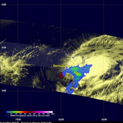
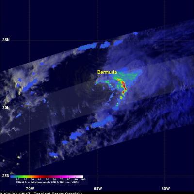
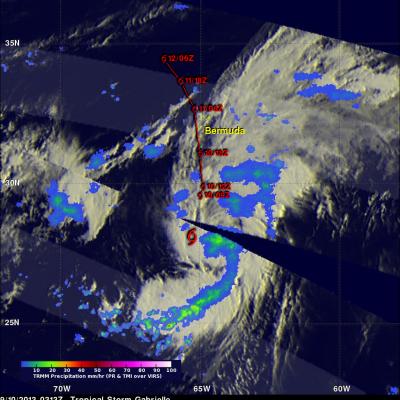
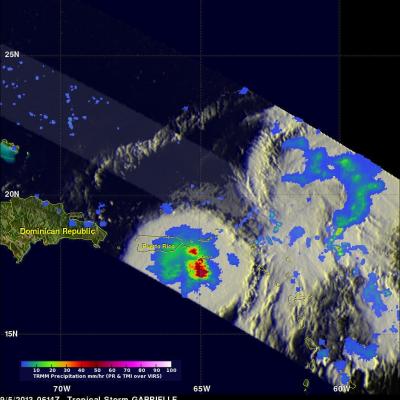
Tropical Depression Gabrielle
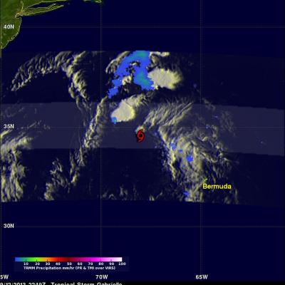
Tropical Storm Gabrielle passed close to Bermuda on Wednesday and has now moved out of the TRMM satellite's coverage area (40N-40S). Tropical depression Gabrielle is currently moving over the open waters of the North-Atlantic toward Newfoundland and is predicted to be absorbed by a front tomorrow. A red tropical storm symbol shows the location of Gabrielle's nearly rain free center when TRMM passed above on Thursday September 12, 2013 at 2249 UTC (6:49 PM EDT).