flooding

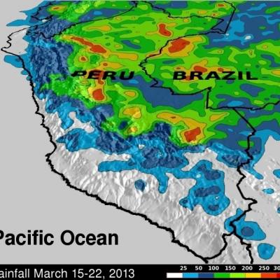
Flooding in Eastern Peru, Dry in the West

Hundreds of people in central Peru were recently flooded out of their homes. Rivers left their banks washing away buildings and highways while areas of Peru along the coast of the Pacific Ocean were relatively dry. Flooding from heavy rainfall in some areas of Peru was occurring at the end of the normal rainy season. Data from the TRMM satellite are used to calibrate rainfall data merged from various satellite sources. TRMM-based, near-real time Multi-satellite Precipitation Analyses (TMPA) at the NASA Goddard Space Flight Center are used to monitor rainfall over the global Tropics. TMPA

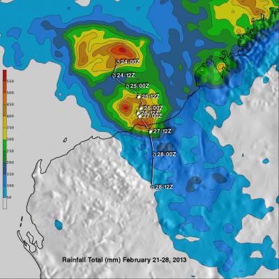
Tropical Cyclone Rusty's Flooding Rainfall

In addition to high winds tropical cyclone Rusty's heavy rainfall caused flooding in north-western Australia. The TRMM satellite's main purpose is the accurate measurement of tropical rainfall around the globe. TRMM is also used to calibrate rainfall estimates from other satellites. The TRMM-based, near-real time Multi-satellite Precipitation Analysis (TMPA) at the NASA Goddard Space Flight Center provides estimates of rainfall over the global Tropics. TMPA rainfall totals in association with tropical cyclone Rusty are shown for the period from February 21-28, 2013. Rusty's approximate 0000Z

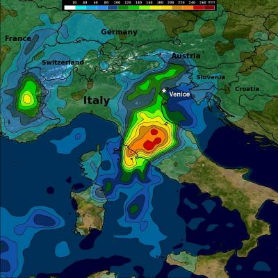
Heavy Rain Brings Flooding to Central and Northern Italy

Beginning this past weekend, parts of central and northern Italy received several days of heavy rain as an upper-level trough situated over western Europe down through the Iberian Peninsula in conjunction with a persistent area of low pressure at the surface over the northern coast of Africa brought a steady flow of warm, moist, unstable air northeastward across the country from the western Mediterranean. A stationary frontal boundary draped across the northern third of the Italian Peninsula provided the focus for showers and storms in that part of the country. The rains caused flooding in

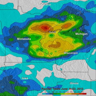
Strong Storms Bring Heavy Rain, Flooding to Upper Midwest

An upper-level trough of low-pressure dropping down out of the Canadian Rockies in combination with a persistent frontal boundary and high pressure over the Southeast, combined to bring about strong storms and flooding over the Upper Midwest. The storms brought the worst flooding on record to Duluth, Minnesota where as much as 10 inches of rain were reported over a 2-day period from 19th to the 20th of June, resulting in flash flooding and many washed out roads. Even the zoo was flooded. Washed out roads were blamed for 3 fatalities in nearby Wisconsin. Counter-clockwise flow around high

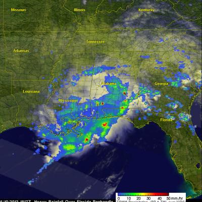
TRMM Sees Flooding Rainfall Along Gulf

The states along the coast of the Gulf of Mexico experienced very heavy rainfall on Saturday June 9,2012 and Sunday June 10, 2012. The images above use TRMM satellite data collected when it flew over on Sunday June 10, 2012. Unusually heavy rainfall was occurring in states near the Gulf coast. Due to the path of TRMM's orbits it had good coverage with more than one orbit. The first orbit occurred at 1501 UTC (11:01 AM EDT). The second image shows a combination of more than one orbit with the later data being collected at about 1817 UTC (2:17 PM EDT). TRMM rainfall analyses from these orbits

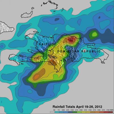
Dominican Republic And Haiti Hit By Deadly Floods

It has been reported that spring floods with mudslides have resulted in the death of at least 9 people and forced 11,000 people to flee their homes in the Dominican Republic. Data from the TRMM satellite are used to calibrate rainfall data merged from various satellite sources. TRMM-based, near-real time Multi-satellite Precipitation Analyses (TMPA) at the NASA Goddard Space Flight Center are used to monitor rainfall over the global Tropics. TMPA rainfall estimates are shown above for the week from April 19 to April 26, 2012. This analysis shows that extreme rainfall (shown in dark red)
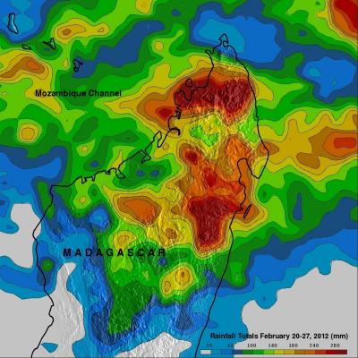
More Flooding Rainfall In Madagascar

A weak tropical cyclone locally called Irina caused flooding over northern Madagascar less than two weeks after deadly flooding by Tropical Cyclone Giovanna . The lastest tropical cyclone didn't have very strong winds when it passed over the coastal city of Vohemar on Madagascar's northeastern coast but street flooding was reported. The rainfall analysis above was made at the Goddard Space Flight Center using data from a near-real time Multi-satellite Precipitation Analysis (TMPA). TRMM-based near-real time Multi-satellite Precipitation Analysis (TMPA) data are used to monitor rainfall over

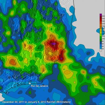
Flooding Hits Southeastern Brazil

In the last week the South American Convergence Zone (SACZ) has caused heavy rains and severe floods in Southeastern Brazil's states Minas Gerais, Espirito Santo and Rio de Janeiro. NOAA's Hydrological Prediction Center (HPC) is forecasting an intensification of the SACZ in the next days over that area. Flooding and mudslides from days of heavy rain in southeastern Brazil has forced thousands to flee their homes. Rainfall estimates from the TRMM-based, near-real time Multi-satellite Precipitation Analysis (TMPA) at the NASA Goddard Space Flight Center are shown above for the week from 30