flooding

Super Typhoon Haiyan Hits the Philippines
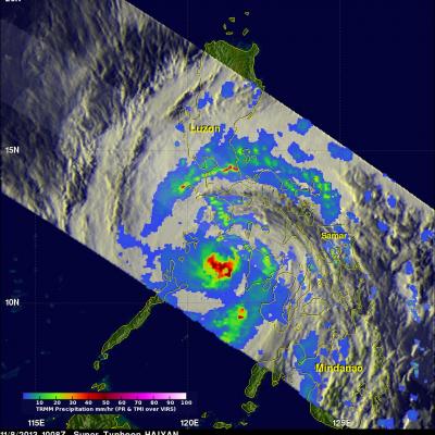
Super typhoon Haiyan, equivalent to a Category 5 hurricane on the US Saffir-Simpson scale, struck the central Philippines municipality of Guiuan at the southern tip of the province of Eastern Samar early Friday morning at 20:45 UTC (4:45 am local time) as an extremely powerful super typhoon, perhaps the strongest ever recorded at landfall, with sustained winds estimated at 195 mph (315 kph) by the Joint Typhoon Warning Center. Previously, Hurricane Camille, which struck the northern Gulf Coast in 1969, held the record with 190 mph sustained winds at landfall. After striking Samar, Haiyan...

Deadly Typhoon Usagi Hits Southern China

The most powerful typhoon of 2013 hit southern China with reported winds of 95.6 kts (~110 mph) killing at least 20 people. The TRMM satellite had a fairly good view on September 22, 2013 at 0923 UTC as typhoon USAGI's eye was very near the coast of southern China. TRMM's Microwave Imager (TMI) and Precipitation Radar (PR) instruments showed that in addition to the extreme winds reported there were areas just south of USAGI's eye where rain was falling at a rate of over 169mm/hr (~6.7 inches). TRMM sliced through USAGI and found that heights of storms within USAGI were reaching only about 12km

Mexico Flooded by Tropical Storm Manuel and Hurricane Ingrid

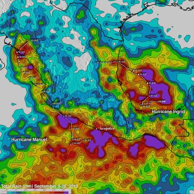
Mexico's Pacific and Gulf coasts were both inundated by deadly tropical rainfall at the same time. Hurricane Manuel dropped extremely heavy rainfall along Mexico's Pacific coast. At least 55 people have been reported killed in Mexico due to flooding and landslides caused by extreme rainfall. Hurricane Ingrid weakened to a tropical storm and came ashore from the Gulf Of Mexico into the state of Tamaulipas near La Pesca, Mexico on Monday September 16,2013. The approximate 0000Z and 1200Z locations of the tropical cyclones are shown overlaid in white. The TRMM-based, near-real time Multi-
PMM Article Image
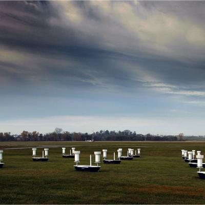
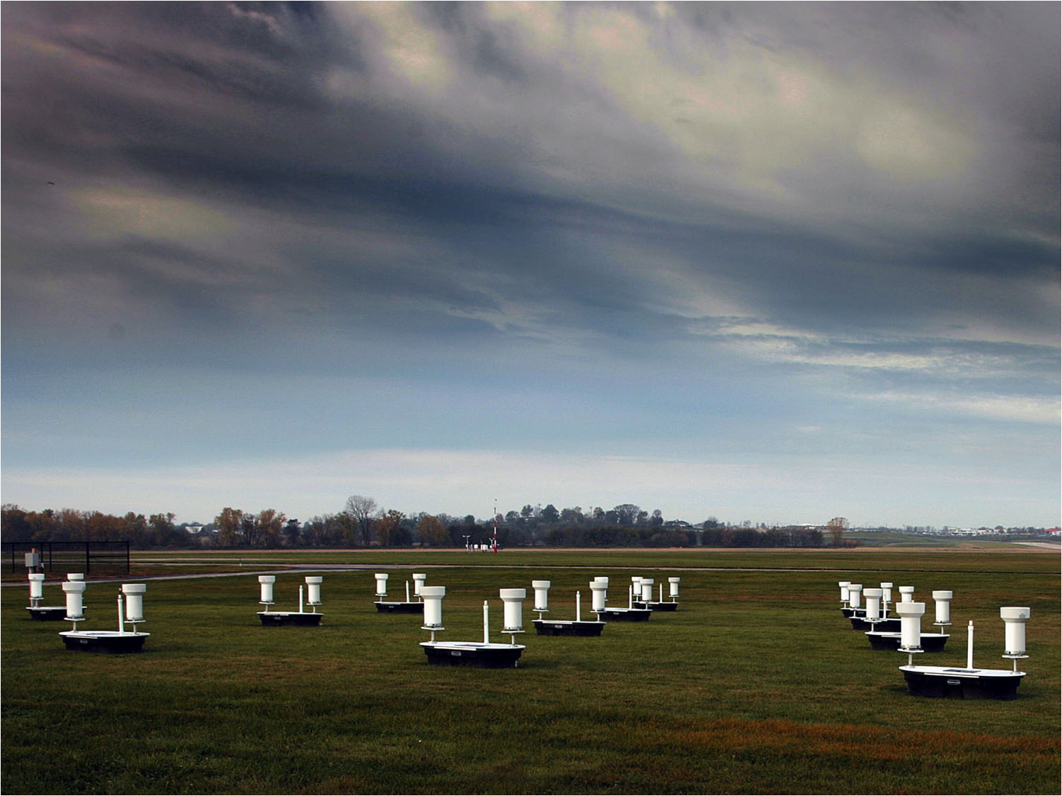
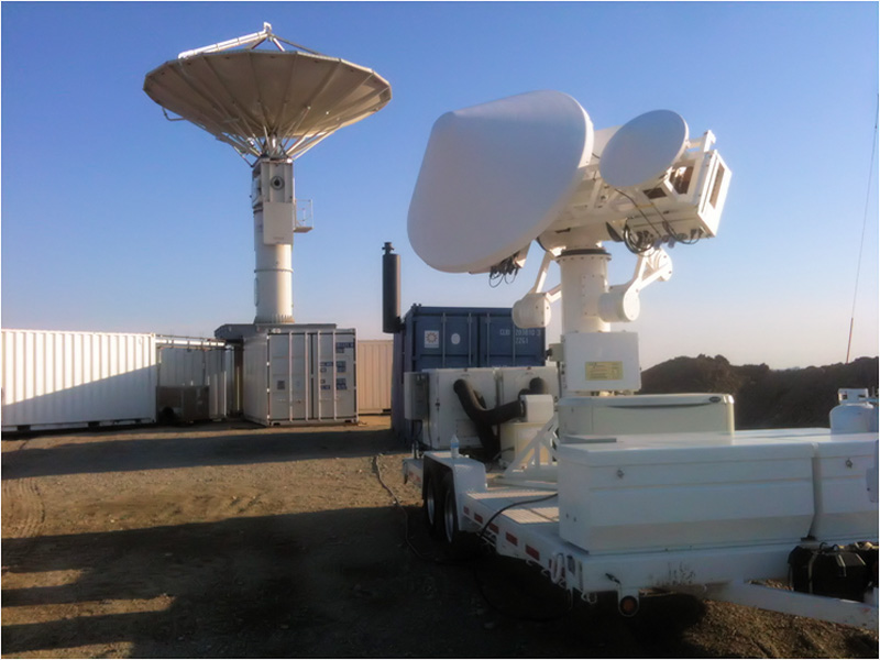
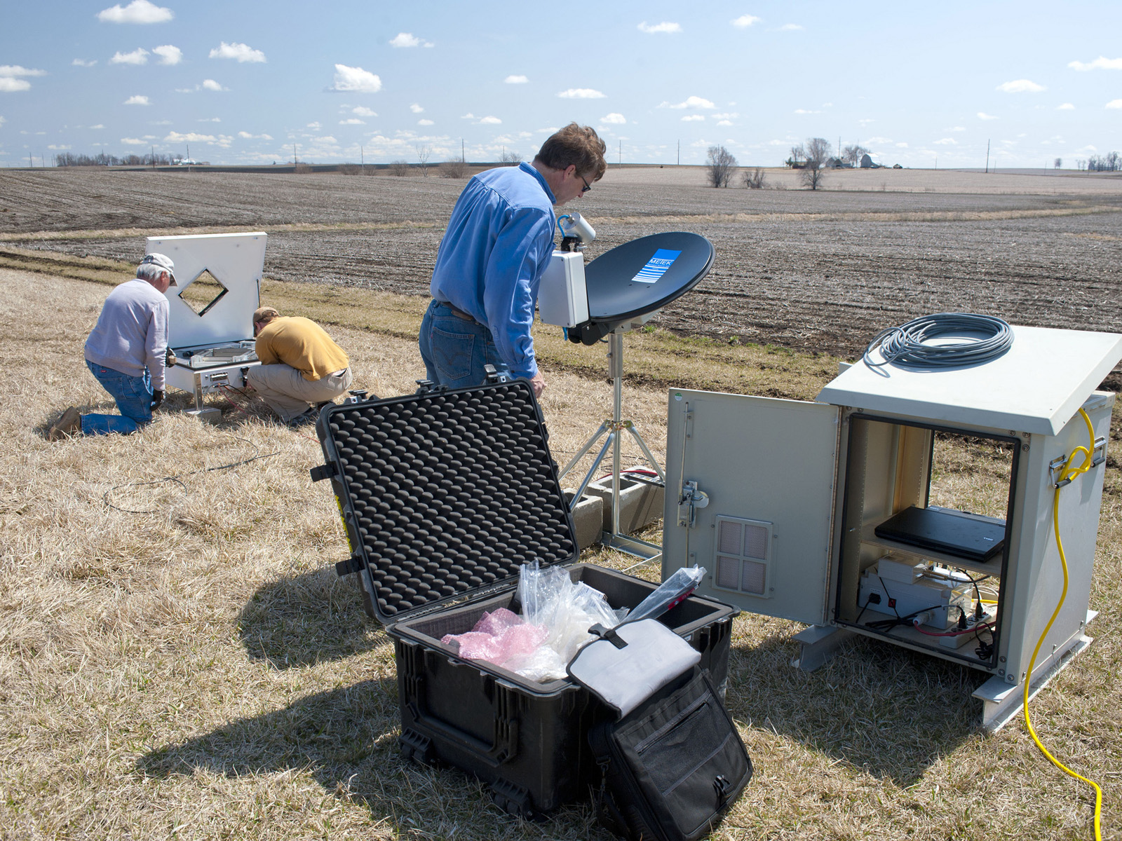
On a Wednesday afternoon in June, a severe storm outbreak spawned huge thunderstorms across Iowa and western Illinois. NASA's Polarimetric precipitation radar was in place to scan the storms as they swept through the region. "It's unbelievable out here," Walt Petersen of NASA's Wallops Flight Facility in Virginia wrote in an email dispatch from Traer, Iowa. There, two NASA radars were stationed as part of the Iowa Flood Studies field campaign, which Petersen led, for the Global Precipitation Measurement, or GPM, mission. Caption: A cluster of rain gauges and soil moisture sensors deployed in...

Deadly Tornadoes and Flooding Rainfall in the U.S.

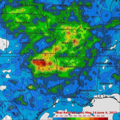
Last week's flooding and tornadoes caused the reported deaths of at least 18 people in Oklahoma. Today extensive flooding from heavy rainfall occurred in Missouri when a levee was breached. The TRMM-based, near-real time Multi-satellite Precipitation Analysis (TMPA) at the NASA Goddard Space Flight Center was used in this analysis to show rainfall over these areas. TRMM with its combination of passive microwave and active radar sensors was used to calibrate rainfall estimates from other satellites. TMPA rainfall totals are shown here for the 21-day period from May 14 to June 4, 2013. Heavy

Heavy Weekend Rainfall Causes Flooding In Texas

Warm moist air from the Gulf of Mexico collided with a cold front resulting in extremely heavy rainfall in eastern Texas over the weekend. Rapid flooding resulted from reported rainfall of up to seven inches near Houston, Texas. The rainfall analysis was derived from the TRMM-based, near-real time Multi-satellite Precipitation Analysis (TMPA) at the NASA Goddard Space Flight Center. These rainfall data are derived from a TRMM-calibrated merger of various other satellite rainfall data. TMPA rainfall totals are shown here for the 3-day period from April 26-29, 2013. This analysis shows that

Recent Flooding in the Midwest, 5 Year Anniversary of 2008 Flood

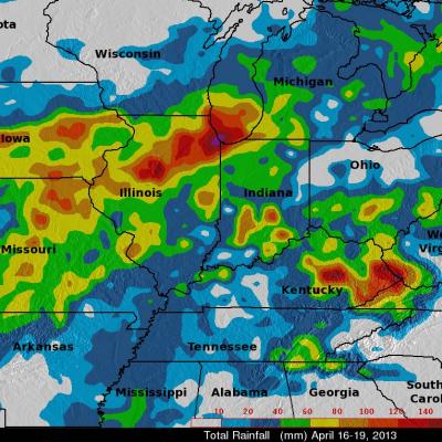
An advancing frontal system extending from the Great Lakes region all the way down to the Gulf Coast supported a line of widespread storms and thunderstorms that brought heavy rain to parts of Iowa, Illinois, Missouri, and Indiana. The hardest hit area was northern Illinois where flooding was reported in and around Chicago. The scenario was set up by a deep upper-level trough that moved out of the Rockies and into the Plains. Strong southerly winds ahead of the trough allowed warm, moist air from the Gulf of Mexico to stream northwards all the way up to Lake Michigan. The TRMM-based, near-real