east coast

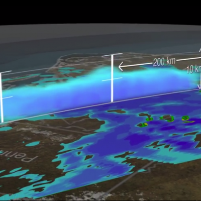
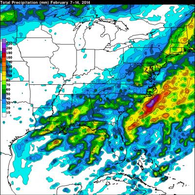
Flooding Rainfall Over the U.S. East Coast Examined by GPM

Flood watches and warnings have been issued today for states from North Carolina through New York. Major flooding of rivers and streams is forecast in Pennsylvania as heavy rainfall continues. A Large blocking high located east of Nova Scotia and Low Pressure over the upper mid west has been funneling moisture over the Mid-Atlantic states. This weather pattern includes a strong upper level trough with it’s axis becoming oriented from the Great Lakes through the eastern Gulf Of Mexico. This resulted in a dip in the jet stream that has been transporting tremendous amounts of moisture from the
3D Views of February Snow Storms from GPM
Download this video in HD formats from NASA Goddard's Scientific Visualization Studio The Global Precipitation Measurement (GPM) Core Observatory captured a 3-D image of a winter storm on Feb. 17, 2015, that left 6 to 12 inches of snow over much of Kentucky, southwestern West Virginia and northwestern North Carolina. The shades of blue indicate rates of snowfall, with more intense snowfall shown in darker blue. Intense rainfall is shown in red. The imagery shows great variation in precipitation types over the southeastern United States. Download this video in HD formats from NASA Goddard's...
GPM Data from March 2014 East Coast Snowstorm
PMM Related Image
JacobAdmin Thu, 09/04/2014
Image Caption
One of the first storms observed by the NASA/JAXA GPM Core Observatory on March 17, 2014, in the eastern United States revealed a full range of precipitation, from rain to snow.

Precipitation Measured from U.S. Winter Storm

Freezing rain and snow from a winter storm have caused power outages and deaths from the southeastern to the northeastern United States. The TRMM-based, near-real time Multi-satellite Precipitation Analysis (TMPA) at the NASA Goddard Space Flight Center is used to estimate precipitation for much of the globe. TMPA (liquid) precipitation totals (mm) are shown for the week from February 7-14, 2014 when a winter storm was moving through the area. Snow depths can be expected to be 10 to 12 times that for the same amount of rainfall. Liquid precipitation estimates of over 110mm (~4.3 inches) are

Andrea brings Heavy Rains to Cuba and parts of the US East Coast

Tropical Storm Andrea formed on the late afternoon of June 5th, 2013 from a trough of low pressure that had persisted for several days over the southeast Gulf of Mexico. This trough extended out over the Gulf from the Yucatan Peninsula and provided the focus for the development of showers and thunderstorms in the region, eventually leading to the formation of Tropical Storm Andrea. With its suite of passive microwave and active radar sensors, TRMM is ideally suited to measure rainfall from space. For increased coverage, TRMM is used to calibrate rainfall estimates from other additional