data

IMERG Dataset Back Online

The issues with NOAA's 4-km Merged IR data are closed and the IMERG Early and Late Runs have been restarted from the point at which they stopped. This will provide a continuous record for each, but it also means that it will take a while to process the backlog of data and catch up to the nominal latency.

TRMM PR Data Distribution Resumes

TRMM/PR data distribution resumes during the experimental operation period. The satellite has descended to an altitude of around 350 km on February 12, 2015, which is the original nominal altitude before 2001. Verification of the data quality concluded and JAXA and PPS started distribution of PR data around the 350 km altitude (orbit number from 98231) to the public. PR available data period around 350 km altitude will be about 40 days since February 12, 2015. Please see TRMM/PR data distribution for further information and for the data locations.

GPM Data Goes Public

The most accurate and comprehensive collection of rain, snowfall and other types of precipitation data ever assembled now is available to the public. This new resource for climate studies, weather forecasting, and other applications is based on observations by the Global Precipitation Measurement (GPM) Core Observatory, a joint mission of NASA and the Japan Aerospace Exploration Agency (JAXA), with contributions from a constellation of international partner satellites. The GPM Core Observatory, launched from Japan on Feb. 27, carries two advanced instruments to measure rainfall, snowfall, ice
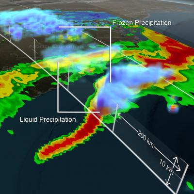
GPM Data from a March 2014 Snostorm
Image Credit: NASA's Goddard Space Flight Center Download this video in HD formats from NASA Goddard's Scientific Visualization Studio The most accurate and comprehensive collection of rain, snowfall and other types of precipitation data ever assembled now is available to the public. This new resource for climate studies, weather forecasting, and other applications is based on observations by the Global Precipitation Measurement (GPM) Core Observatory, a joint mission of NASA and the Japan Aerospace Exploration Agency (JAXA), with contributions from a constellation of international partner...

GPM Data Release Schedule Announced

The GPM Core Observatory satellite was successfully launched on February 27th, 2014. Data from the GPM Microwave Imager (GMI) and Dual-frequency Precipitation Radar (DPR) have the following release schedule. All data are freely available through the NASA's Precipitation Processing System at http://pps.gsfc.nasa.gov June 16th – GMI Level 1 Brightness Temperature data have been released. This includes GMI instrument swath data. July 14th – GMI Level 2 Precipitation Rate data will be released. This includes precipitation rates estimated using the Goddard Profiling algorithm (GPROF14) and are

GPM's Stormy New View

Submitted by JacobAdmin on Tue, 03/25/2014
Video Embed

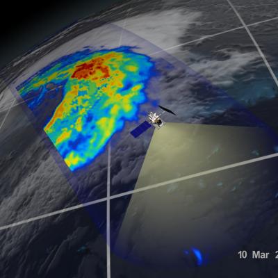
On March 10, the Core Observatory passed over an extra-tropical cyclone On March 10, the Core Observatory passed over an extra-tropical cyclone about 1055 miles (1700 kilometers) due east of Japan's Honshu Island. Satellite data shows the full range of precipitation in the storm. 

Learn More 

First Images from NASA-JAXA GPM Satellite
On March 10, the Core Observatory passed over an extra-tropical cyclone about 1055 miles (1700 kilometers) due east of Japan's Honshu Island. Satellite data shows the full range of precipitation in the storm. Image Credit: NASA's Goddard Space Flight Center Download related multimedia in HD formats from NASA Goddard's Scientific Visualization Studio NASA and the Japan Aerospace Exploration Agency (JAXA) have released the first images captured by their newest Earth-observing satellite, the Global Precipitation Measurement (GPM) Core Observatory, which launched into space Feb. 27. The images...