

Using Satellites to Predict Malaria Outbreaks
Credits: NASA's Goddard Space Flight Center / Joy Ng
In the Amazon Rainforest, few animals are as dangerous to humans as mosquitos that transmit malaria. The tropical disease can bring on high fever, headaches and chills and is particularly severe for children and the elderly and can cause complications for pregnant women. In rainforest-covered Peru, the number of malaria cases has spiked. In the past five years, the country has had on average the second highest rate in the South America. In each of the years 2014 and 2015 there were 65,000 reported cases.
Containing malaria outbreaks is challenging because it is difficult to figure out where people are contracting the disease. As a result, resources such as insecticide-treated bed nets and indoor sprays are often deployed to areas where few people are getting infected, allowing the outbreak to grow.
To tackle this problem, university researchers have turned to data from NASA’s fleet of Earth-observing satellites, which are able to track the types of human and environmental events that typically precede an outbreak. With funding from NASA’s Applied Sciences Program, they are working in partnership with the Peruvian government to develop a system that uses satellite and other data to help forecast outbreaks at the household level months in advance and prevent them from happening.
Tracking Mosquitos

Anopheles darlingi mosquitoes are most responsible for spreading malaria in the Peruvian Amazon.
Credits: copyrights Fábio Medeiros da Costa, via Flickr (CC BY-NC-SA 2.0)
License terms
In the Amazon, the Anopheles darlingi mosquito species is most responsible for spreading malaria, which is caused by single-celled parasites called Plasmodia. Females (and only females) ingest the parasite upon feeding on the blood of an infected human and can pass it on to the next human it feeds on. “Malaria is a vector-borne disease, which means you have to have a vector, or mosquito, in this case, transmit the disease,” said principal investigator William Pan, an assistant professor of global environmental health at Duke University. “The key to our malaria forecasting tool lies in pinpointing areas where prime breeding grounds for these mosquitos overlap simultaneously with human populations.”
Predicting where these mosquitos will flourish relies on identifying areas with warm air temperatures and calm waters, such as ponds and puddles, which they need for laying eggs. Researchers are turning to the Land Data Assimilation System, or LDAS: a land-surface modeling effort supported by NASA and other organizations. NASA satellites, such as Landsat, Global Precipitation Measurement, and Terra and Aqua, serve as inputs for LDAS, which in turn provides ongoing information on precipitation, temperature, soil moisture and vegetation around the world.
While not identifying puddles and ponds outright, LDAS shows where they are very likely to form. For example, flooding may overflow riverbanks or heavy rains can saturate the soil, allowing water to pool.
“It’s an exercise in indirect reasoning,” said Ben Zaitchik, the project’s co-investigator responsible for the LDAS component and an associate professor at Johns Hopkins University’s Department of Earth and Planetary Sciences. “These models let us predict where the soil moisture is going to be in a condition that will allow for breeding sites to form.”
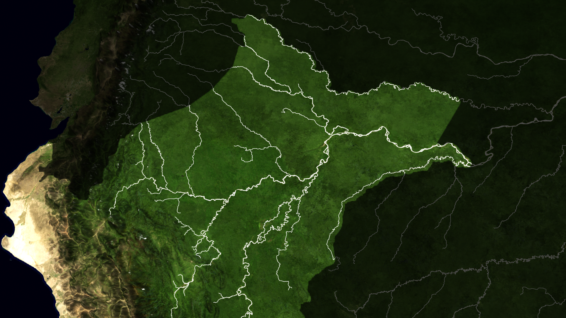
A map showing the rivers the Peruvian Amazon and surrounding areas. Precipitation and other environmental conditions affect river height, which can impact the number of mosquito breeding sites along their banks.
Credits: NASA's Scientific Visualization Studio
Through satellite-derived vegetation and land cover maps, LDAS also tracks another major indicator for future malaria outbreaks: deforestation, in particular when road development is involved. When roads are built, bulldozers dig ditches to dispose of trees and other vegetative waste; when filled with rainwater those ditches become mosquito breeding sites. When infected people traverse these roads and transmit the disease to Anopheles darlingi, an outbreak can occur.
Tracking Humans
While LDAS tracks weather and deforestation to identify emerging mosquito populations and future outbreak hotspots, reported malaria cases place the infected on the map. But for the purposes of predicting an outbreak, that map doesn’t tell a complete story.
In Peru, malaria is diagnosed and treated at health posts scattered around the country, and resources are dispatched to those posts to contain outbreaks. The problem with this approach to containment, according to Pan, is that the health post where a person seeks treatment isn’t always near where he or she contracted the disease. That’s because those who are at greatest risk for malaria spend several months of the year logging or mining, which often sends them on journeys far from their homes.
Finding where people are getting infected forms the crux of the malaria forecast system, and Pan is developing a regional-based statistical model and a more detailed agent-based model to target these hotspots.
For the regional model, reported cases of malaria are incorporated along with population estimates for each county and assumptions about where people are traveling based on seasonal migration studies. Integrating environmental data through LDAS not only places mosquito populations on the map but also helps to inform human movement, for example, by detecting rising rivers during the rainy season. “It’s much easier to float logs down a river when its high, and at the same time mosquitos thrive because pockets of water emerge along the riverbank,” Pan explained, “so these types of conditions correspond with high malaria risk.”
The regional model will provide a big-picture look at how humans, mosquitoes, and the disease are located and where they’re headed based on how those variables interact. At the same time, the agent-based model—named because it models the behavior of every agent, or every human, mosquito, and malaria parasite within an area—will zoom in on a tighter geographic space by utilizing high-resolution hydrology data and by homing in on neighborhoods and the movement of people. In combination with LDAS data, the model will run a simulation to assess the probability of when, where and how many people are expected to get bitten and infected with the disease.
Preventing an Outbreak
According to Pan, the two models will be used to project forward 12 weeks and pinpoint, down to the household level, where the disease is predicted to take hold. The models will also simulate what would result from any one of several actions, from handing out bed nets and sprays that can reduce human-mosquito contact to administering preventive anti-malaria treatment that can stop transmission. Based on the results, the ministry of health can carry out the optimum plan.
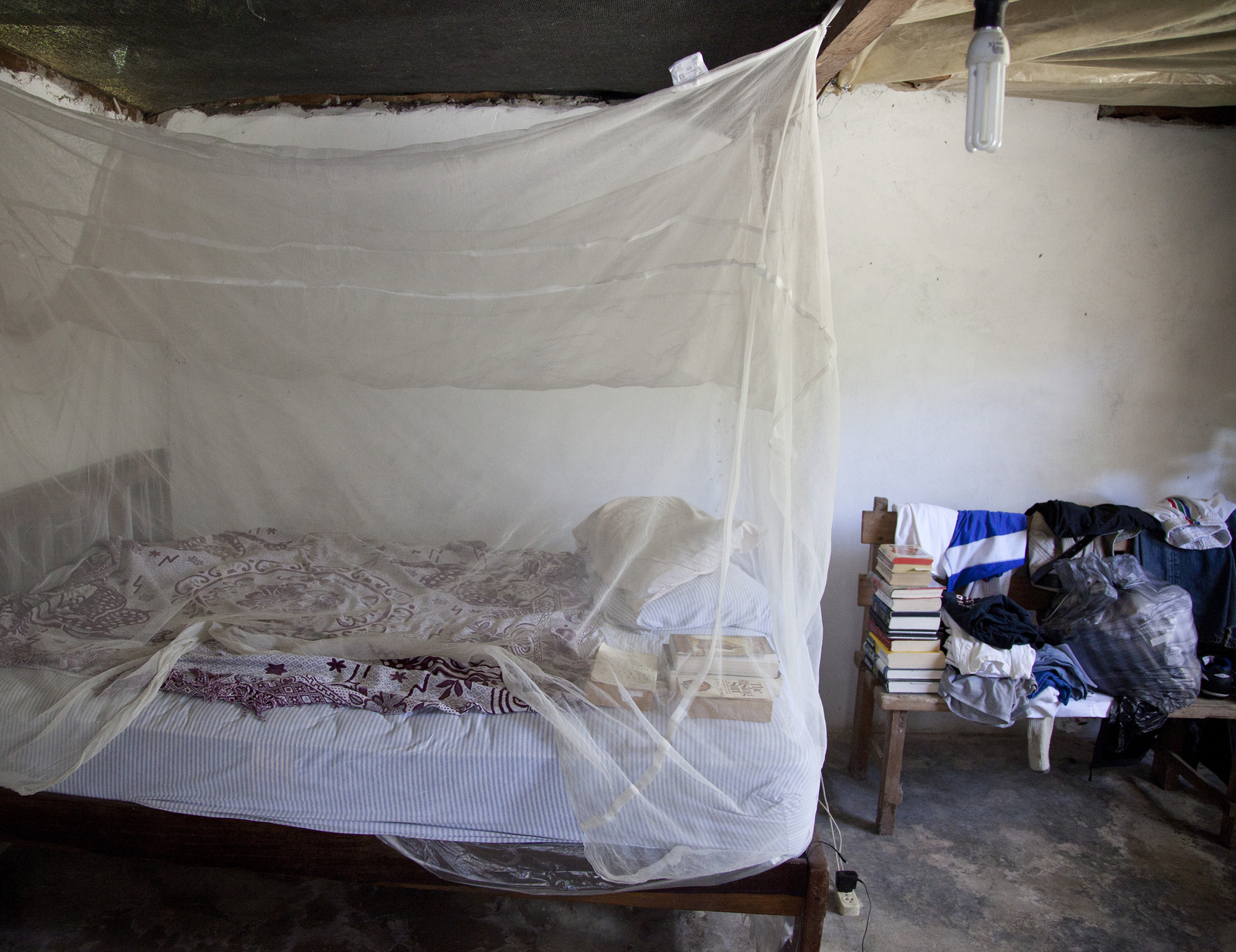 Bed nets create a physical barrier against mosquitoes for people sleeping beneath them.
Credits: U.S. Peace Corps
The agent-based model’s ability to make projections down to the household level allows for resources to go where they’re needed. It would be a marked turn from the government’s current method, which is to distribute resources broadly, sometimes to areas that may not need them. “Instead of treating 100 percent of the community, we could focus vector control in certain households or specific areas of the community,” Pan explained. “It’s a targeted strategy that can achieve the same reduction in malaria, but at potentially lower cost and with a more rapid response.”
As the project enters the third of its three-year grant, Pan and his colleagues continue to refine the models. He estimates the forecasting tool could be ready for use within a few years. The Peruvian government is already working with Pan to familiarize itself with the system, particularly as it begins its Malaria Cero program, which aims to eliminate the disease by 2021. Other countries, including Colombia and Ecuador, have expressed interest.
While this project is focused on malaria, Pan noted that one of the advantages of the tool is its adaptability, as the LDAS and population models can be used for tracking not only malaria but also a number of other diseases, such as Zika and Dengue. “I think that government health agencies will find not just one but many uses for the system that can benefit a lot people,” he said. “That’s always been our goal.”