GCPEx Blog

Six Week GCPEx Campaign Concludes

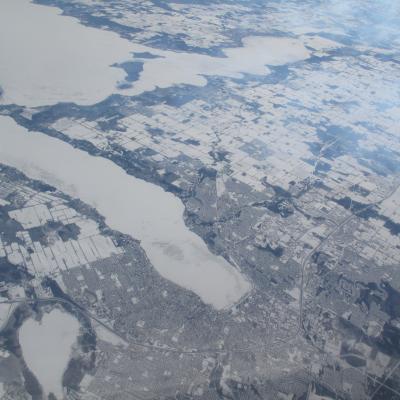
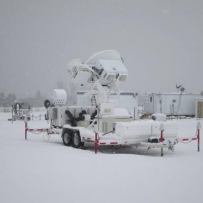
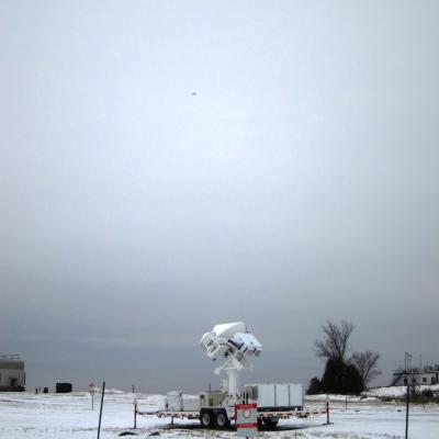
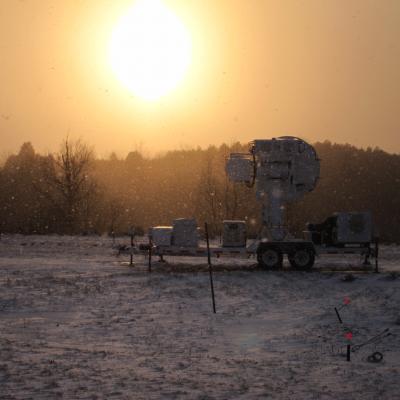
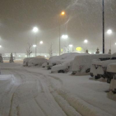
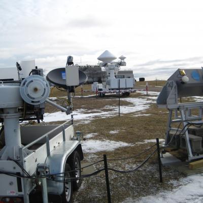
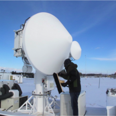
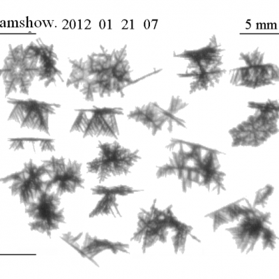
February 29 marked the last day of the GPM Cold Season Experiment. After six weeks of no snow, light snow, rain, and some nice heavy snowstorms, the GCPEx team is heading home. The ADMIRARI instrument at the CARE site with blowing light snow (11 Feb 2012) Credit: NASA / Chris Kidd The campaign ended with a big storm last Friday, February 24th, that put all three planes in the air over an eight hour period. They captured a wide array of different types of snow and rain from Eastern New York as the DC-8 flew in from Maine to north of the CARE site in Huronia and Georgian Bay, off of Lake Huron

Saving the Best for Last - Prelude to a Storm

Joe Munchak is a scientist at Goddard Space Flight Center who specializes in remote sensing of snow. This week he writes from the air in the DC-8 out of Bangor, Maine. Last time I wrote for the GCPEx blog, I was stationed in Barrie, Ontario with the ground team. I’ve since switched hats to that of CoSMIR Instrument Scientist. CoSMIR (Conically Scanning Millimeter Imaging Radiometer) is one of two instruments on the NASA DC-8 which is based out of Bangor, Maine – my home for the past ten days. With CoSMIR and the Airborne Precipitation Radar-2 (APR2), the DC-8 is acting as a simulator for the

Operations Update with Steve Nesbitt (video)

View on Youtube This video shows a glimpse of operations during the NASA Global Precipitation Measurement (GPM) Cold Season Precipitation Experiment (GCPEx) during a heavy snow event on 18 February 2012 Steve Nesbitt is an assistant professor of atmospheric sciences at the University of Illinois at Urbana-Champaign. He studies clouds and precipitation using satellite data and ground based and aircraft observations in projects world wide. Using NASA and other measurements in tropical storms, and mid-latitude cyclones, his research group works to improve the understanding of precipitation

Snow - Must be Saturday!

Chris Kidd is a hydrologist at Goddard Space Flight Center. This week he is at the CARE site in Ontario and writes to us about this week's flights. Isn’t it strange how the best snow tends to occur on the same day of the week; when I was little it was always a Thursday. Last Saturday we had a good lake effect snowfall over Barrie (Ontario), this Saturday we had another 6 inches of snow. The forecast proved to accurate in terms of the timing; a 3:15 am start from the hotel to drive out to the field site and prepare for the days operations; the first flakes of snow started to fall as I arrived

Snow on the Ground, Satellites Overhead

Chris Kidd is a hydrologist at Goddard Space Flight Center. This week he is at the CARE site in Ontario and writes to us about this week's flights. Although the excitement of the lake-effect snow last weekend was welcome, in contrast this week was somewhat benign. There were a number of good opportunities identified in the model forecasts that didn’t really materialize, leaving us with a number of, although marginal, still useful events. The dual-frequency radar at the CARE site Friday, February 17th. The little spec in the sky is the Citation aircraft flying overhead. Credit: NASA / Chris

More Snow Photos

NASA scientist Chris Kidd shared some of his photos from the last several days at GCPEx: The ADMIRARI instrument at the CARE site with blowing light snow (11 Feb 2012) Credit: NASA / Chris Kidd The radar at the CARE site with blowing light snow (11 Feb 2012) Credit: NASA / Chris Kidd The ADMIRARI instrument operating at the CARE site (11 Feb 2012) The lights on the instrument allows remote operators to keep and eye on any snow build up on the sensors that would affect the measurements. Credit: NASA / Chris Kidd Mission operations inside the CARE trailer – which can be very cold at times! (11

Lake Effect Parking

Over the weekend, GCPEx had its first large lake effect snow, which put 2 inches down at the CARE site. Chris Kidd, Operations Scientist for GCPEx this week, said in an email, "We were feeling rather poorly done-by at CARE due to the lack of snow there. However, we cheered up as we got back to Barrie [12 miles up the road where the GCPEx team is staying]. About 12+ inches here!" Parking lot at the GCPEx team's hotel in Barrie, Ontario. They were very excited to be buried in a foot of snow. Credit: NASA / Chris Kidd Lake effect snow forms when cold winds pick up moisture and energy as they pass

Waiting for Snow

In the CARE operations trailer monitoring weather conditions during the DC-8 flights on 6 February 2012 at approximately 9pm EST. Gail Skofronick-Jackson is the Deputy Project Scientist for GPM at Goddard Space Flight Center in Greenbelt, Md. She specializes in the remote sensing of snow, and is currently the mission scientist for the campaign at the CARE ground site in Ontario, Canada. She writes to us about a night flight on February 6 and the snow that didn't show. Models showed quickly developing snow from 9-10pm EST tonight (6 Feb 2012). We are at 9:22 and we don't yet see snow in the

Three Days, Two Snowstorms

Joe Munchak is a scientist at Goddard Space Flight Center who specializes in remote sensing of snow. This week he is at the CARE site in Ontario as one of the operations scientists for the GCPEx ground validation. It’s been a relatively eventful few days here in Barrie, Ontario, with two coordinated air-ground campaigns over the past three days. I was actually driving to Barrie from my home in Maryland during the first event (January 28th), and got to experience some lake effect snow bands first-hand in northern Pennsylvania on my way up. These were very narrow, only a few miles wide, but

Snowflakes!

This image of falling snowflakes was taken by the Snow Video Imager (SVI) at one of the auxiliary ground sites, the Steamshow Fairgrounds, 5 miles (8km) south of the main CARE site, during a light snowfall on Saturday, January 21. The SVI is set up about two feet off the ground and the snowflakes are falling from top to bottom through the frame. They can be seen here in different three-dimensional orientations at 5x magnification. In the top left corner and the center right, you can see two examples of classic six-sided dendrite snowflakes. The other flakes with crystals growing up and down