Extreme Rainfall Over Florida Panhandle
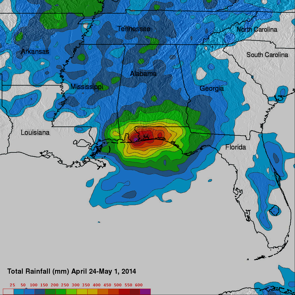
The TRMM satellite had a good view of recent extreme rainfall over the Florida panhandle that caused extensive flooding. TRMM Multi-satellite Precipitation Analysis (TMPA) data were used at NASA Goddard Space Flight Center to estimate total precipitation (mm) for the week from April 24 to May 1,2014. Rainfall totals of up to 620 mm (about 25 inches) were analyzed in the Pensacola, Florida area.
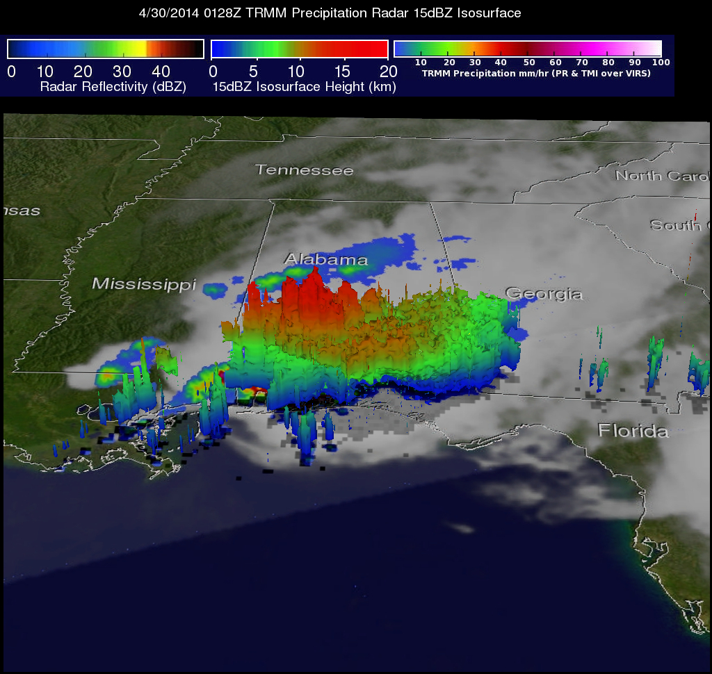
The continuous "training" of heavy rainfall into the area was viewed several times by the TRMM satellite. The TRMM satellite flew above the area on April 30, 2014 at 0128 UTC (9:28 PM EDT April 29, 2014). TRMM Microwave Imager (TMI) and Precipitation Radar (PR) data are shown overlaid on a GOES-EAST infrared image that was received at close to the same time. This TRMM pass revealed that rain was falling at a rate of over 120 mm/hr (about 4.7 inches) directly above Pensacola, Florida. TRMM's Precipitation Radar (PR) instrument found that very powerful thunderstorms in this stormy area were reaching altitudes of above 16.5 km (about 10.2 miles).
.jpg)