
Tropical Storm Odile Forms
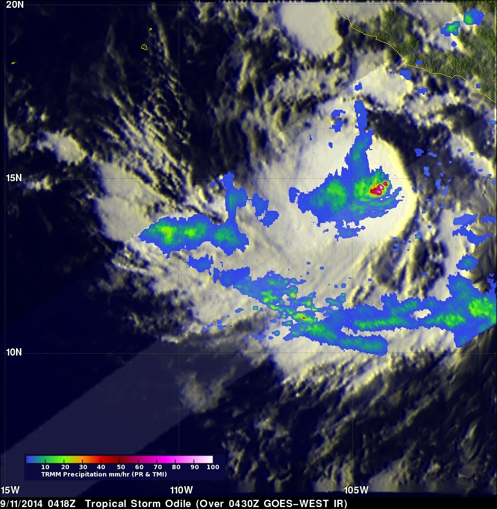
The hurricane season continues to be active in the eastern Pacific Ocean. Hurricane Norbert dissipated a few days ago and then tropical storm Odile formed yesterday (September 10, 2014) in the same area where Norbert formed. The TRMM satellite flew over tropical storm Odile on September 11, 2014 at 0418 UTC and collected data used in the images above. The first image shows a rainfall analysis made from TRMM's Microwave Imager (TMI) and Precipitation Radar (PR) data overlaid on a 0430 UTC GOES-WEST enhanced infrared image. TRMM PR found that Odile was dropping rain at the extreme rate of over 196 mm (7.8 inches) per hour in powerful convective thunderstorms near Odile's center of circulation.
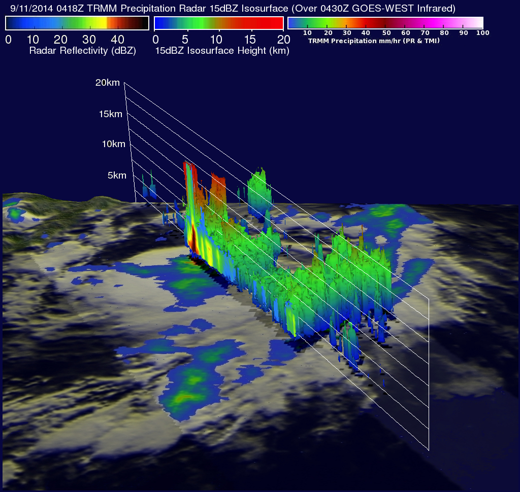
The next image shows a simulated 3-D view (toward the east) of Odile's rainfall structure using radar reflectivity data collected by the TRMM Precipitation Radar (PR) instrument. This view shows that the most intense thunderstorms within Odile were reaching altitudes of over 14.7 km (about 9.1 miles). The release of this much energy would normally lead to intensification but northeasterly vertical wind shear was dampening Odile. The National Hurricane Center (NHC) forecasts that Odile will intensify into a hurricane after a day or so. Odile is expected to follow close to the same track as hurricane Norbert and pass to the west of Baja California on Monday September 15, 2014.