
TRMM Sees Powerful Tropical Cyclone Ita Approaching Queensland, Australia
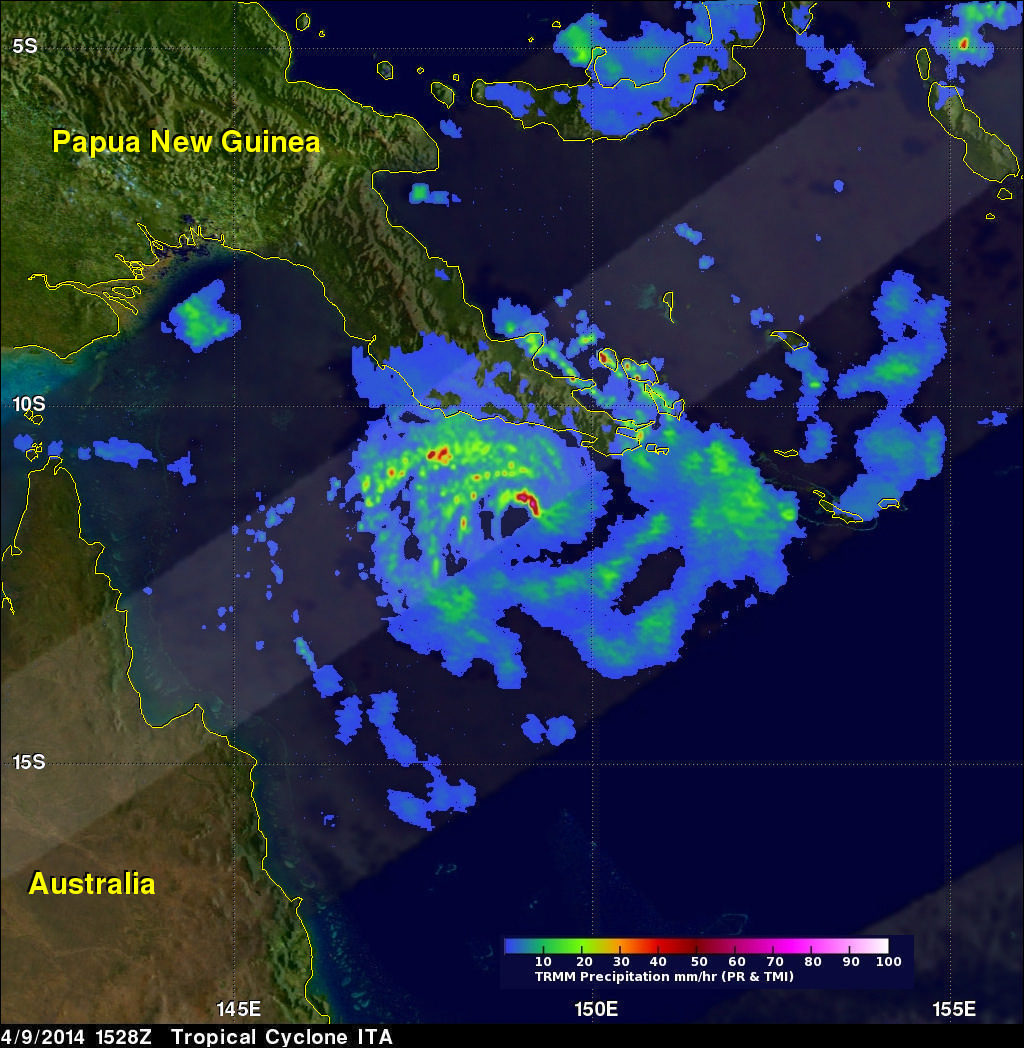
Tropical cyclone ITA, located in the Coral Sea northeast of Australia, continues to intensify while heading toward the northeastern coast of Australia. ITA was seen twice by the TRMM satellite on April 9, 2014. The tropical cyclone's wind speeds had increased from 65kts (about 75 mph) with the first pass at 0536 UTC to 80kts (about 92 mph) when viewed again at 1528 UTC. ITA is predicted to continue becoming more powerful and have sustained winds of 135 kts (about 188 mph) before hitting Australia's Queensland coast tomorrow.
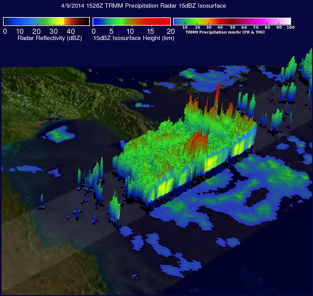
TRMM's Precipitation Radar (PR) instrument sliced through ITA's eye and those data were used in this 3-D "cut-a-way" view. Powerful storms in ITA's eye wall were found to reach heights of over 14km (about 8.7 miles). The tallest thunderstorm towers shown here were reaching heights of over 16 km (about 9.9 miles) in a feeder band well to the northeast of ITA's eye.
Click here to see a Low Resolution 640x360 simulated 3-D (Quicktime) flyby animation using TRMM PR data.
Click here to see a Low Resolution 640x360 simulated 3-D (MPEG) flyby animation using TRMM PR data.