
Powerful Hurricane Arthur Hits North Carolina
.jpg)
Hurricane Arthur battered North Carolina after coming ashore late last night at 0315 UTC (11:15 PM EDT). The TRMM satellite flew directly over Arthur on July 3, 2014 at 1922 UTC ( 3:22 PM EDT) as the hurricane was becoming increasingly more powerful. An analysis of rainfall from TRMM's Microwave Imager (TMI) and Precipitation Radar (PR) instruments was overlaid on a 1926Z GOES-EAST Visible/Infrared image. Intense bands of thunderstorms north of Arthur's well defined eye were revealed by TRMM to be dropping rainfall at a rate of over 98.4 mm ( about 3.9 inches) per hour.
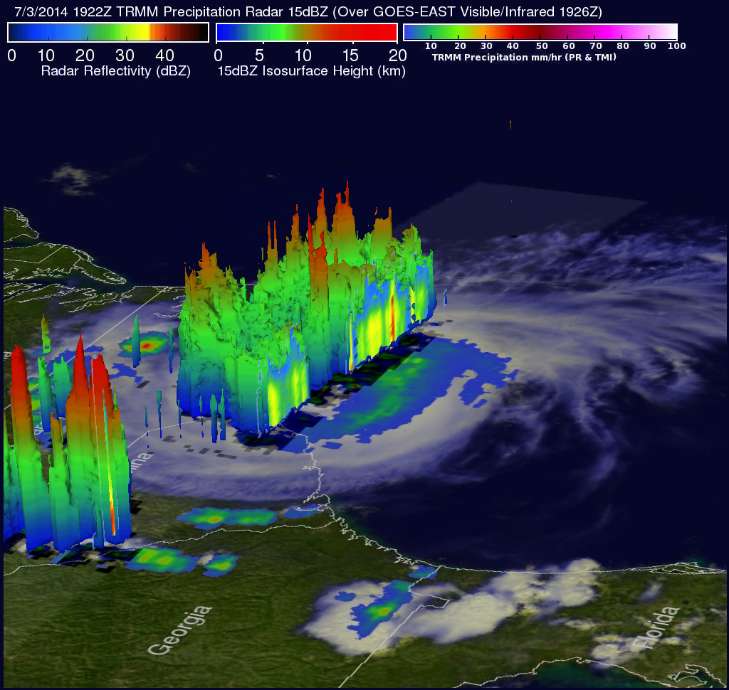
One of the TRMM Precipitation Radar's most useful functions has been it's ability to provide 3-D vertical profiles of precipitation from the surface up to a height of about 12 miles (20 kilometers). TRMM PR data were used in the simulated view above to show a 3-D view of hurricane Arthur. Of particular interest are tall thunderstorm towers near the center of the hurricane. These "hot towers" found reaching heights of over 15.0 km (about 9.3 miles) are often a sign that a hurricane is becoming more powerful. Even taller thunderstorm tops were found reaching heights of 16km (about 9.9 miles) in the states of North and South Carolina. Heavy rainfall within these storms were returning radar reflectivity values of over 54 dBZ to the satellite.
Click here to see a Low Resolution 640x360 simulated 3-D (Quicktime) flyby.
Click here to see a Low Resolution 640x360 simulated 3-D (MPEG) flyby.