
Hurricane Iselle Heads Toward Hawaii
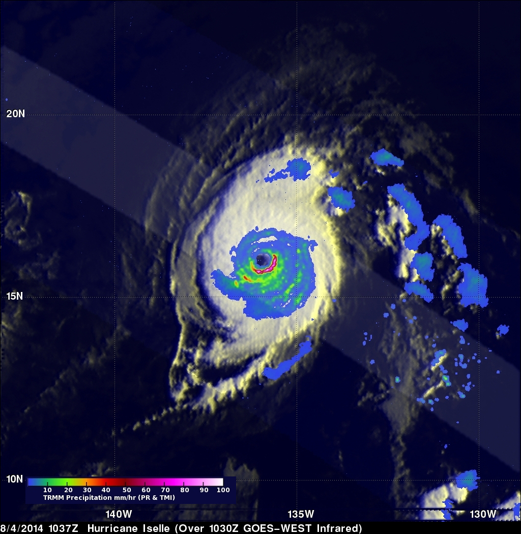
The TRMM satellite flew directly over the eye of powerful hurricane Iselle on August 4, 2014 at 1037 UTC. Iselle had winds of about 120kts (about 138 mph) at that time making it a dangerous category four hurricane on the Saffir-Simpson hurricane wind scale. Rainfall from TRMM's Microwave Imager (TMI) and Precipitation Radar (PR) instruments is shown overlaid on a GOES-WEST enhanced infrared image captured at 1030 UTC. Rain was found by TRMM PR to be falling at a rate of almost 182 mm (about 7.2 inches) per hour in Iselle's eye wall.
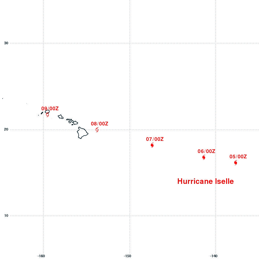
Hurricane Iselle is predicted by the National Hurricane Center (NHC) to weaken as it heads westward into the central Pacific Ocean. Iselle is expected to have winds of about 60kts (about 69 mph) when approaching the Hawaiian Islands on August 8, 2014.
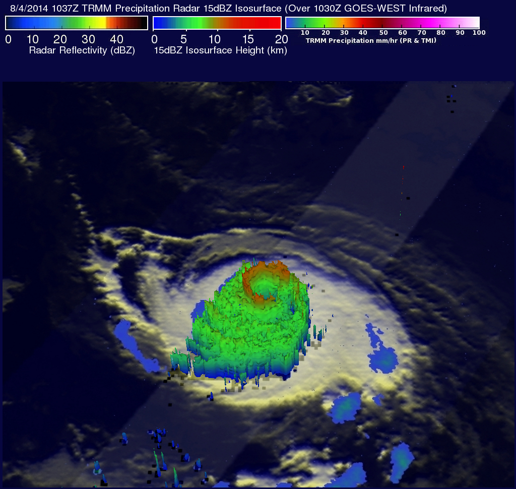
The 3-D image above was produced using radar reflectivity values from TRMM's Precipitation Radar (PR) instrument. It shows storms in Iselle's eye wall reaching from 13km (8 miles) to the surface of the ocean below.