Deadly Tropical Storm Cristobal
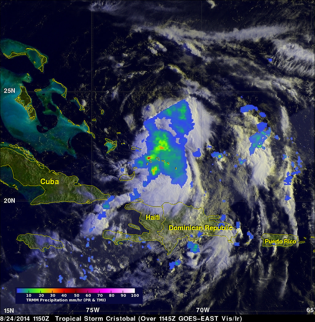
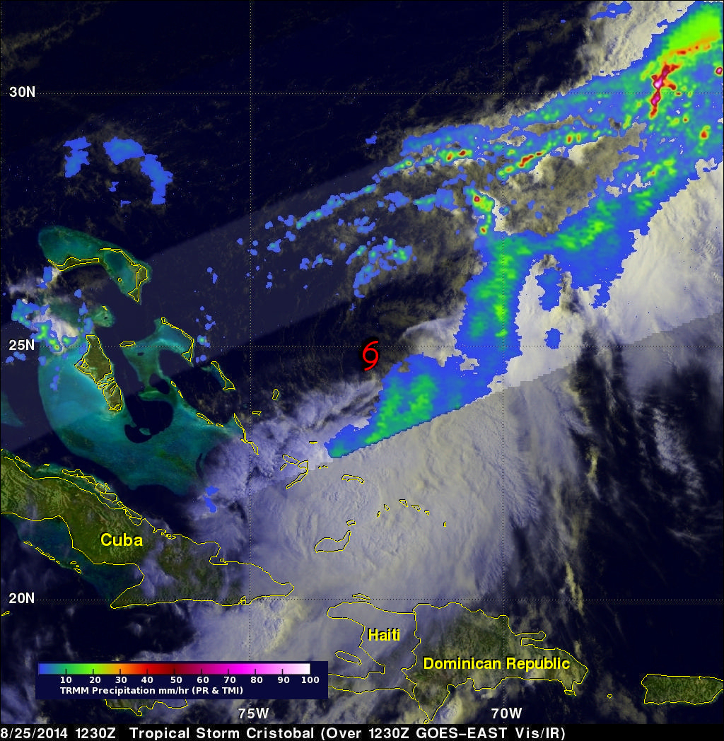
Strong winds and flooding associated with tropical storm Cristobal have caused deaths in the Dominican Republic, Haiti and Jamaica. Rainfall data for the first image above was captured by the TRMM satellite on August 24, 2014 at 1150Z (7:50 AM EDT). Tropical depression four was upgraded to tropical storm Cristobal a short time after that TRMM view. The next image uses data received by TRMM a day later on August 25, 2014 at 1230 UTC ( 8:30 AM EDT). Cristobal was a sheared tropical cyclone with a rain free center so a red tropical storm symbol was used to clarify the location of Cristobal's center of circulation. On August 25, 2014 TRMM PR found that the most intense rain was falling at at a rate of over 159.3 mm (about 6.3 inches) per hour in a line of storms that was located well to the northeast of Cristobal's center. Rainfall data from TRMM's Microwave Imager (TMI) and Precipitation Radar (PR) instruments are shown overlaid on GOES-EAST images received at close to the same times as the TRMM orbits.
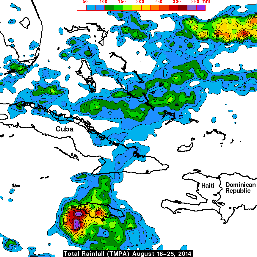
The rainfall associated with tropical storm Cristobal is shown in the TRMM-based, near-real time Multi-satellite Precipitation data (TMPA) analysis shown above during the period from August 18-25, 2014. This shows that the greatest flooding rainfall during this period totalled over 350mm ( 13.8 inches) near southwestern Jamaica.