
Cyclone Pam Departs Vanuatu
As one of the strongest cyclones every recorded in the South Pacific, Cyclone Pam devastated the island archipelago of Vanuatu. As the cyclone bore down on Vanuatu's central islands on the afternoon (local time) of March 13th, Pam's maximum sustained winds were estimated to have increased to 270 kph (~167 mph) by the US Joint Typhoon Warning Center (JTWC), making it a category 5 storm on the US Saffir-Simpson scale. The storm caused immense, widespread damage with the islands of Erromango and Tanna suffering a direct hit. Although damage is still being assessed, the number of reported fatalities fortunately has been rather low at 11 considering the power of the storm.
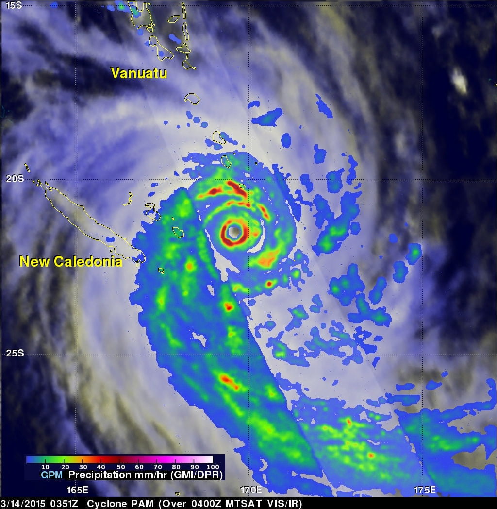
NASA's GPM Core observatory satellite passed over Pam as the cyclone began pulling away from Vanuatu on the 14th. The image was taken at 03:51 UTC (2:51 pm, local time) on 14 March 2015 and shows rain rates within Cyclone Pam observed from GPM's microwave (GMI, in the outer swath) and radar (DPR, inner swath) instruments. GPM shows that Pam is still a very powerful storm. A well-defined, closed inner eye wall denoted by the annulus of intense rain rates (shown in red), is indicative of a well-formed intense cyclonic circulation. Typically the faster the winds, the more symmetrical the precipitation features around the storm's center. At this time, Pam's maximum sustained winds were still estimated at 135 knots (~155 mph), putting it near the top of the Saffir-Simpson category 4 scale. Pam stayed east of New Caledonia as it continued tracking southward and continued to weaken further. PMM is a joint mission between NASA and the Japanese space agency JAXA.