
Weakening Tropical Storm Bill Seen By GPM
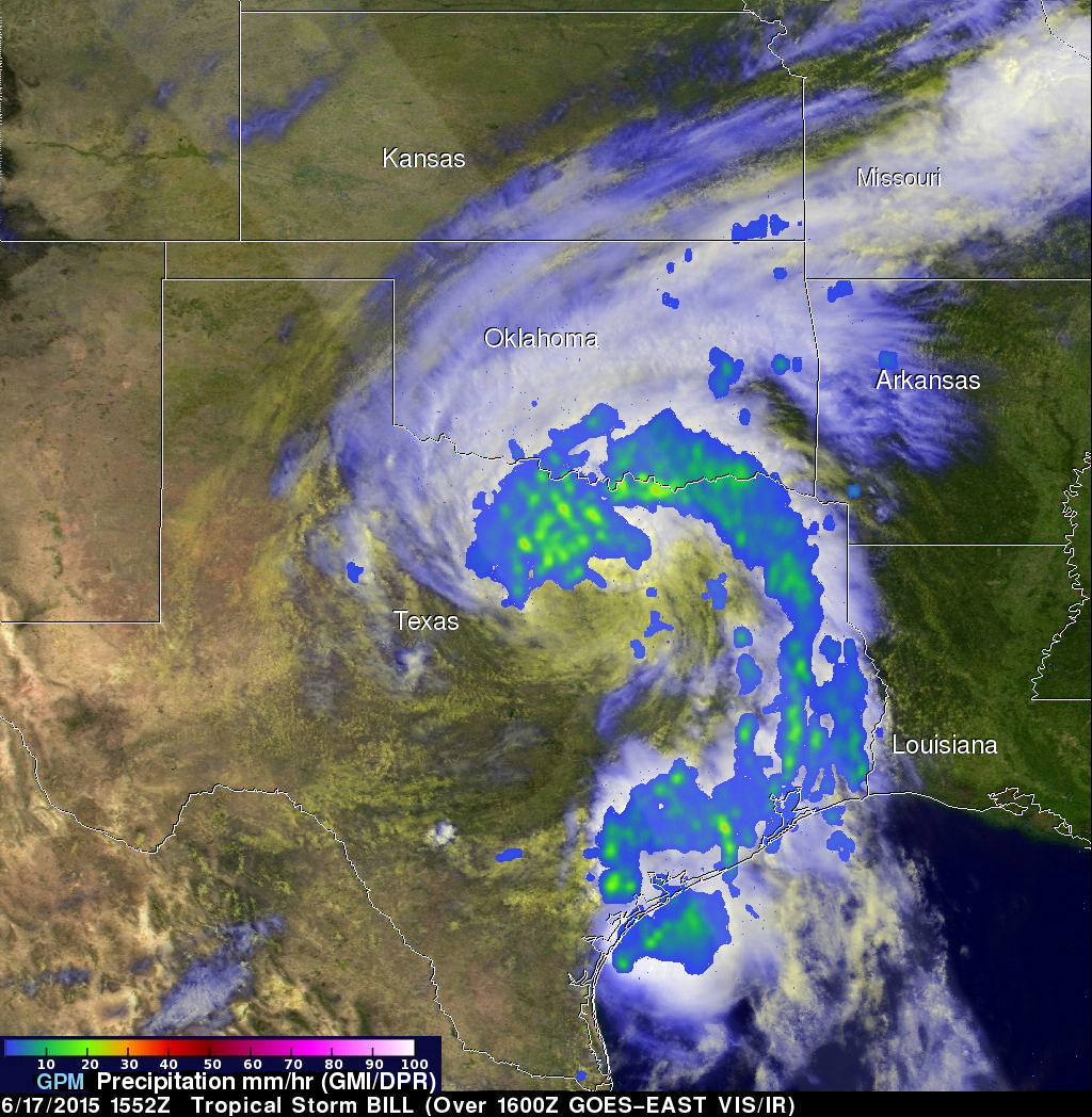
The GPM core observatory satellite had a good daytime look at tropical storm Bill on Wednesday June 17, 1015 at 1552 UTC ( 10:52 AM CDT). GPM saw that an area of heavy rain on Bills northern side was then moving into southern Oklahoma. The Dual-Frequency Precipitation Radar (DPR) on board the satellite measured rain dropping at a rate of over 50 mm (almost 2 inches) per hour in some intense storms.
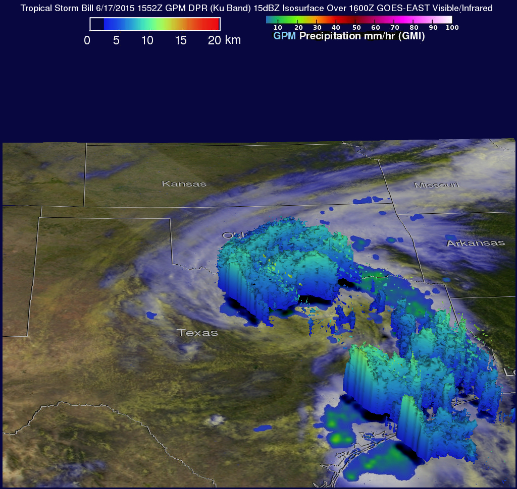
GPM radar data (Ku band) were also used to look at the 3-D structure and storm top heights within storms associated with tropical storm Bill. This image shows that in some areas the dissipating tropical storm still had storm tops reaching heights of almost 10 km (6.2 miles).