
Two Future Typhoons Monitored By GPM
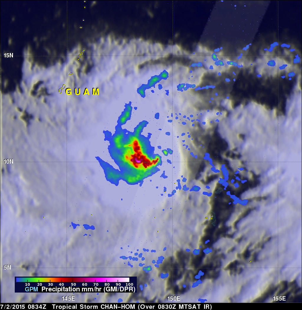
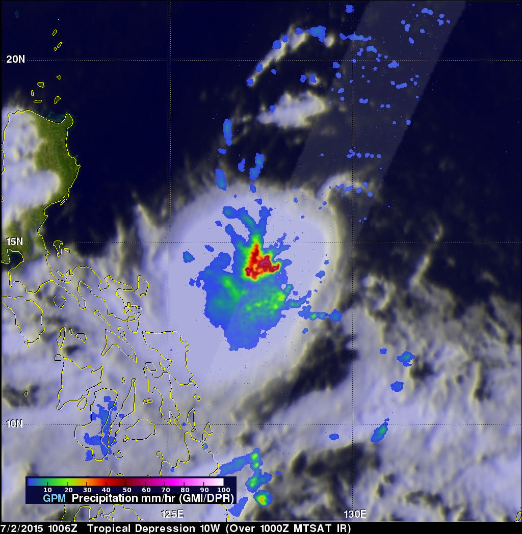
A chain of tropical cyclones has started forming in the western Pacific Ocean. The GPM core observatory satellite saw two of them this morning. Tropical storm Chan-Hom was seen southeast of Guam by GPM on July 2, 1015 at 0834 UTC. Less than two hours later at 1006 UTC GPM passed over intensifying tropical depression 10W that was located east of the Philippines. Both are expected to become more powerful over the next few days. Typhoon Chan-Hom is predicted by the Joint Typhoon Warning Center (JTWC) to pass just northeast of Guam with winds of over 80 kts (92 mph). TD10W is also predicted to be a typhoon with winds of about 70 kts (about 80.5 mph) when it passes near the northern Philippines in a couple days.
GPM's Microwave Imager (GMI) and Dual-Frequency Precipitation Radar (DPR) instruments measured heavy rainfall in both tropical cyclones. Chan-Hom was found by GPM to have rain falling at a rate of 110mm (4.3 inches) per hour. TD10W was found to have similarly high rainfall rates of over 113.0mm (4.4 inches) per hour.
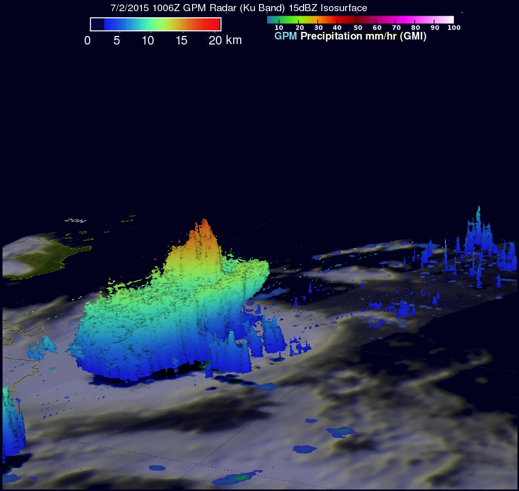
GPM saw some very high storms within TD10W as it flew directly above them. This 3-D image that was constructed using GPM's DPR (Ku Band) radar reflectivity data shows the structure of rainfall within TD10W. Several of the intense thunderstorms within TD10W were found by GPM to have storm top heights of over 17 km (10.5 miles).