
Tropical Storm Sandra
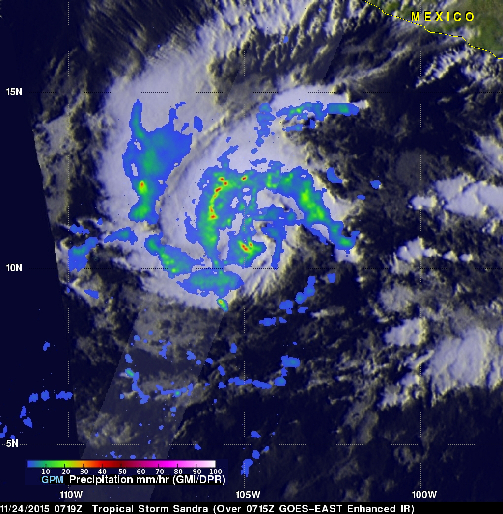
Early this morning tropical Storm Sandra became the 18th named storm of the 2015 Eastern Pacific hurricane season. Intensifying tropical storm Sandra had winds of about 35 kts (40 mph) when the GPM core observatory satellite passed over on November 24, 2015 at 0719 UTC. A rainfall analysis derived using data collected at that time by from GPM's Microwave Imager (GMI) and Dual-Frequency Precipitation Radar (DPR) instruments is shown. DPR discovered that the intense convective storms south of the tropical storm's center of circulation were dropping rain at a rate of over 80 mm (3.1 inches) per hour.
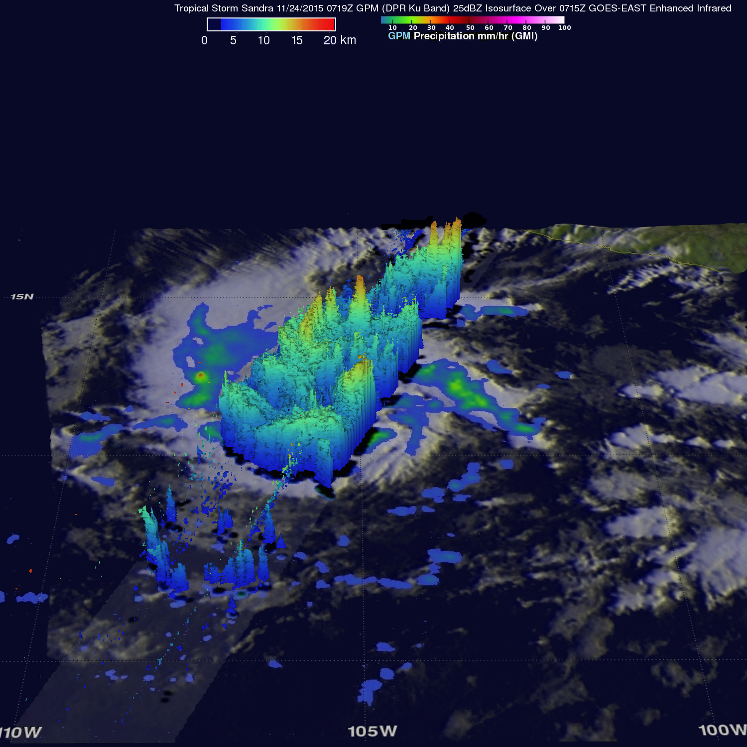
The tops of some convective storms within Sandra's circulation were measured reaching heights above 16 km (9.9 miles). A 3-D cross-section using GPM's radar data (DPR Ku band) shows that several other powerful thunderstorms were also reaching heights of over 15km (9.3 miles).
Tropical storm Sandy is in an area of warm ocean water and light vertical wind shear that promotes intensification. The Joint Typhoon Warning Center (JTWC) predicts that Sandy will become more powerful and become a hurricane tomorrow.