
Tropical Storm Koppu Heads Toward The Philippines
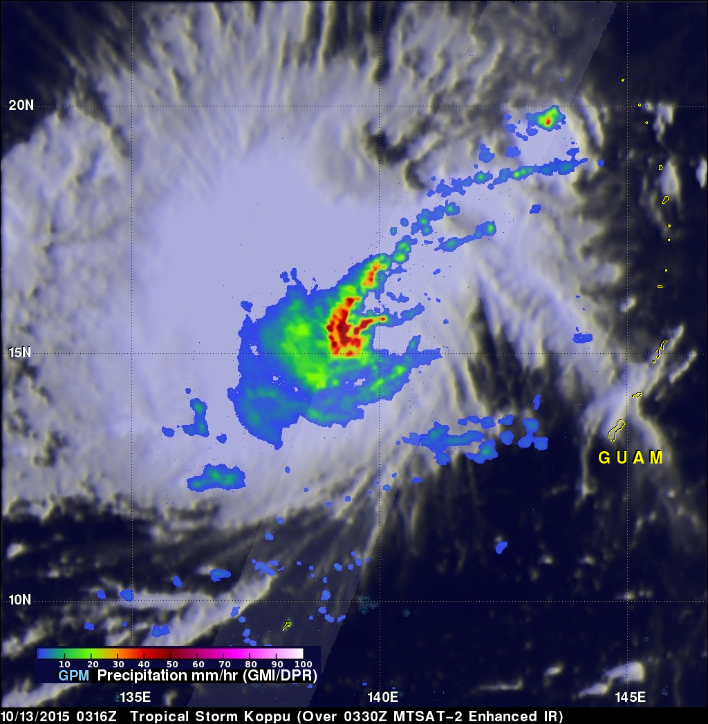
Tropical storm KOPPU that recently formed northwest of Guam in the western Pacific Ocean may threaten the Philippines in the next five days. A recent prediction by the Joint Typhoon Warning Center (JTWC) indicates that tropical storm KOPPU will intensify to typhoon intensity while heading westward toward the northern Philippines. The GPM core observatory satellite flew over tropical storm KOPPU on October 13, 2015 at 0316 UTC. Data collected with GPM's Microwave Imager (GMI) and Dual-Frequency Precipitation Radar (DPR) instruments shows that numerous intense thunderstorms near the tropical storm's center of circulation were dropping rain at a rate of over 88 mm (3.5 inches)
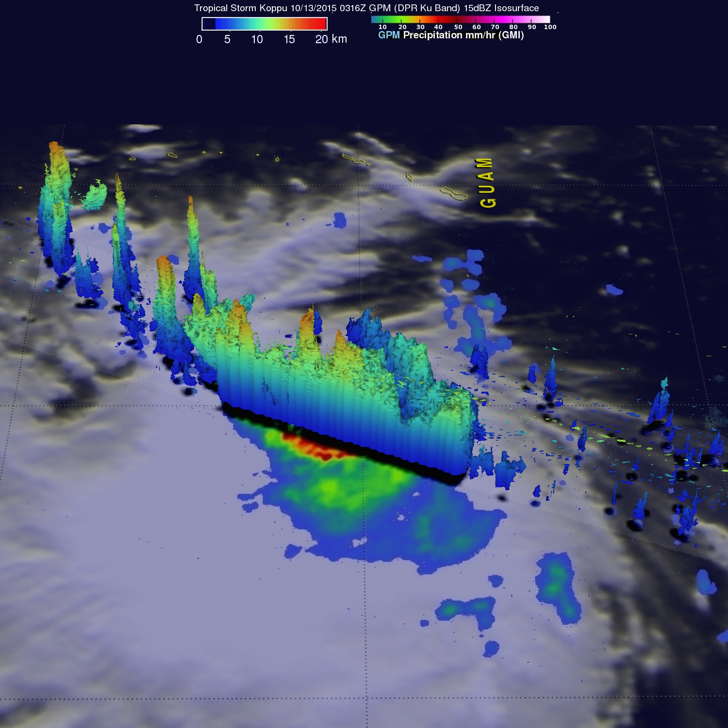
A simulated 3-D view from the west was constructed using GPM's Ku Band radar data. It reveals the 3-D shape of precipitation within tropical storm KOPPU. Some storm top heights were found by GPM's Ku band radar to reach altitudes above 17.8 km (11 miles). This release of energy by precipitation in the tropical cyclone's core often provides fuel for future intensification.