
Tropical Storm Joaquin forms in the Western Atlantic
Tropical Storm Joaquin became the 10th named storm of the season after forming late last night (EDT) in the western Atlantic midway between the Bahamas and Bermuda from what was previously a tropical depression (#11), which itself had formed a day earlier from an area of low pressure that had been lingering in the region since Saturday.
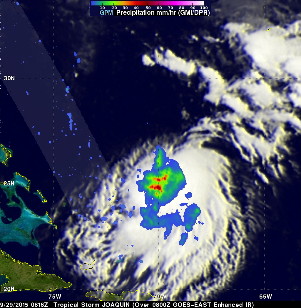
GPM captured this image of Joaquin early this morning at 8:16 UTC (4:16 am EDT) on the 29th of September as the storm was slowly drifting westward about 390 miles east of the northern Bahamas. The image shows rain rates derived from the GPM GMI (outer swath) and DPR (inner swath) overlaid on IR data from the GOES-East satellite. At the time, the low-level center of circulation was located on the northwest edge of the rain area, which reveals the presence of northwesterly shear as reported by the National Hurricane Center (NHC). Within Joaquin's rain field there are areas of heavy rain (shown in red) with rates of up to 60 mm/hr (~2.4 inches/hr). There is also some evidence of weak banding in the rain features, which is consistent with a weak but established cyclonic wind circulation. Near the time of this image, Joaquin's maximum sustained winds were reported at 40 mph by NHC, making it a weak tropical storm. The shear, which is currently inhibiting the storm's ability to strengthen is expected to continue for the next day or so before diminishing, which could then allow Joaquin to strengthen.
NHC is forecasting Joaquin to become a strong tropical storm in about 2 days as it continues slowly westward towards the Bahamas before turning northward ahead of an upper-level trough over the Southeast US. At the moment, Joaquin is not expected to reach the Bahamas and to parallel the US East Coast off shore; however, there is still some uncertainty in the forecast at this point.
GPM is a joint mission between NASA and the Japanese space agency JAXA.